| EXIT | EASTBOUND Read Down |
WESTBOUND Read Up |
Other Features |
|||||||||
|---|---|---|---|---|---|---|---|---|---|---|---|---|
| STATE OF WEST VIRGINIA
COMMONWEALTH OF PENNSYLVANIA |
||||||||||||
| MILE 0 |
||||||||||||
| 1 | West Alexander | |||||||||||
| TRUCK ALERT | ||||||||||||
| NO TRUCK ACCESS TO US 40 FROM EXIT 1 |
||||||||||||
| West Alexander | ||||||||||||
| TRUCK ALERT | ||||||||||||
| NO TRUCK ACCESS TO US 40 FROM EXIT 1 |
||||||||||||
| MILE 5 |
 |
|||||||||||
 |
||||||||||||
| 6 | Claysville |
|||||||||||
| EXIT ONLY | ||||||||||||
Claysville |
||||||||||||
| 11 | Taylorstown |
|||||||||||
| MILE 13 |
||||||||||||
| 15 | Chestnut Street |
|||||||||||
Washington County Airport Wild Things Park Washington Crown Center Washington Business District |
||||||||||||
Chestnut Street |
||||||||||||
Washington County Airport Wild Things Park Washington Crown Center |
||||||||||||
| 16 | Jessop Place | |||||||||||
| Jessop Place | ||||||||||||
| 17 | Jefferson Avenue |
|||||||||||
| TRUCK ALERT | ||||||||||||
| TRUCKS TO
|
||||||||||||
| 18 | Raymond P. Shafer Highway Pittsburgh |
|||||||||||
| EXIT ONLY | ||||||||||||
Raymond P. Shafer Highway Pittsburgh |
||||||||||||
| EXIT ONLY | ||||||||||||
| 19 | Murtland Avenue |
|||||||||||
| Washington Mall Oak Spring Center Trinity Point Strabane Square |
||||||||||||
| EXIT ONLY | ||||||||||||
| PROHIBITED
102" TWINS 102" TRAILERS OVER 28½ FEET SOUTH ON US 19 |
||||||||||||
| 20 | TO Beau Street |
|||||||||||
Washington and Jefferson College |
||||||||||||
| TO Beau Street |
||||||||||||
| EXIT ONLY | Washington and Jefferson College Washington Business District |
|||||||||||
| 21 | Raymond P. Shafer Highway Waynesburg Morgantown, WV |
|||||||||||
| EXIT ONLY | ||||||||||||
Raymond P. Shafer Highway Waynesburg Morgantown, WV |
||||||||||||
| EXIT ONLY | ||||||||||||
| 25 | Eighty Four Glyde |
Glyde Eighty Four |
||||||||||
PennDOT Maintenance District 12-4 Office |
||||||||||||
| 27 | Dunningsville | |||||||||||
| Dunningsville | ||||||||||||
| 31 | Kammerer | |||||||||||
| 32 A | Ginger Hill |
|||||||||||
| NO REENTRY EASTBOUND | ALL TRUCK SERVICES USE EXIT 32B |
|||||||||||
| NO TRUCK SERVICES | ||||||||||||
| 32 B | TO Bentleyville |
|||||||||||
| TO Bentleyville Ginger Hill |
||||||||||||
| 35 | Monongahela Centerville |
|||||||||||
| 36 | Lover | |||||||||||
| NO REENTRY WESTBOUND AT THIS EXIT |
||||||||||||
| 37 A |
James J. Manderino Memorial Highway California |
|||||||||||
| Brownsville
PennWest California |
||||||||||||
James J. Manderino Memorial Highway California |
||||||||||||
| Brownsville
PennWest California |
||||||||||||
| 37 B |
James J. Manderino Memorial Highway Pittsburgh |
|||||||||||
James J. Manderino Memorial Highway Pittsburgh |
||||||||||||
 |
||||||||||||
| MILE 39 |
||||||||||||
| 39 | Speers | |||||||||||
| Speers | ||||||||||||
| 40 | Charleroi Allenport |
|||||||||||
| EXIT ONLY | ||||||||||||
Charleroi Allenport |
||||||||||||
| Washington County
Belle Vernon-Speers Bridge Monongahela River Westmoreland County |
||||||||||||
| 41 | Belle Vernon Monessen |
|||||||||||
Belle Vernon Monessen |
||||||||||||
| MILE 41 |
||||||||||||
| 42 | North Belle Vernon | |||||||||||
| MILE 42 |
||||||||||||
| 42 A | Monessen | |||||||||||
| 43 |
|
|||||||||||
Rostraver Square |
||||||||||||
| 43 A | Fayette City |
|||||||||||
Rostraver Square |
||||||||||||
| 43 B |
|
Monessen Monessen Business District |
||||||||||
| 44 | Arnold City | |||||||||||
| Arnold City | ||||||||||||
| 46 A | Uniontown |
|||||||||||
| Cedar Creek Golf Course | ||||||||||||
Uniontown |
||||||||||||
| Cedar Creek Golf Course | ||||||||||||
| 46 B | Pittsburgh |
|||||||||||
| Cedar Creek Park | ||||||||||||
Pittsburgh |
||||||||||||
| Cedar Creek Park | ||||||||||||
| Smithton High Level Bridge
Youghiogheny River |
||||||||||||
| 49 | Smithton | |||||||||||
| I-70 Industrial Park | ||||||||||||
| 51 | Mount Pleasant West Newton |
|||||||||||
| TRUCK WARNING | ||||||||||||
| MAXIMUM GROSS WEIGHT 10 TONS AT WEST NEWTON TRAILERS PROHIBITED |
||||||||||||
| 53 | Yukon | |||||||||||
| 54 | Madison | |||||||||||
| 57 | New Stanton Hunker |
New Stanton Hunker |
||||||||||
| EXIT ONLY | ||||||||||||
58 |
|
RIDC Westmoreland | ||||||||||
|
|
||||||||||||
|
||||||||||||
| RIDC Westmoreland | ||||||||||||
 |
||||||||||||
| MILE 75 |
NEW STANTON INTERCHANGE TOLL PLAZA
|
OVERSIZE LOADS PULL TO SIDE ASSISTANCE AT OFFICE |
||||||||||
| MILE 75 |
||||||||||||
| MILE 75 |
Pittsburgh EXITS 67 - 2 |
|||||||||||
MILE 75 |
WEST Pittsburgh Cleveland EXITS 67 - 2 |
|||||||||||
| MILE 77 |
 |
|||||||||||
| MILE 78 |
||||||||||||
| MILE 81 |
||||||||||||
| 91 | DONEGAL
|
|||||||||||
|
||||||||||||
| Idlewild & SoakZone Saint Vincent College Seton Hill University Caddie Shak Family Fun Center |
||||||||||||
| Kooser State Park Laurel Hill State Park Ohiopyle State Park Fallingwater Seven Springs Ski Resort Hidden Valley Ski Resort Laurel Mountain Ski Resort |
||||||||||||
DONEGAL
|
||||||||||||
|
||||||||||||
| Idlewild & SoakZone Saint Vincent College Seton Hill University Caddie Shak Family Fun Center |
||||||||||||
| Kooser State Park Laurel Hill State Park Ohiopyle State Park Fallingwater Seven Springs Ski Resort Hidden Valley Ski Resort Laurel Mountain Ski Resort |
||||||||||||
| MILE 94 |
 |
|||||||||||
| MILE 95 |
||||||||||||
| MILE 98 |
||||||||||||
| MILE 99 |
 |
|||||||||||
| Westmoreland County
Somerset County |
||||||||||||
| MILE 102 |
||||||||||||
| MILE 105 |
||||||||||||
| MILE 107 |
||||||||||||
| MILE 108 |
||||||||||||
| 110 | SOMERSET
|
|||||||||||
 |
||||||||||||
|
||||||||||||
| Factory Shoppes at Georgian Place Somerset Commons Somerset Crossings Summit Plaza |
||||||||||||
| Somerset Historical Center Flight 93 National Memorial |
||||||||||||
SOMERSET
|
||||||||||||
|
||||||||||||
| Factory Shoppes at Georgian Place Somerset Commons Somerset Crossings Summit Plaza |
||||||||||||
| Somerset Historical Center Flight 93 National Memorial |
||||||||||||
| MILE 112 |
 |
 |
||||||||||
| MILE 113 |
||||||||||||
| MILE 119 |
||||||||||||
| MILE 121 |
||||||||||||
| MILE 122 |
||||||||||||
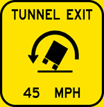
| MILE 122 |
Allegheny Mountain Tunnel |
|||||||||||
| TURN ON HEADLIGHTS
REMOVE SUNGLASSES |
||||||||||||
| Somerset County
Bedford County |
||||||||||||
| MILE 123 |
 |
|||||||||||
| MILE 126 |
||||||||||||
| MILE 130 |
||||||||||||
| MILE 130 |
||||||||||||
| MILE 131 |
||||||||||||
| MILE 133 |
||||||||||||
| MILE 134 |
||||||||||||
| MILE 136 |
||||||||||||
| MILE 137 |
||||||||||||
| MILE 139 |
||||||||||||
| Juniata River (Raystown Branch) | ||||||||||||
| Juniata River (Raystown Branch) | ||||||||||||
| MILE 141 |
||||||||||||
| 146 | BEDFORD
|
|||||||||||
|
||||||||||||
| Cumberland, MD | ||||||||||||
| Blue Knob State Park Shawnee State Park |
||||||||||||
BEDFORD
|
 |
|||||||||||
|
||||||||||||
| Cumberland, MD | ||||||||||||
| Blue Knob State Park Shawnee State Park |
||||||||||||
| MILE 147 |
 |
|||||||||||
 |
||||||||||||
| Juniata River (Raystown Branch) | ||||||||||||
| MILE 149 |
||||||||||||
| MILE 153 |
||||||||||||
| MILE 154 |
||||||||||||
| MILE 158 |
||||||||||||
MILE 161 |
EAST Harrisburg EXITS 180 - 353 |
|||||||||||
MILE 161 |
EAST Harrisburg EXITS 180 - 353 |
|||||||||||
| MILE 161 |
||||||||||||
| MILE 161 |
BREEZEWOOD INTERCHANGE TOLL PLAZA
|
OVERSIZE LOADS PULL TO SIDE ASSISTANCE AT OFFICE |
||||||||||
| MILE 161 |
FOLLOW |
|||||||||||
| MILE 146 |
||||||||||||
| MILE 146 |
||||||||||||
| MILE 146 |
McConnellsburg |
|||||||||||
| TRUCK RESTRICTION 5 MILES | ||||||||||||
MILE 146 |
EAST McConnellsburg |
|||||||||||
| NO EXPRESSWAY LEFT TURNS AND CROSS TRAFFIC NEXT ¼ MILE |
||||||||||||
| MILE 147 |
FOLLOW |
|||||||||||
| MILE 147 |
Everett |
Breezewood |
||||||||||
| MILE 147 |
||||||||||||
| 149 | South Breezewood | |||||||||||
|
Everett |
||||||||||||
| South Breezewood | ||||||||||||
| Bedford County
Fulton County |
||||||||||||
| 151 | Crystal Spring |
|||||||||||
| MILE 153 |
 |
|||||||||||
| 156 | Town Hill |
|||||||||||
| 163 | Amaranth |
|||||||||||
Amaranth |
||||||||||||
| 168 |
|
|||||||||||
FOLLOW |
||||||||||||
|
||||||||||||
| MILE 169 |
 |
|||||||||||
| MILE 170 |
||||||||||||
| COMMONWEALTH OF PENNSYLVANIA
STATE OF MARYLAND |
||||||||||||
 Exit Guide