 |
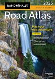
Road Atlas The premier atlas of North America's highways started in 1924 with the first edition of the then titled Rand McNally Auto Chum. It was the first to publish in all color in 1960 and to utilize digital production in 1993. |
 |
Motor Carriers' Road Atlas This specialized edition of the standard road atlas provides detailed information on truck specific routes, what hazards to avoid, and where there might be a weigh station. Also provides state-by-state and province-by-province listing of information such as permit contacts and specific routings within cities. |
 |
Pennsylvania State Map A road map covering Philadelphia to Pittsburgh, Erie to Scranton, and everything in between. |
 |
Pennsylvania State Map This road map is similar to the one above except for one major difference: you can write on it with a dry-erase marker! It will wipe off easily because the map itself is laminated. |
 |
Pittsburgh Street Map Road map for those who need to navigate the complex street system in the "City of Bridges." |
 |
Pittsburgh Regional Map Map covering southwestern Pennsylvania with enlargements of Butler, Greensburg, Indiana, Johnstown, New Castle, Pittsburgh, Uniontown, Washingtown, and Wheeling, West Virginia. |
 |
Streetwise Philadelphia Map Road map detailing the highway system and the SEPTA system in the City of Philadelphia, and what is nice is that it is laminated so you can make notes on it and wipe them off when done. |
 |
Philadelphia & Southeast Pennsylvania Map Map covering southeastern Pennsylvania as well as parts of Delaware and New Jersey. |
 |
Philadelphia Metro Street Atlas If you need more coverage than a map can provide, this atlas covers the five southeastern counties. Not only does it provide points of interest, zip codes, block numbers, and highway exit numbers, but the wire binding means the atlas will stay open. |
 |
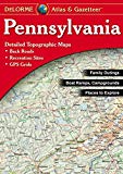
Pennsylvania Atlas & Gazetteer The perfect atlas for the hiker, biker, fisherman, hunter, or outdoorsman as this atlas shows in amazing detail not only natural, but also man-made features. |
 Map Store