
John H. Ware III Memorial Highway
Roosevelt Expressway
Roosevelt Boulevard
Martin Luther King Jr. Expressway
John H. Ware III Memorial Highway
Roosevelt Expressway
Roosevelt Boulevard
Martin Luther King Jr. Expressway
The original north-south artery on Eastern Seaboard of the United States, US 1 predates its Interstate replacement by at least 50 years. The first US 1 shield began to be erected in 1926 when the United States initiated the original Interstate System that gave us the US routes.
The highway in northern Philadelphia got it start in 1902, when then Philadelphia Mayor Samuel H. Ashbridge, proposed the Torresdale Boulevard. The boulevard would have a 300-foot right-of-way from Broad Street northeast to Torresdale. At that time, this area was mostly farming communities connected by dirt trails. With this new highway, that area would have a direct connection with central Philadelphia. The sections of the Torresdale Boulevard opened in 1903, 1907, 1911, and 1914. The cost of construction was estimated at $3.5 million dollars, and upon completion it was renamed Northeast Boulevard. It was renamed again in honor of Theodore Roosevelt after it was extended to Pennypack Creek in 1918.
From the Maryland border, US 1 traveled through Oxford, West Grove, Kennett Square and split from the current alignment to enter Philadelphia on Baltimore Pike and Baltimore Avenue. After going through the "City of Brotherly Love" on 38th Street, Chestnut Street, Broad Street, Hunting Park Avenue and Roosevelt Boulevard, US 1 became the Lincoln Highway and traveled through Oakford, Oxford Valley, and Morrisville before entering the "Garden State." In 1931, the highway was under construction from Oxford to Forestville and was completed the following year. In 1935, the route was changed to follow 44th Street, Powelton Avenue, then 31st Street for northbound traffic and 32nd Street for southbound traffic, and Spring Garden Street to bypass Center City. In 1938, the highway was widened from Oxford to Avondale, Hamorton to Philadelphia, and Philadelphia to Morrisville.
In 1940, the highway was widened from Thompson Road to Hamorton. In 1948, the direction of travel was changed near the present Turnpike interchange: northbound was on the current alignment from Old Lincoln Highway to Business US 1 and southbound traffic on Old Lincoln Highway.
The first new segment of US 1 began in 1952 when construction started on the 1,324-foot-long Trenton-Morrisville Toll Bridge and expressway section from Business US 1 to the bridge. In 1954, the designation was moved onto 32nd Street, Zoological Avenue, Girard Avenue, 33rd Street, and Hunting Park Avenue as well as the expressway opened from Business US 1 to New Jersey. In 1955, construction began on the section of the Schuylkill Expressway from Exit 339 to Exit 340B. In 1958, the designation was split in Kennett Square with southbound traffic remaining on State Street and northbound placed on Cypress Street. Also that year, a median was installed from Elwyn Road to Media as well as construction began on the Roosevelt Expressway from Kelly Drive to Hunting Park. Yet another designation change took place in Philadelphia that year, when northbound traffic was signed on 43rd Street between Baltimore Avenue and Powelton Avenue while southbound remained on 44th Street. Even a name change took place with Zoological Avenue changed to 34th Street. In 1959, the section of the Schuylkill Expressway from Exit 339 to Exit 340B opened to traffic while construction began from Baltimore Pike to the Springfield Township line.
During the late 1950s, when the Interstate System was beginning to take shape, Pennsylvania had originally planned to route I-95 along US 1 in Bucks County. The Federal Bureau of Public Roads was concerned that this would serve the same purpose as the New Jersey Turnpike. Interstate 95 was to leave the Delaware Expressway alignment and connect to US 1 at Langhorne to continue northward across the Trenton Toll Bridge into New Jersey. The Garden State did not like routing the Interstate across the bridge, so Pennsylvania and New Jersey jointly proposed three crossing: Scudders Falls, Trenton Toll Bridge, and Biles Island. The two states agreed on the Scudders Fall crossing in 1960, and in 1964 the Bureau of Public Roads approved the current alignment for I-95 in Bucks County.
The 1960s began with the opening of the Media bypass and the designation moved onto State Road, Township Line Road, and City Line Avenue to the Schuylkill Expressway. It then crossed the Schuylkill River to Ridge Avenue and West Allegheny Avenue to Hunting Park Avenue. In 1961, the $3.6 million Roosevelt Expressway opened to traffic and the designation moved onto the Schuylkill Expressway and the new expressway to Hunting Park. Also, the designation was moved entirely onto the current alignment between Old Lincoln Highway and Business US 1 in Oakford. Prior to 1962, the section north of Cottman Avenue was named Bensalem Avenue but that year it became Roosevelt Boulevard. In 1963, a median was installed from Thompson Road to Kennett Square and from there to the Media Bypass, and at the interchange with Woodhaven Road. In 1964, the section from Trenton Avenue to the US 13 interchange opened. In the southern part of Pennsylvania, construction began in 1965 on the expressway from PA 41 to the current US 1 alignment north of Kennett Square. Also that year, at the other end of the alignment in the Commonwealth, the Trenton-Morrisville Toll Bridge was widened to six lanes for a total curb-to-curb width of 62 feet.
In 1966, with congestion building on the Roosevelt Boulevard as Northeast Philadelphia began to grow, the city planning commission proposed the Northeastern Expressway. The new highway would be constructed from Hunting Park Avenue to the Pennsylvania Turnpike near Bensalem. It would have followed the existing boulevard for the most part, with the exception of veering north and west above Tacony Creek Park onto a new alignment. This new alignment would have run along Pennway Street and Northeast Avenue and then tying into the now Martin Luther King Jr. Expressway. Although never officially dropped by the Department of Transportation, the expressway plan hasn't been discussed in any plans since 1980.
While an expressway was being planned in Northeast Philadelphia in 1966, the section from PA 41 to US 1 north of Kennett Square opened to traffic. However, the designation would not be moved to it until 1967. That year construction began on the section of expressway from Business US 1 to PA 213, while the existing highway from the Pennsylvania Turnpike to Business US 1 was upgraded to an expressway. A median was installed on the section from the Philadelphia County line to the Turnpike interchange that year as well.
In 1968, construction began on the expressway from PA 896 to PA 41, and from Business US 1 to the I-95 interchange. The following year construction began from Ridge Road near the Maryland state line to PA 869.
The 1970s began with the complete opening the the expressway from Ridge Road near the Maryland state line to PA 41. Also that year, the expressway was completed from the Turnpike interchange to I-95 while construction was extended north of there to the Oxford Valley Road interchange. In 1972, the section from I-95 to the Oxford Valley Road interchange opened. However, the section between the Business US 1 interchanges would not receive the US 1 designation until 1987.
In 1983, an aluminum median barrier was erected across the Trenton-Morrisville Toll Bridge, which created three northbound and two southbound lanes. In 1984, construction began on the last link of the Bucks County US 1 expressway between Oxford Valley Road and Trenton Avenue which finally opened in 1987, thus completing US 1 in Pennsylvania as it is seen today.
In 1991, Interstate 476 finally opened and brought the first three-level diamond, or as Scott Oglesby deemed the "Volleyball Interchange," to Pennsylvania at the US 1 interchange. Visit Kurumi's Field Guide to Interchanges for a diagram of this unique interchange.
Every year, State Farm Insurance comes out with their top ten most dangerous intersections. For 2001, two intersections on Roosevelt Boulevard were voted number two and number three worst. They are located at Red Lion Road and Grant Avenue respectively. The ranking was determined by the number of crashes at the intersection, how many of those crashes involved injury, and the severity of those crashes.
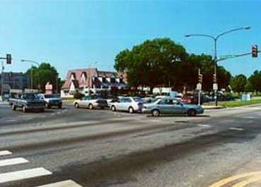 Roosevelt Boulevard at Red Lion Road: Number 2. (State Farm Insurance) |
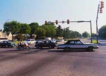 Roosevelt Boulevard at Grant Avenue: Number 3. (State Farm Insurance) |
Conditions got so bad on Roosevelt Boulevard, that the City of Philadelphia and PennDOT formed a joint task force in 2002 to come up with some short term solutions. One of them was the installation of new signage. Most of the medium and long term improvements involve reconstruction of the highway. Some of it is quite extensive and expensive, and there is no money right now for such projects.
Even though Roosevelt Boulevard isn't going to see any improvement in the near future, other parts of US 1 were getting a facelift. Beginning in September 1997, four improvement projects totaling $15 million took place in Delaware and Chester Counties. That project cost $4.7 million and took place on four miles of highway between PA 52 and the Delaware/Chester County line. In April 1998, a $1.1 million project to add a left turn lane on the northbound side of US 1 at Darlington Road concluded. In April 2000, PennDOT completed a $4.3 million improvement of the highway between PA 352 and Thornton Road in Chester Heights, which consisted of median barrier installation, left turn lanes, and a jug handle intersection at Cheyney Road. The last project began on September 5, 2001 between the Delaware/Chester County line and Thornton Road, and consisted of installing median barriers and left turn lanes at certain intersections. The $4,733,376 project ended in May 2002.
Eliminating the two deadliest intersections on Roosevelt Boulevard, as well as a double-decker Schuylkill Expressway has been discussed, and if Pennsylvania House Speaker John Perzel has his way, it will become a top priority for PennDOT. In his discussions with Governor Rendell, the Northeast Philadelphia Republican has pushed building underpasses at Grant Avenue and Red Lion Road as well as double-decker proposal for I-76 and I-95. However, this would only happen if the gas tax was raised and there are no plans in effect to raise the tax. He said, "They are two of the highest intersections for fatalities in the country. If we are going to do something to enhance the revenue at PennDOT," referring to an increase in the gas tax, "...that means I am going to go in and fight to get the underpasses." State transportation officials estimated those improvements to Roosevelt Boulevard would cost more than $1 billion; however, experts at a transportation conference he attended in France last year told him otherwise. They said the underpasses would run between $15 million and $18 million. Rendell said of the projects, "If we had the money, sure. It would be great." Perzel added that it would all depend on how much federal highway aid Pennsylvania would receive, and if the Commonwealth received less than expected, none of the projects would get off the ground.
Another first for US 1 was the debut of the first red light cameras in Pennsylvania on Roosevelt Boulevard. At 11 AM on February 23, 2005, the first cameras were turned on at Grant Avenue. In 2003, Philadelphia Mayor John Street signed into law City Council Bill Number 000682, which authorized the initiation of an automated Red Light Enforcement System Program provided under state law, Act Number 2003-123. Drivers were given a 120 day grace period where anyone caught running a red light would receive a warning. I guess too many people read about this loop hole because around 5,169 warnings were issued in the first month alone!
With time, weather, and a river taking its toll (no pun intended) on the Trenton-Morrisville Toll Bridge, it was time for a facelift. The project began in earnest in January 2007, and encompassed rehabilitating the span and widening it to accommodate an additional northbound lane, reconstructing the pavement of the approaches to the bridge, adding a deceleration lane on the viaduct over the Delaware Canal and Conrail property, modifying the interchange at South Pennsylvania Avenue and installing a new traffic signal and resurfacing that street, installing sound walls, building a new toll plaza in Morrisville, and finally cleaning and repainting the structural steel components of the bridge and approaches. The $102 million project officially came to an end on the morning of November 12, 2009 when the Delaware River Joint Toll Bridge Commission held a rededication ceremony.
Not traffic, but rather heat took its toll on the Media Bypass in Delaware County on July 8, 2010. With temperatures reaching into the mid-90s, one of the southbound lanes near Sandybank Road began showing signs of cracking, a tell-tale sign of impending buckling. PennDOT made emergency repairs and reopened the lane just before rush hour that day.
The last weekend of September 2015 was another important time in the history of the City of Philadelphia. Pope Francis became the second pontiff since John Paul II in 1979 to visit "The City of Brotherly Love," and with his visit came travel restrictions. On Friday, September 25, the entire section of City Avenue from US 30 to Belmont Avenue was closed due to the Pope staying at Saint Charles Borromeo Seminary, and did not reopen until late on Sunday, September 27.
When the Coronavirus, or COVID-19, pandemic swept into the country in March 2020, the Delaware River Joint Toll Bridge Commission took measures to stem the spread to their employees and staff. At 10:00 PM on March 24, all tolled bridges, including the Trenton-Morrisville Toll Bridge, went to a cashless toll collection system. E-ZPass users would pass through the plazas as normal, and drivers who normally paid by cash were directed to the far right lane of the toll plazas and to have their license plate captured. A bill for the toll only, without additional administrative or violation fees, would then be sent to their address which would then have to be paid within 30 days or else each unpaid transaction would face a $30 violation fee. At 11 PM on May 13, the DRJTBC began accepting cash payments again. Additional safety measures were put in place, such as toll collection staff being given plastic face shields, masks, and nitrile gloves. They also encouraged drivers paying by cash to wear a face covering when using a cash lane.
It was an end of an era for the Trenton-Morrisville Toll Bridge on January 12, 2025 when cash payments stopped being accepted at 11 PM. This span, along with the Interstate 78, Easton-Phillipsburg, and Delaware Water Gap toll bridges, were the final Delaware River Joint Toll Bridge Commission tolled spans to switch to all-electronic tolling (AET) utilizing only E-ZPass and TOLL BY PLATE for payments. A design contract to replace the toll plazas with gantries that have E-ZPass readers and TOLL BY PLATE cameras was awarded at the Commissions's June 24, 2024 meeting to Rummel, Klepper & Kahl, LLP (RK&K) of King of Prussia to develop two gantry designs: one for low-traffic volume toll bridges, such as the New Hope-Lambertville, and another for high-traffic-volume toll bridges like the Interstate 78 span.
Links:
Exit Guide
US 1 Auxiliary Routes
US 1 Pictures
E-ZPass - Delaware River Joint Toll Bridge Commission
Trenton-Morrisville Toll Bridge - Delaware River Joint Toll Bridge Commission
Lansdowne Expressway -
Steve Anderson
Roosevelt Expressway
- Steve Anderson
Terminus
of US 1 - Dale Sanderson
Trenton-Morrisville Toll Bridge - Steve Anderson
US 1 Chester
County Expressway - Alex Nitzman
US 1 Expressway (Bucks County Section) - Steve Anderson
US 1 Expressway (Chester County Section) - Steve Anderson
US
1 Pictures - Andy Field/Alex Nitzman
US 1 Pictures
- Steve Alpert
US
1 Photos - Valerie Deane
US
Route
1 - David Golub
West Philadelphia
(52nd Street) Expressway - Steve Anderson
 INFORMATION
 |
| Southern Entrance: | Maryland state line in Sylmar |
| Northern Entrance: | New Jersey state line at the Trenton-Morrisville Toll Bridge in Morrisville |
| Length: | 81 miles |
| National Highway System: | Entire length |
| Names: | Kennett-Oxford Bypass, John H. Ware III Memorial Highway, Baltimore Pike, Media Bypass, State Road, Township Line Road, City Avenue, Schuylkill Expressway, Roosevelt Expressway, Roosevelt Boulevard, Lincoln Highway, and Martin Luther King Jr. Expressway |
| SR Designations: | 0001 6001: Roosevelt Boulevard (local lanes) 0076: Exit 339 to Exit 340B |
| Counties: | Chester, Delaware, Philadelphia, and Bucks |
| Expressway: | Maryland state line to Longwood
Gardens Black Horse to Marple Exit 339 to Exit 340B on I-76 I-76 to PA 611 in Hunting Park PA 132 to the New Jersey state line |
| Multiplexed Routes: | PA 52: Longwood Gardens
to Hamorton US 322: US 202 to Concordville I-76: Exit 339 to Exit 340B US 13: PA 611 to Levick Street PA 63: Red Lion Road to Veteran's Memorial Road/Woodhaven Road |
| Former Designations: | PA 12 (1925 - 1930):
Maryland state line to PA 352 PA 1 (1925 - 1930): US 30 to I-76 and PA 611 to Old Lincoln Highway Bypass US 1 (1935 - 1960): PA 320 to I-76 Bypass US 13 (1935 - 1967): Kirklyn to I-76 I-80S (1957 - 1958): Exit 339 to Exit 340B I-280 (1958 - 1960): Exit 339 to Exit 340B |
BicyclePA Route: |
Chadds Ford |
 Pennsylvania Byway: |
Longwood Gardens to Hamorton |
 Traffic Cameras: |
City
Avenue (Northbound) South of Henry Avenue (Northbound) Fox Street (Southbound) Wissahickon Avenue (Southbound) Roberts Avenue/Berkley Street (Northbound) 17th Street (Northbound) PA 611 (Southbound) 9th Street |