
William Penn Highway
William Penn Highway
If Bud Shuster can get a highway, can't the founder of Pennsylvania get one as well? The difference between the two is that William Penn legitimately got this highway that traverses the middle of the state named after him by other people.
In 1926, the route was still unpaved from the West Virginia state line to Potato Garden Road, and under construction from there to Santiago, Newport to Amity Hall, and Wescoesville to Allentown. In 1928, the highway was under construction from the West Virginia state line to Potato Garden Road, Mexico to Thompsontown, Heckton to Harrisburg, and Trexlertown to Wescoesville. It was finished between Newport and Amity Hall and Wescoesville to Allentown. That year it was moved to follow its current alignment from Mill Creek to Lewistown from the former route from Mill Creek to Reedsville on current PA 655 and then down to Lewistown. In 1929, the section from the Allegheny County line to Santiago, Mexico to Thompsontown, Heckton to Harrisburg, and Trexlertown to Wescoesville were finished while construction began from Moon Run to Crafton.
Planning for altering the designation between Harrisburg and Allentown began in 1930. On November 8, 1930, Fred L. Shankweiler, president of the backing organization for the William Penn Highway, wrote to the American Association of State Highway Officials' Executive Secretary, W. C. Markham: "We also hope that you will use your influence to see to it that the Wm. Penn Highway, as it now runs from Harrisburg to Allentown, be not changed. In other words, we seriously hope that you will not concur with the recommendations of some highway officials that the present Route 43 be designated as the Wm. Penn Highway. Inasmuch as the prevailing public now knows the Wm. Penn Highway and also for the benefit of the towns located along the present Wm. Penn Highway, it is very important that this remain as it is as present."
Markham replied on November 10 that the highway designation would not be discussed during the annual meeting in Pittsburgh. He referred Shankweiler to the Pennsylvania Department of Highways because AASHO did not concern itself with naming highways."
Chief Engineer Samuel Eckels informed Markham on June 3, 1931, of several desired changes in the US highway system. One involving US 22: "I am calling your particular attention to Route 22 between Harrisburg and Allentown, familiarly known in the State of Pennsylvania as the William Penn Highway. We have constructed a new route between Allentown and Harrisburg which is probably the highest speed road in our entire State and is used by practically all through traffic over the William Penn Highway between Harrisburg and Allentown." On June 8, 1931, AASHO's Executive Committee approved the changes in Pennsylvania and they were printed in the 1932 route log. The Department of Highways moved the "William Penn Highway" name to the new route of US 22. PA 43 which was replaced with the US 22 designation would resurface as the Schuylkill Expressway in the 1950s and then the Mon-Fayette Expressway in the 1990s. The designation was removed from Market Street, Mulberry Street, and Derry Street in the capital, and the current US 322 alignment from there to US 422 and onto Reading. In Reading, the designation had been signed on Penn Street and Fifth Street where it then followed current US 222 to Allentown. There it was signed on Hamilton Boulevard, Hamilton Street, and 15th Street. The designation was moved to Walnut Street and State Street in Harrisburg, Tilghman Street in Allentown, Union Boulevard between Allentown and Bethlehem. There it was moved onto Main Street and Elizabeth Avenue from Broad Street and Linden Street. In Easton, it was extended on Butler Street and Walnut Avenue.
In 1931, the section from Turkey Creek Road to Canoe Creek was paved while in Harrisburg the designation was moved from Chestnut Street to Market Street and in Reading from Ninth Street to Fifth Street. In 1934, the highway was under construction from Mundys Corners to the Cambria Township line. Also that year in Cambria County, the designation was moved off Manor Drive and Saint Joseph Street via Loretto and onto Admiral Peary Highway between Ebensburg and Cresson. In Easton, the designation was moved back to 13th Street between Butler Street and Northampton Street. In 1935, the section from Mundys Corners to the Cambria Township line was completed and the designation was moved yet again in Harrisburg to follow Maclay Street and Cameron Street between Front Street and State Street. In 1938, widening took place on the highway from McKee Road to Pittsburgh, Pittsburgh to current PA 130, Duncansville to Frankstown, Point View to Yellow Spring, Lewistown to Mifflintown, Speeceville to Clark Creek, PA 443 to Harrisburg, and Parkway Manor to Allentown.
The 1940s began with widening work continuing along the route from Summit to the Juniata Township line and Harrisburg to Progress. In 1941, the route was widened from Palmerton Road to Kettle Hollow Road, Cresson to Summit, current PA 655 intersection to Mount Union, Jacks Creek to Mifflintown, Amity Hall to the current PA 849 intersection, Progress to Paxtonia, PA 72 to Greble Road, and Berne Road to Hamburg. In 1946, widening took place from Knolton Road to Bavington Road, current PA 130 to Newlonsburg, Water Street to River Road, Main Street to the current PA 655 intersection, Clark Creek to Dauphin, at the Old Route 22 intersection, PA 343 to Main Street, and Chapman to Parkway Manor. A new alignment was completed from Paxtonia to PA 72. The designation was moved again in Harrisburg, back along Front Street to Walnut Street and Fisher Plaza for eastbound traffic and Fisher Plaza and North Street for westbound traffic. In Easton, the designation was removed from Northumberland Street between Prospect Avenue and the New Jersey state line and placed on Prospect Avenue and Pearl Street to cross into the Garden State. Construction began on July 26, 1946 on the Penn-Lincoln Parkway from the Boulevard of the Allies to the current Business US 22. A new William Penn Highway had been completed from the Parkway interchange to just east of the Turnpike that year, removing the designation from Old William Penn Highway which parallels the third alignment of US 22 through Monroeville, the Penn-Lincoln Parkway. In 1948, the route was widened from Hornock Lane to Rushwood Road, Greble Road to Old Route 22, and Old Route 22 to PA 343. In 1949, the route was widened from Sol Road to Hornock Lane, Huntingdon to Main Street, Clarks Ferry to Speeceville, and PA 343 to the Berks County line while construction began on new alignments from Newlonsburg to Sol Road, and PA 26 to Penn Street south of Huntingdon.
In 1950, widening continued with a section from Amity Hall to the current PA 849 intersection seeing work. Also that year, the segments from Newlonsburg to Sol Road in Westmoreland County and PA 26 to Penn Street south of Huntingdon. The section from the Lebanon County line to the PA 501 interchange was upgraded, while construction began on the section from there to the PA 419 interchange. Construction began on July 25, 1950 on the Penn-Lincoln Parkway from Steubenville Pike to Saw Mill Run Boulevard. In 1951, the section from the PA 501 interchange to the PA 419 interchange opened while the highway was widened in Gas Center.
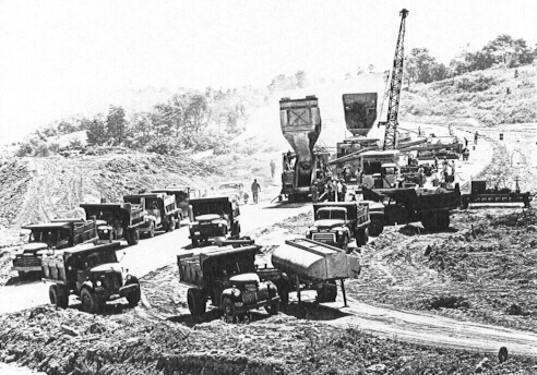
Penn-Lincoln Parkway under construction at the
Campbells Run
Road interchange in
1951. (Clyde Hare)
The following year the highway was widened from Rushwood Road to the current PA 217 interchange and a new alignment was under construction from there to the current Old Route 22 intersection. Construction began on the Lehigh Valley Thruway from the current interchange where the I-78 multiplex ends to New Jersey in 1952. Widening took place from PA 443 to Dauphin, Mill Hill Road to Mill Road, Windsor Township line to Lenhartsville, Klinesville to Sutter Road, Lutz Road to New Smithville, and Kecks Road to Adams Road. On June 5, 1953, the first section of the Penn-Lincoln Parkway from the Boulevard of the Allies to Business US 22 opened and on October 15, 1953, the section from Steubenville Pike to Saw Mill Run Boulevard opened. With the opening, the designation was removed from the current PA 60 alignment from Robinson to the West End Circle, and from Forbes Avenue, Beeler Street, Wilkins Avenue, Dallas Avenue, and Penn Avenue on the eastern side of the city. Traffic still had to use the original route between the Saw Mill Run Boulevard interchange and the current PA 885 interchange. The remainder of the new alignment to bypass Blairsville opened and with it, the designation was removed from West Market Street and East Market Street through the borough. In 1954, the highway was under construction from the PA 419 interchange to PA 183 interchange. That same year, the first section of the Lehigh Valley Thruway opened to traffic from west of PA 100 to the PA 987 interchange removing the US 22 designation from Tilghman Street and Union Boulevard.
In 1955, the section from the PA 419 interchange to the PA 183 interchange as well as the Lehigh Valley Thruway from PA 987 to the Easton-Phillipsburg Toll Bridge opened. The latter removed the designation from Schonersville Road, West Union Boulevard, Main Street, Elizabeth Avenue, Easton Avenue in Bethlehem and Butler Street, 15th Street, Prospect Avenue, and Pearl Street in Easton. That year the highway was widened from PA 103 to Lewistown. In 1956, the highway was widened from Ebensburg to Munster while construction began from the Shartlesville to the Hamburg interchange. That same year, the designation for westbound traffic was moved from North Street to Seventh Street and Forester Street in Harrisburg. On September 10, 1956, the section of the Penn-Lincoln Parkway opened from the Boulevard of the Allies to the current PA 885 interchange. In 1957, construction began from the Hamburg interchange to the Lehigh County line. In 1958, medians were installed from PA 130 to Murrysville, at the PA 66 interchange, Hornock Lane to US 119, current PA 217 to Palmerton Road, Cresson to the Blair County line, Healy Road to Juniata Township line, at the Foot of Ten Road intersection, sections between Alexandria and Hartslog Valley Road, at PA 26, at Fairgrounds Road, at Penn Street, Amity Hall to the current PA 849 intersection, Clarks Ferry to Speeceville, in Dauphin, and Progress to I-78. Widening took place in sections between Alexandria and Hartslog Valley Road and the Granville Township line to PA 103. The section between the Shartlesville and Hamburg interchanges opened while construction began from Electric Avenue to Main Street in Lewistown. In Harrisburg, westbound traffic was moved to Second Street and Division Street while eastbound remained on Front Street, and both directions were both moved to Forster Street and Seventh Street. In 1959, the Penn-Lincoln Parkway opened from the Point to the Boulevard of the Allies and on June 19, the Fort Pitt Bridge opened, which removed the designation from the Point Bridge, Water Street, Liberty Avenue, Boulevard of the Allies, and Bates Street. Also opening was the section from the Berks County line to west of PA 100, and Electric Avenue to Main Street in Lewistown. Construction began on the Mundys Corners and Ebensburg bypasses as well.
The 1960s saw the highway begin to be upgraded to accommodate more and more traffic. The $16 million Fort Pitt Tunnels opened at 2 PM on September 1, 1960, completing the Penn-Lincoln Parkway from Churchill to the Airport. The designation was removed from the West End Bypass and East Carson Street. In Harrisburg, a median was installed on Forester Street and Seventh Street. The following year, construction began on the final link of the Penn-Lincoln Parkway from Churchill to the Turnpike. Not just because of I-70 being proposed through the city, but also because of the growth of Monroeville justified the construction of a bypass. The $11,124,763 section opened at 11:30 AM on October 27, 1962. In 1961, the Mundys Corner and Ebensburg bypasses opened and the segment between the two was widened and a median was installed. Work began on a new alignment in 1962 from Philadelphia Street to PA 403. In 1963, construction began on the section of the Penn-Lincoln Parkway from the US 30/PA 978 interchange to PA 60, while the designation was moved to the Parkway between the Business US 22 interchange and the Turnpike. In 1964, the section of the Penn-Lincoln Parkway from the PA 978 interchange to PA 60 and the segment from Philadelphia Street to PA 403 opened. Construction began from the Washington County line to PA 978, US 322 interchange to the Electric Avenue interchange, and in Perry county from just east of the Watts interchange to US 11/US 15. In 1965, the expressway from a temporary interchange at Steubenville Pike to PA 978, US 322 interchange to Electric Avenue, and from the Watts interchange to the US 11/US 15 interchange. Construction was extended from PA 34 to east of the interchange. In 1966, construction began on a new alignment east of the Mifflin County line to Milroy and extended from the Perry County line to the PA 34 interchange. In 1967, the expressway opened from the Millerstown interchange to the Watts interchange while construction began from Pfautz Valley Road to the Millerstown interchange. In 1968, construction began from Interstate 78 to the Berks County line. In 1969, construction began from PA 18 to the temporary interchange, while from Pfautz Valley Road to the Millerstown interchange opened.
In 1970, construction began from the West Virginia state line to PA 18 as did the section from I-78 to the Berks County line. In 1971, the expressway opened from the West Virginia state line to the temporary interchange at Steubenville Pike, and now provided Weirton a limited-access, high-speed highway connection to Pittsburgh. In the central part of the state, construction began on the expressway from Dauphin to Arsenal Boulevard. The following year construction began from US 322 in Macedonia to the Lost Creek Road underpass and the Helltown Road underpass to the Pfautz Valley Road interchange. In 1973, construction began from the Lost Creek Road underpass to the Helltown Road underpass. In 1975, the expressway between Macedonia and the Pfautz Valley Road interchange opened. In the final year of the 1970s, the section from Dauphin to Arsenal Boulevard opened. With that opening, the designation was moved off Front Street, Second Street, Forester Street, and Seventh Street and onto Arsenal Boulevard and Herr Street to bypass downtown Harrisburg.
The 1980s were a slow period in the history of US 22. In 1982, construction began on the expressway from Admiral Peary Highway in Ebensburg to PA 764 and opened to traffic in 1984.
The 1990s for US 22 were a decade of rebuilding and upgrading. Traffic has steadily grown on the corridor over the years, and with the poor condition of the route such as only three lanes in locations, something had to be done to make it a more modern highway. The rebuilding consists of widening the highway, installing a median, and building jug-handled, signalized intersections at various points. The first part was Wilson Road to PA 819 which began in 1993 and finished in 1995. The next section was from PA 819 to US 119 which began in 1994 and finished in 1995 as well. Construction on the Dauphin Bypass from PA 225 to PA 443 began in 1997 and was finished in 1999. A project to rehabilitate the Lehigh Valley Thruway from the Lehigh River to PA 191 began in 1997. The surface was rebuilt, a Jersey barrier was installed in the median, ramps were extended, and bridges were rebuilt. The work finished in November 1999. The next step in the project to widen US 22 to six or eight lanes from Interstate 78 to the Lehigh River is being reevaluated due to the revised 12-Year Transportation Program.
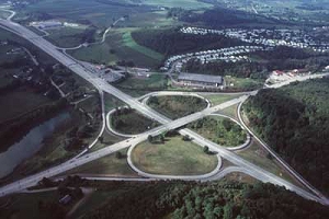
Construction began on transforming the US 22 interchange with PA Turnpike 66 from a cloverleaf into a SPDI (Single Point Diamond Interchange) on April 5, 1999. On October 9, 1999, the beams were lifted into place for the new bridge that carries US 22 over PA 66. The interchange partially opened on August 31, 2000 then completely on September 14, 2000 and cost $23 million. "It's a diamond interchange, but it's not a normal diamond because it has two connecting legs and two lights on each side. This has one light on each side, and moving traffic is a lot more efficient. I went through it a couple of times this morning, it's a very slick operation," said Mike Dufalla, PennDOT District 12 engineer said on the day it opened.
 |
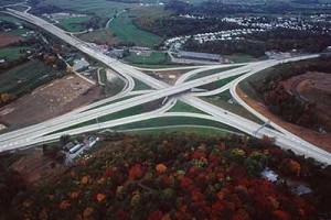 |
| Left is the
original cloverleaf interchange and the right is the completed SPDI. (PennDOT) |
|
In 2000, the section from the Susquehanna River to PA 325 was upgraded to an expressway and from there to PA 225 in 2001.
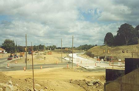
A groundbreaking ceremony on March 31, 2000 signaled the beginning of construction on the Northern Lewistown Bypass, with the first section involving widening and repaving four miles of US 22/US 522 from Wakefield Road to Airport Hill Road which began in April 2000 and finished in 2003. The next section involved building the expressway from south of Country Lane to the high-speed interchange at US 322 as well as rehabilitating three miles of it in the interchange area and constructing a new Electric Avenue interchange, all of which began in January 2001. The section from Airport Hill Road to just south of Country Lane began in January 2002.
A "Roll & Stroll" community day was held on October 15, 2005 which allowed local residents to walk or bike down the new expressway from 12 PM to 4 PM. A dedication was held between Caldwell Hill Road US 322 which unveiled the official name of the bypass as the Vietnam Veterans Memorial Highway.
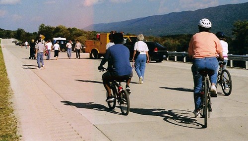
"Roll & Stroll" attendees walking and
biking down the unopened
expressway. (PennDOT)
The 12 new miles of expressway and ramps cost more than $130 million and opened on November 21, 2005. A ceremony attended by local officials and the media took place between Caldwell Hill Road and the Electric Avenue interchange. The project finally wrapped up in Fall 2006 when the Industrial Park interchange opened.
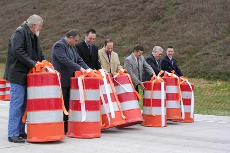
Instead of a ribbon-cutting, a barrel-rolling signifies the opening of
the expressway. L to R: Ralph Mashuda, Mashuda Corporation
president; William Gomes, AICP, Planning Director, Mifflin County;
Senator Jake Corman; Mike Glazer representing Congressman
John Peterson; Kevin Kline, P.E., District Executive of District 2-0;
Representative Larry Sather; and Representative Adam Harris.
The next section to be widened and divided from US 119 to PA 981 began in 2001. The $20.5 million project consisted of widening the highway, building left turn lanes at the intersections with US 119, Washington Avenue, and PA 981, and replacing the bridge over the Loyalhanna Creek. Work finished on December 13, 2002.
On January 4, 2001, construction began on the Water Street Bypass in Huntingdon. The highway was improved, including construction of a new bridge over Shaffer's Run to replace the one that had been there since the 1930s, and improvements to the US 22/PA 453 intersection. Construction was completed in 2002.
The rebuilding of the US 22/US 119 interchange in Blairsville began on August 1, 2001 with groundbreaking ceremonies kicking off construction. Work involved reconfiguring the ramp layout of the interchange as well as replacing the bridge carrying US 22 and realigning Old Route 22. The final cost was $28.8 million and the new interchange opened in Fall 2003.
 View of the interchange from the bridge in Fall 2002. (PennDOT) |
 View of the bridge from Old William Penn Highway in Fall 2002. (PennDOT) |
The state was looking to widen and realign the highway from US 119 to Armagh. Carl Young, who owns Young's Garage said, "They've been talking about that highway since 1970." He added that two of his three garages would have to go to make way for the wider US 22. Another business owner, Len Lichtenfels of Len's Auto at the corner of US 22 and Bowser Road said, "I'm not one to fight it. I might bite my tongue off later, though." He would lose the most with his house sitting right behind his business. "The house, that's going to be the kicker," he said. "That's where the fight is." Construction to widen this section began in Fall 2002 and finished when the new eastbound lanes opened on June 19, 2004.
A sinkhole developed on the section of expressway known as the Penn-Lincoln Parkway West in North Fayette near the Tonidale interchange on March 7, 2002. The two-foot-deep, 60-foot long dip occurred in the left lane of the highway, but affected the right lane as well. PennDOT blamed mine subsidence for the creation of the sinkhole. Crews worked around the clock to fill the hole with grout, as was done with construction projects in eastern Pennsylvania. All lanes were reopened on March 13.
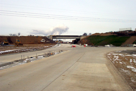
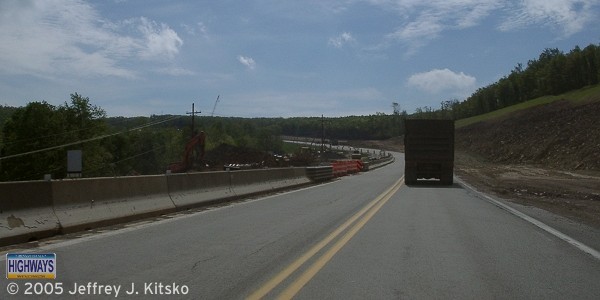
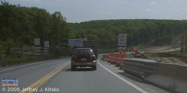
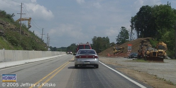
The former gap in the expressway through the Lewistown Narrows which was considered the most dangerous stretch of highway in Pennsylvania. The reason is that the highway was two-lanes, narrow, and connected two sections of expressway where traffic travels faster. Construction began on the Arch Rock interchange to upgrade it from a half-diamond to full-diamond interchange to provide access for both directions in April 2002 and was completed in Fall 2003 at a cost of $12.9 million. The $19.1 million rehabilitation of the interchange with Business US 22, including a new bridge over the widened highway, began in early 2003 and finished in 2005. The upgrading of the highway to an expressway between those two interchanges began in early 2004 and finished in 2008 at a cost of $110 million.
Westbound in "The Narrows" prior to
construction beginning.
On December 9, 2002, the Southwestern Pennsylvania Commission approved shifting $6.7 million in state and Federal funds to complete the interchange at I-79 so construction could get under way in 2005. Pennsylvania Department of Transportation Engineer Ray Hack said the project will take two years and cost at least $50 million. Currently to head west on US 22 and US 30, one must exit and travel PA 60, which has become congested with development. "Everybody knows the ramps are long overdue," Hack said. "People who have to use Route 60 to and from the airport face nothing but traffic lights between I-79 and the parkway." In addition, PennDOT will widen more than one mile of the Parkway West to three lanes in each direction between the I-79/I-279 interchange and Parkway View Industrial Park. Hack went on to say, "Someday, the Parkway West will be three lanes in each direction between Pittsburgh and the airport." Construction began in Summer 2006 and finished in 2008 marking the completion of the interchange after 30 years. The ramp to US 22 westbound opened on November 24 and the ramp from US 22 eastbound opened on December 9.
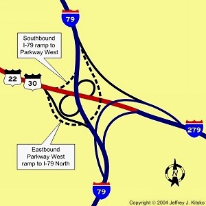
Location of proposed new ramps.
With the explosion of development in Robinson Township, improvements to interchanges began. In December 2003, construction started on a $28.8 million project to rebuild the Settler's Cabin Park ramps into a full interchange. The project included: full interchange between Campell's Run Road and the Parkway West, widening and relocating parts of Campbell's Run Road, upgrading Ridge and Bayer Roads, and building a six-lane bridge across the Parkway. The main reason for the interchange upgrade was that traffic waiting to exit the Parkway onto Campbell's Run Road would back up onto the Parkway itself. This interchange, at least the fifth new or improved one in the corridor in a decade, opened on October 28, 2005.
In 2003, construction began from the Allegheny County line to the Cozy Inn Cut-off. From the Allegheny County line to Trafford Road was widened to six lanes while from there to School Road widened to four lanes. An aesthetically appealing median was installed from Trafford Road to School Road. The bridge over Turtle Creek and the Turtle Creek Railroad was also replaced and the entire project finished on April 30, 2005.
On February 18, 2004, construction began from the Indiana County line to Mundys Corners. The project included widening the highway to four lanes with an eastbound truck climbing lane, installing lighting at all interchanges in Cambria County, drainage, signing, and guide rail improvements. Construction was completed on August 9, 2007.
 Land being cleared on either side of the current alignment for the future four-lane right-of-way. |
 Further east on the current alignment, closer to Mundys Corner, more earthmoving taking place. |
Construction began in Spring 2005 on the section from the Cozy Inn Cut-off to PA 66 which involved widening the highway to four lanes and installing a Jersey barrier in the median. Openings in the median will be provided for left turns at intersections. The $43,887,812 project finished in Summer 2008.
 Grading for the future eastbound lanes taking place east of the Cozy Inn Cut-off. |
 Further east before Berlin Farm Road where more earthmoving is taking place. |
In Spring 2006, work began on the section from PA 981 to just west of the PA 982 intersection, and included a traffic signal at Rushwood Road, finished in August 2009 and cost $35 million. A year later, work moved to the section from just west of the PA 982 intersection to Derry TR 968 which wrapped up in 2010 and cost $19.6 million, and from there to the Indiana County line which began in 2008 and cost $34 million. The last section which included construction of a new bridge over Stoney Run and a traffic signal at Jonnet Road officially ended on July 21, 2011 when PennDOT held a ceremony at the indoor-outdoor flea market just west of the Indiana County line which marked the end of 18 years of construction in the corridor.
On June 28, 2005, construction began on a $28 million project to widen the highway to four lanes from US 119 to the Mount Tabor Church. Construction finished in 2007 which is the same year construction began from there to the Armaugh bypass. This $50.8 million project included building a new alignment around Clyde which finished on October 26, 2010.
If people talking on cell phones while driving wasn't a distraction, how about people performing stunts outside the car or "car surfing?" Off-duty State Trooper Jolando Hinton witnessed just that on July 13, 2005 while traveling southbound. Brian Crawford of Irwin, a student at the Art Institute of Pittsburgh and aspiring stuntman, was seen climbing around the vehicle he was a passenger in, performing stunts that will make you cringe all while traveling 60 MPH. One of his friends was videotaping the stunts, which included hanging on the side of the car and "Superman" where he hung vertically only a foot off the ground, with an Art Institute camera. The stunts continued for two miles until on-duty troopers pulled the car over near Robinson Town Centre and found four men in the car ranging in age from 19 to 21. They faced reckless endangerment and disorderly conduct charges, and punishment by the school for using equipment in a criminal activity.
Even after the reconstruction work of the late 1990s, talk about improving the Lehigh Valley Thruway continued into the 2000s. One improvement was widening the highway from four lanes to six lanes to increase the capacity for local traffic. However, on August 31, 2009, Lehigh Valley area transportation officials were informed by PennDOT that they were scrapping the plan because of budget shortfalls and the Department focusing on repairing deteriorating bridges and roadways. Instead improvements would be scaled back from the $320 million needed for widening to replacing the Lehigh River Bridge as well as rehabilitating the Fullerton Avenue and MacArthur Road interchanges which would only cost $95 million. Plans for the new bridge were a bone of contention for the Lehigh Valley Planning Commission which raised objections to the design being eight feet too short to accommodate six lanes. The LVPC demanded answers to why their ideas were shot down, so they filed a formal request on December 15, 2009 using the state's then new Right-to-Know Law to request details of engineering and planning studies. Within 24 hours, PennDOT had denied the request. Whitehall Township had also filed a similar separate request, which too was denied. PennDOT Open Records Officer Elaine DeRienzo commented that the studies related to the project "are currently being drafted and reviewed by the necessary approving authorities," and that "until these records become a final approved plan, [they] reflect the internal, predecisional deliberations of PennDOT regarding the best course of action" for US 22. Even with the disagreements, LVPC Executive Michael Kaiser said their relationship with the Department of Transportation remains strong, and District Executive Mike Rebert of PennDOT District 5-0 agreed, adding it's "nothing personal."
Another improvement project that was getting underway on the Lehigh Valley Thruway was the rehabilitation of the Easton-Phillipsburg Toll Bridge. On February 27, 2012, the Delaware River Joint Toll Bridge Commission awarded Parsons Brinkerhoff, Inc. a contract for preliminary, final, and post-design engineering services.
The PA 145/MacArthur Road interchange improvement project in Lehigh County began in May 2012. The cloverleaf interchange was reconfigured into a diamond to better facilitate merging onto the expressway, traffic signals would be installed at the ramps, and a wider and taller bridge for PA 145 would be built. The $13.8 million project will be completed in 2014. Project website: http://www.145-22int.com.
A rehabilitation project on the Lehigh Valley Thruway that began July 9, 2012 had Mayor Sal Panto of Easton up in arms. At the city council meeting on August 8, 2012, he voiced his displeasure with the tree trimming PennDOT crews had performed from 25th Street to Fourth Street, saying "They just rip the trees down. [The] 13th Street interchange [interchange] is virtually naked." Mayor Panto said the following day that the city has deep roots in the Tree City USA program, and that the actions of the Department of Transportation was not supportive of that program. The same day, PennDOT District 5 Spokesman Sean Brown responded saying that they were reclaiming the right-of-way, falling limbs on the highway could cause accidents, and in winter, overhanging trees can allow more snow and ice to build up on the roadway. Panto said he would have liked to have seen a different approach, and Brown added that PennDOT respects the opinions of the city, but their duty is to maintain the safety of the roadway. The $7.15 million project also included new guide rail, signs, milling, patching, and paving, which the latter probably also had the mayor up in arms. Originally, the project was to be completed at the end of October 2012, and while the resurfacing of the eastbound lanes wrapped up at that time, completion of the westbound lanes lasted into 2013.
PennDOT study begun in 2010 recommended approximately $20 million worth of safety and maintenance improvements on a 41-mile-long section of the highway from Duncansville to the Mifflin County line. Four public meetings were held in Blair and Huntingdon counties, two in the fall of 2011 and two in the spring of 2012, and a citizen advisory committee was consulted on how to upgrade the road. The work includes improvements to the Forsht Drive intersection in Duncansville, DeGol Drive intersection, Reservoir Road intersection, and the Turkey Valley Road and Juniata Valley Road intersection. Thirteen other projects were recommended that were unfunded : seven in Blair County and six in Huntingdon County. The Blair County projects include parking restrictions on Duncansville's main street, improvements to US 22 at the Sheetz store and Old Canal Inn in Hollidaysburg, improvements to the Newry, North Juniata and Allegheny streets intersection, PA 36 intersection, and the top priority being improvements to the PA 764 intersection. A truck climbing lane near Canoe Creek was also proposed. The Huntingdon County projects include intersection improvements at River Road, Fourth Street in Huntingdon, PA 453 in Water Street, at Penn Street, and at the Thousand Steps parking area, with the top priority the PA 829 intersection. PennDOT District 9-0 staff began work on the Transportation Improvement Program in January 2013 to fund these projects, with the decision on the recommendations to come Summer 2014.
The Harrisburg morning commute on May 9, 2013 was not a smooth one for those who regularly use US 22. At 6:10 AM, a tanker truck hauling 7,500 gallons of diesel fuel traveling the ramp from Interstate 81 northbound to US 22/US 322 westbound lost control and crashed, bursting into flames. Fortunately, no other vehicles were involved and the driver managed to escape the cab before the truck exploded, which burned for about 45 minutes and caused guide rail to melt and the roadway surface to explode. The fuel that did not burn leaked into Paxton Creek and the lake in Wildwood Park.
US 22/US 322 and Interstate 81 were closed immediately so PennDOT could determine the structural integrity of the affected bridges. The ramp where the accident took place as well as the bridge that carried US 22 eastbound south towards downtown Harrisburg would both need replaced. Traffic on US 22 westbound and the ramp from it to I-81 northbound resumed later that morning at 10:30 AM, the ramp to I-81 southbound at 1:40 PM that afternoon, the ramp from I-83 northbound to I-81 southbound reopened at 4:45 PM, and later that night, Exit 61 and Exit 65 reopened. Governor Tom Corbett signed a disaster emergency proclamation on the night after the accident. "This accident has created a traffic nightmare for thousands of citizens as they try to go about their daily lives to work, school and other activities," Corbett said. "But the economic impact across the Northeast United States and Mid-Atlantic region is potentially staggering when you consider the amount of commerce that travels through Pennsylvania on these roads every day." To provide a detour route, the Turnpike Commission waived tolls for anyone entering and exiting at Exit 226/Carlisle and Exit 247/Harrisburg East from May 9 to midnight on May 13.
Demolition of the affected spans began on May 10, with the first being the US 22 eastbound span. At the same time, temporary median crossovers were built north and south of the bridge to restore eastbound traffic was happened at 3 PM on May 12. Demolition of the US 22 span was completed the following day at a cost of $2.1 million, with Interstate 81 northbound traffic being restored at 7 PM and southbound traffic at 7:35 PM. PennDOT learned on May 14 that the USDOT released $2 million in emergency funds to pay for work getting the Interstate reopened. The new eastbound span opened to one lane of traffic at 3:20 PM on November 14, 2013, and the $3.3 million phase officially came to a close a week later at 1 PM after the temporary crossovers were removed and guiderail installed. US 22 westbound was restored to two lanes of traffic a little after 3 PM on November 21.
When the Coronavirus, or COVID-19, pandemic swept into the country in March 2020, the Delaware River Joint Toll Bridge Commission took measures to stem the spread to their employees and staff. At 10:00 PM on March 24, all tolled bridges, including the Easton-Phillipsburg Toll Bridge, went to a cashless toll collection system. E-ZPass users would pass through the plazas as normal, and drivers who normally paid by cash were directed to the far right lane of the toll plazas and to have their license plate captured. A bill for the toll only, without additional administrative or violation fees, would then be sent to their address which would then have to be paid within 30 days or else each unpaid transaction would face a $30 violation fee. At 11 PM on May 13, the DRJTBC began accepting cash payments again. Additional safety measures were put in place, such as toll collection staff being given plastic face shields, masks, and nitrile gloves. They also encouraged drivers paying by cash to wear a face covering when using a cash lane.
It was an end of an era for the Easton-Phillipsburg Toll Bridge on January 12, 2025 when cash payments stopped being accepted at 11 PM. This span, along with the Trenton-Morrisville, Interstate 78, and Delaware Water Gap toll bridges, were the final Delaware River Joint Toll Bridge Commission tolled spans to switch to all-electronic tolling (AET) utilizing only E-ZPass and TOLL BY PLATE for payments. A design contract to replace the toll plazas with gantries that have E-ZPass readers and TOLL BY PLATE cameras was awarded at the Commissions's June 24, 2024 meeting to Rummel, Klepper & Kahl, LLP (RK&K) of King of Prussia to develop two gantry designs: one for low-traffic volume toll bridges, such as the New Hope-Lambertville, and another for high-traffic-volume toll bridges like the Interstate 78 span.
Links:
Exit Guide
US 22 Auxiliary Routes
US 22 Pictures
US 22 Expressway (Cancelled)
Interstate 376
Interstate 78
E-ZPass - Delaware River Join Toll Bridge Commission
Easton-Phillipsburg Toll Bridge
- Delaware River Joint Toll Bridge Commission
US 22-The William Penn Highway - Federal Highway Administration
Lehigh
Valley Thruway - Steve Anderson
Terminus of US 22 - Dale Sanderson
US
22 Pictures - Andy Field/Alex Nitzman
US 22
Pictures - Steve Alpert
US
22 Photos - Valerie Deane
US
Route 22 - David Golub
 INFORMATION
 |
|
| Western Entrance: | West Virginia state line near Paris. |
| Eastern Entrance: | New Jersey state line at the Easton-Phillipsburg Toll Bridge in Easton. |
| Length: | 319 miles |
| National Highway System: | West Virginia state line to PA
230 I-78 to the New Jersey state line |
| Names: | William Penn Highway Penn-Lincoln Parkway, New William Penn Highway, Sixth Avenue, Third Avenue, Broad Street, Blair Street, Vietnam Veterans Memorial Highway, 28th Division Highway, William B. Lentz Highway, Cameron Street, Arsenal Boulevard, Herr Street, Jonestown Road, Allentown Boulevard, 78th Division Highway, and Lehigh Valley Thruway |
| SR Designations: | SR 0022 SR 0376: Exit 60 to Business US 22 SR 0078: Exit 8 to Exit 51 |
| Counties: | Washington, Allegheny, Westmoreland, Indiana, Cambria, Blair, Huntington, Mifflin, Juniata, Perry, Dauphin, Lebanon, Berks, Lehigh, and Northampton |
| Expressway: | West Virginia state line to
Business US 22 Ebensburg to PA 764 Business US 22 to Business US 22 West of Cub Mills to PA 325 Dauphin to Harrisburg Exit 8 to Exit 51 on I-78 I-78 to the New Jersey state line |
| Multiplexed Routes: | US 30: PA 978 to Exit 78A I-376: PA 60 to Business US 22 US 19: Exit 69A to Exit 69C Truck US 19: Exit 69C to Exit 70C US 119: New Alexandria to Blairsville PA 655: Mill Creek to Mapleton PA 764: Cross Creek to Duncansville Business US 220: Duncansville to Plank Road US 522: Mount Union to Lewistown US 322: Lewistown to Harrisburg I-78: Exit 8 to Exit 51 PA 343: Fredericksburg |
| Former Designations: | PA 3 (1925 - 1930):
Monroeville to Ebensburg and Duncansville to Mill Creek PA 45 (1927 - 1928): Mount Union to Business US 22 PA 24 (1927 - 1928): Harrisburg to Harper Tavern PA 43 (1927 - 1932): Harper Tavern to Hamlin PA 43 (1928 - 1932): Harrisburg to Harper Tavern Bypass US 22 (1935 - 1979): PA 230 to State Street |
BicyclePA Route: |
PA 453 to Alfarata |
BicyclePA Route: |
Dauphin Boro interchange to PA
443 PA 325 to US 11/US 15 |
 Belt System: |
Oakdale interchange to PA 60 |
 Traffic Cameras: |
PA
60 Settlers Cabin Easbound Off-Ramp Settlers Cabin Settlers Cabin Eastbound On-Ramp Bishops Corner Campbells Run I-79 Interchange West I-79 Interchange East Rosslyn Farms Carnegie Green Tree Green Tree Hill (Top) Green Tree Hill (Middle) Banksville Road Fort Pitt Tunnel Garage Fort Pitt Tunnel Upper Portal Fort Pitt Tunnel Lower Portal Commonwealth Place Fort Pitt Boulevard Grant Street County Jail Second Avenue Brady Street Bates Street Swinburne Street Saline Street Beechwood Boulevard Commercial Street Swissvale Edgewood Brinton Road Forest Hills Wilkinsburg Greensburg Pike Churchill Penn Hills Deshong Mountain Road Center Street/Willmore Road Cresson Summit Gallitzin PA 764 PA 453 Business US 22 Macedonia Gap Road Clark's Ferry Bridge PA 225 PA 39 PA 645 PA 183 PA 61 PA 143 PA 737 PA 100 I-78 PA 309 Cedar Crest Boulevard 15th Street PA 145 Fullerton Avenue Airport Road Schoenersville Road PA 512 PA 191 PA 33 4th Street |