It has been 12, almost 13, years since a map was published by the Turnpike Commission. So it came as a surprise to see a PDF version of one from 2024 on their website. I stopped in at the Western Regional Office looking for this elusive map. Being in the neighborhood to check out the newest Rutter’s, and first west of the US 219 corridor, I took a short (and free) detour up PA Turnpike 66. Well, I found a map, and it is new-ish. OK, it is the 2020 official Turnpike map.
Similarly to previous editions, the 2020 official Turnpike map has the strip maps of the mainline Turnpike and the extensions. The food choices at the service plazas are illustrated. Not only are there two changes since the 2013 map, one of them is a pretty big one.
Bucks County
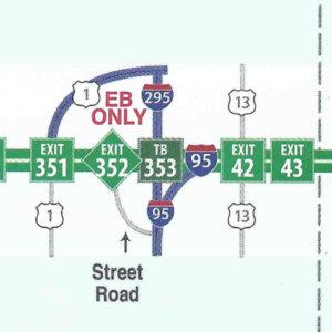
Interstate 95 connector is open to traffic
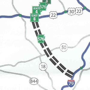
Allegheny County/Washington County
PA Turnpike 576 is under construction between US 22 and Interstate 79.
This map lists lodging selections at interchanges along the mainline Turnpike and Northeast Extension. Included are phone numbers for making reservations with those establishments. Each one has a number that corresponds to their location in the inset maps of those interchanges.
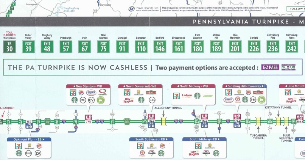
The Turnpike Commission began studying transitioning to all-electronic toll collection in 2010. However, the COVID-19 pandemic forced their hand, and they changed the mainline, Northeast Extension, and Mon-Fayette Expressway to cash-less in 2020. Therefore, a notice on the map right above the mainline Turnpike strip map mentions acceptance of only E-ZPass and TOLL BY PLATE now. Furthermore, a text box next to that one references the then ongoing pandemic and that limited services are available at the service plazas, with the web address of their page at the Pennsylvania Turnpike’s website.
The cover features a picture of the Susquehanna River Bridge. It carries traffic over said river and is located between Exit 242/Harrisburg West and Exit 247/Harrisburg East.