It is the newest social media craze to hit the Internet: Threads. Just don’t pull those threads, instead follow them.
If you don’t know by now, Threads is Meta’s (Facebook’s and Instagram’s parent company) competitor to Twitter. It is more on the Instagram side of the company, as it is an off-shoot of that product. However, it is more like a text-based version of that product. Even so, it gained 10 million followers in less time than Twitter, or even Facebook.
As I mentioned, it is a product similar to Twitter in that a user can share anything with their followers or the entire Internet according to their privacy settings. It is how Twitter used to be before changes took place when Elon Musk purchased control and took the company private. Speaking of Elon, he is suing Meta.
Look for our content at Threads, along with Twitter.
One thing that we have tried to make Pennsylvania Highways be is at the forefront of innovations of Internet technology. Recently, that technology is with the evolution of social media, or what was once referred to as “Web 2.0.” While we will be the first to admit that the site itself still has work to be done, it’s presence in social media has been extensive. Some of our social media channels have worked out well engaging with the public, such as Twitter and Facebook, and others not so much, such as Del.icio.us and Vimeo, have not.
One new social media outlet that has been talked about in recent time is Snapchat. It is similar to text messaging or instant messaging, except that the “snaps” you send someone automatically deletes itself after a period of time. Even with this limitation, businesses are jumping on the bandwagon and joining.
We figured we might as well jump on the bandwagon as well, but trying to navigate Snapchat is a little challenging. Businesses use it to advertise discount codes for their stores, share branded filters, or show “behind-the-scenes” activities. I doubt anyone wants to see me code pages or update content, so I guess it’ll be used to promote new construction projects. If you want to join us on the trip, just snap (see what I did there?) our snapcode below.
We all know the function of periscopes on submarines. They are the instrument that sailors use to check out what is going on on the surface. Just as that periscope helps see a wider view, there is now an app that can do the same thing.
Periscope was developed by Kayvon Beykpour and Joe Bernstein in 2014 and acquired by Twitter a year later. The purpose of the app is to stream in real-time anything using a smartphone. Hopefully I will be able to use it to live stream events such as ribbon-cutting ceremonies, project open houses, and other events related to the highway system. As they say in the television business, “stay tuned.”
Pictures seem to be social media’s “bread and butter” these days. No more just telling people about what you are seeing or what your are experiencing, but now you can snap a picture with your smartphone and show your followers. One service has been built strictly to do just that, and even caught the attention of one of the “big boys” of social networking when Facebook purchased Instagram.
On Instagram, users can not only share pictures but also small short video clips. With the application of various filters, the images can even look like old Polaroid instant pictures. A service such as this seems like a perfect fit for Pennsylvania Highways, where sharing pictures of roads, signs, traffic signals, etc. has been a part of our site for years. So if you like checking out interesting pictures of highway infrastructure, head on over to our page, but don’t shake your monitor like a Polaroid picture.
You might have heard of the website Pinterest, or at the very least, seen “Pin It” icons on sites you have visited. It is another social media websites like Facebook and Twitter, but not about sharing statuses or links to Icanhascheezburger, but sharing pictures. People use Pinterest to plan weddings, pick out a place to visit for their next vacation, and design a new living room by posting pictures they find to “boards” on their page.
Businesses are also joining in on the fun of sharing. The Department of Tourism, VisitPA, has a page that shares pictures from around the state of points of interest and scenes of natures. Today, Pennsylvania Highways has joined to share pictures relating to the highway system of the Commonwealth as well things relating to highway travel. The best part is, there is nothing sharp involved.
One of the things I like about working on this website is showing and explaining how the highway system of Pennsylvania has evolved over the years. Now I am taking the show on the road…literally.
So on March 11, I am taking this website and crunching it down to an hour-long presentation entitled Pennsylvania’s Roadways: From the Lincoln to Eisenhower. It will be Sunday, March 11 beginning at 2 PM at the Lincoln Highway Experience, the headquarters for the Lincoln Highway Heritage Corridor, at 3435 Route 30 East (a.k.a. the Lincoln Highway) in Latrobe. Refreshments will be provided.
Due to limited seating in the auditorium, advanced reservations are required, which can be made through the LHHC’s website or by calling 724-879-4241. Admission is $10/person for non-LHHC members and $7/person for Friends of the Lincoln Highway.
Global Positioning Satellites, or GPS, has revolutionized the world. Now with the help of GPS-enabled devices, being lost is quickly becoming obsolete. Not only can people be found who were lost and possibly injured in the deepest wooded area, but drivers can find that hidden shortcut, and walkers and joggers can record their latest achievement.
One of the uses of GPS chips has been inclusion in cell phones over the past decade. Aside from being able to locate you in the event of an emergency when calling 911, it can help navigate unfamiliar territory. The advent of the smartphone has brought apps utilizing the GPS chip such as Google Maps and Foursquare.
“What is Foursquare?” you may ask. It is a social networking platform like Twitter and Facebook, but unlike those websites, Foursquare gets you away from your computer and out exploring. Users can “check in” to various locations from their cell phones, which earn them points and badges. Check in more times at one place, and you will become “Mayor” of that location which might earn you a perk.
Foursquare is about where Twitter was two years ago. It is on the cusp of being the “next big thing” in the world of Web 2.0. Just as organizations jumped on the Twitter bandwagon, they are jumping, or I should say checking in, on the Foursquare bandwagon. VisitPA (the Department of Tourism) has three badges, PA Retail Polka, PA 4 Score & 7, and PA Shooflyer, that users can earn by checking in at certain places around the Commonwealth.
Now Pennsylvania Highways has joined them, and Washington State Department of Transportation and Missouri Department of Transportation, with a Foursquare page. It will be used to give tips on highway-related check in points such as the Squirrel Hill Tunnel or one of the Turnpike interchanges, but only read them on the website or let a passenger read them to you. Perhaps a badge or two will be offered if Foursquare permits it in the future, but before you ask, there will not be a “Pothole Badge.”
Let me tell you kids about the good ol’ days, as some folks like to call them. Human knowledge would be put into “books,” which are like websites. These “books” were similar to a Kindle, iPad, or Slate, but consisted of “paper” rather than microchips. They also did not need recharging every other day, nor a Wi-Fi or cellular connection. Even back in these “analog” days, there was a Pennsylvania Highways presence.
In this simpler time, a “superhighway” consisted of asphalt and concrete rather than fiber optics and servers. These roads would connect the farthest reaches of the country with the other farthest reaches. In the early days of the highway system, there were no signs nor maps. Forget about GPS devices! They wouldn’t be available at the local Sears, Roebuck and Company for about another eight decades.
Associations formed around the United States to solve the problems that early travelers faced on unmarked and unnumbered trails. In this early period of road travel, names marked highways rather than numbers. Two of the more notable ones were the Lincoln Highway and the Yellowstone Trail.
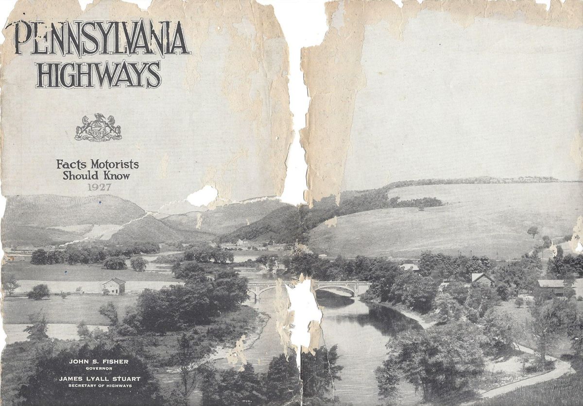
States saw what these groups were doing and decided to take matters into their own hands. They began marking those routes by numbers rather than names. Pennsylvania was one of the first to number main highways in 1925. It was also the first to assign a single designation to cross-state routes. To spread the world to the traveling public about these routes and help tourism across the Commonwealth, PennDOT’s predecessor the Department of Highways published the booklet Pennsylvania Highways: Facts Motorists Should Know in 1927.
Pennsylvania Highways circa 1927
I did not know about this booklet when I named the website, which was originally entitled Pennsylvania Highways and Byways. My uncle discovered this rare gem on eBay. He gave it to me as a birthday gift, roughly 80 years after it was printed. The North-South Parkway, or the “New 48” as it was referred to, would have cut through where he lives had it been built.
The booklet begins with a message about being the keystone of the highway system from Governor John S. Fisher and one about the highway program from Secretary of Highways, James Lyall Stuart. Further articles talked about the Pennsylvania Highway Patrol (State Police) and how motorists benefit from maintenance from the Department of Highways Chief Engineer. There is even one on the highways of Pennsylvania from the perspective of a woman. One article that stood out was from the President of the Pennsylvania Motor [AAA] Federation Richard C. Haldeman, who proclaimed in the title, “Pennsylvania Has the Best Highway System in America.”
Much like the modern version, the booklet contains descriptions of routes under the State’s jurisdiction, as well as pictures from various points along them. The following is a list of the state routes which existed at the time of publication:
1 – Lincoln Highway
2 – Lackawanna Trail
3 – William Penn Highway
4 – Susquehanna Trail
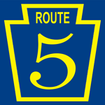
5 – Lakes to Sea Highway
6 – Old Monument Trail
7 – Roosevelt Highway
8 – William Flinn Highway
9 – Yellowstone Trail
10 – Buffalo-Pittsburgh Highway
11 – National Pike
12 – Baltimore Pike
13 – Harrisburg to Maryland State Line via Carlisle
17 – Benjamin Franklin Highway
19 – Lewistown to Narrowsburg, via Wilkes-Barre and Scranton
24 – Harrisburg to the Maryland Line, through Gettysburg and Emmittsburg
41 – Harrisburg to Lancaster
44 – Buchanan Trail
64 – From State Line, North of Cumberland, Maryland to Susquehanna Trail, South of Lawrenceville
88 – Perry Highway
A map section in the middle of the booklet shows these primary routes, as well as others signed at the time. At this time, route markers were gold on blue rather than the black on white we know today. During this era, telephone or telegraph poles would have route markers painted on them. The map section for the central part of the state made mention of this practice.
Included is an explanation of “DETOUR” and “TEMPORARY” routes. This was important since the highway system was still very much a work in progress. Depictions of various signs that one would find along the roadways of the Commonwealth peppered the booklet. This was to let motorists what they’d find to help them navigate the still burgeoning highway system. What I find interesting are the signs for things such as speed limits and passing zones. They were the same shape as the keystone markers which greeted travelers at the entrances to towns.
Of course, there were no Interstates nor toll roads, or even US routes for that matter. The map section contains the following explanation for those missing routes:
The numbers assigned transcontinental highways by the Joint Board named by the Secretary of Agriculture will not be used on Pennsylvania Highways in 1927. Until a final decision has been made on all routes and the decision is accepted by the Pennsylvania Department of Highways, the markings will not be found on Pennsylvania highways or officially recognized by the Pennsylvania Department of Highways.
I guess that decision came quickly because US routes would appear on the 1928 Department of Highways map.
The tourism section provided pieces on historic sights listed by county. Specific ones such as Lake Erie and President James Buchanan’s birthplace are written about in greater depth. Listings of state parks and tourist camp sites were provided for those who wanted to enjoy the great outdoors. Directions between cities were provided by either traveling one direct route or several alternate routes. The mention of road improvements that had taken place are under the respective route descriptions. Directions are also provided to out-of-state places such as New England and Florida!
Tenjamin G. Eynon, Registrar of Motor Vehicles, wrote the final section of the booklet. He explained the function of his department as well as providing information on titles, plates, required equipment for cars, and rules of the road. The last page has a list with pictures of flowers found along Pennsylvania’s highways, as well as rules on picking them.
It is always interesting to find gems like this which detail transportation in a long-ago era. The more things change, the more they stay the same, it seems. Next up, kids: I will tell you a fantastic story of when MTV played music videos. If there is time, I’ll tell one about when The Weather Channel broadcast weather reports!
There is a lot of talk these days about the newest revolution on the Internet: Social Networking. It started with this blog, which I use to write not just about the roads across the Commonwealth, but musings about Pennsylvania. However, other means of social networking have come along since blogs were all the rage. I began to think how these new tools could benefit Pennsylvania Highways. So today, on the ninth anniversary of when I purchased the pahighways.com domain, I created a couple new avenues of communication, so you can social network with us by tweeting, liking, or watching Pennsylvania Highways.
Twitter The new cultural buzzword. Everyone seems to be twittering, from Oprah to Senator John McCain. I’ve seen other Twitter pages such as CNN’s and the Washington State Department of Transportation’s and thought how it could work for my site. PennDOT and the PTC do have a system where people can receive text messages; however, it doesn’t have the immediacy of a Twitter post. So using the WSDOT “template,” I created an account that will not only be used for updates to the site, but news items pertaining to the highway system.
Facebook Another phenomenon that seems to have come out of nowhere and taken the Internet by storm is Facebook. It seems that everyone from 9 to 90 has a Facebook page, even people’s pets! So I figured why not create a Pennsylvania Highways presence on this platform as well. Posts will include news articles, website updates, announcements of upcoming road enthusiast meets, and other events.
YouTube No doubt you have spent time on this site. Probably watching a clip of a skateboarding bulldog while trying not to get caught by the boss. YouTube is nothing new to the road enthusiast community, as others have been recording their journeys and uploading them to this popular website. So now Pennsylvania Highways has entered the fray. However, trying to find its niche will take a little longer than it took to set the page up.
One issue is that PennDOT has saved me the work by going ahead and videotaping all state routes. Another issue is that I need a newer video camera than my family’s circa 1991 Panasonic camcorder that is as big as a half loaf of bread, or just buy the A/V dongle from Hauppauge, so I can record the video from it onto my computer’s hard drive. Basically, this idea is still on the burner.
The yearly survey of truck drivers and readers of Overdrive magazine has been released. I can now say, as well as the index page can now say, that Pennsylvania’s highways are no longer the worst in the country. Yes, you read that correctly. Pennsylvania’s highways are no longer the worst in the country. We’re not Number 1!
Pennsylvania has relinquished that title to Louisiana, and before you say it, it has nothing to do with Hurricane Katrina. While the storm did damage roadways along the coast, especially the Interstate 10 bridges that cross Lake Pontchartrain, the rest of the state has no excuse and in fact has bounced around the top five worst for years now.
Considering everything that is working against PennDOT:
1. Most if not all traffic between New England and the rest of the country pass through the state 2. Having to maintain the same amount of state routes that is in all of New England 3. Freeze-thaw cycle 4. Federal highway money being siphoned off to prop up mass transit
It is not as if PennDOT is in the throes of their fiscal crisis of the 1970s and 1980s. They have been building new expressways such as US 222 in Reading and rebuilding highways such as the Fort Washington Expressway.
When it comes to snow removal and surface treatment, they are on their game. Just recently, there was a small snow event that came through western Pennsylvania. The state routes were clear and traffic was moving fine, but once onto the city streets of Latrobe, it was like a skating rink.
Again this year, the article mentioned myself along with the website. The one thing I did not like about the article labeling Pennsylvania Highways a “watchdog site.” The only way that it is that, is because I watch what they do, and I can change the information here accordingly. However, the term makes it sound as if I am staking out construction projects or maintenance yards watching for malfeasance.
Anyway, next time you’re driving through a construction zone, just keep saying to yourself, “We’re not Number 1!”