Let me tell you kids about the good ol’ days, as some folks like to call them. Human knowledge would be put into “books,” which are like websites. These “books” were similar to a Kindle, iPad, or Slate, but consisted of “paper” rather than microchips. They also did not need recharging every other day, nor a Wi-Fi or cellular connection. Even back in these “analog” days, there was a Pennsylvania Highways presence.
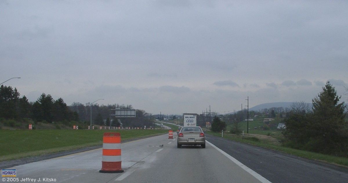
In this simpler time, a “superhighway” consisted of asphalt and concrete rather than fiber optics and servers. These roads would connect the farthest reaches of the country with the other farthest reaches. In the early days of the highway system, there were no signs nor maps. Forget about GPS devices! They wouldn’t be available at the local Sears, Roebuck and Company for about another eight decades.
Associations formed around the United States to solve the problems that early travelers faced on unmarked and unnumbered trails. In this early period of road travel, names marked highways rather than numbers. Two of the more notable ones were the Lincoln Highway and the Yellowstone Trail.
States saw what these groups were doing and decided to take matters into their own hands. They began marking those routes by numbers rather than names. Pennsylvania was one of the first to number main highways in 1925. It was also the first to assign a single designation to cross-state routes. To spread the world to the traveling public about these routes and help tourism across the Commonwealth, PennDOT’s predecessor the Department of Highways published the booklet Pennsylvania Highways: Facts Motorists Should Know in 1927.
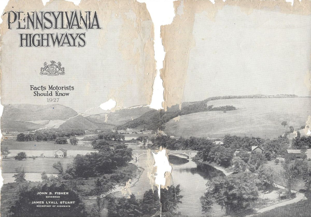
I did not know about this booklet when I named the website, which was originally entitled Pennsylvania Highways and Byways. My uncle discovered this rare gem on eBay. He gave it to me as a birthday gift, roughly 80 years after it was printed. The North-South Parkway, or the “New 48” as it was referred to, would have cut through where he lives had it been built.
The booklet begins with a message about being the keystone of the highway system from Governor John S. Fisher and one about the highway program from Secretary of Highways, James Lyall Stuart. Further articles talked about the Pennsylvania Highway Patrol (State Police) and how motorists benefit from maintenance from the Department of Highways Chief Engineer. There is even one on the highways of Pennsylvania from the perspective of a woman. One article that stood out was from the President of the Pennsylvania Motor [AAA] Federation Richard C. Haldeman, who proclaimed in the title, “Pennsylvania Has the Best Highway System in America.”
Much like the modern version, the booklet contains descriptions of routes under the State’s jurisdiction, as well as pictures from various points along them. The following is a list of the state routes which existed at the time of publication:
- 1 – Lincoln Highway
- 2 – Lackawanna Trail
- 3 – William Penn Highway
- 4 – Susquehanna Trail
- 5 – Lakes to Sea Highway
- 6 – Old Monument Trail
- 7 – Roosevelt Highway
- 8 – William Flinn Highway
- 9 – Yellowstone Trail
- 10 – Buffalo-Pittsburgh Highway
- 11 – National Pike
- 12 – Baltimore Pike
- 13 – Harrisburg to Maryland State Line via Carlisle
- 17 – Benjamin Franklin Highway
- 19 – Lewistown to Narrowsburg, via Wilkes-Barre and Scranton
- 24 – Harrisburg to the Maryland Line, through Gettysburg and Emmittsburg
- 41 – Harrisburg to Lancaster
- 44 – Buchanan Trail
- 64 – From State Line, North of Cumberland, Maryland to Susquehanna Trail, South of Lawrenceville
- 88 – Perry Highway
A map section in the middle of the booklet shows these primary routes, as well as others signed at the time. At this time, route markers were gold on blue rather than the black on white we know today. During this era, telephone or telegraph poles would have route markers painted on them. The map section for the central part of the state made mention of this practice.
Included is an explanation of “DETOUR” and “TEMPORARY” routes. This was important since the highway system was still very much a work in progress. Depictions of various signs that one would find along the roadways of the Commonwealth peppered the booklet. This was to let motorists what they’d find to help them navigate the still burgeoning highway system. What I find interesting are the signs for things such as speed limits and passing zones. They were the same shape as the keystone markers which greeted travelers at the entrances to towns.
Of course, there were no Interstates nor toll roads, or even US routes for that matter. The map section contains the following explanation for those missing routes:
The numbers assigned transcontinental highways by the Joint Board named by the Secretary of Agriculture will not be used on Pennsylvania Highways in 1927. Until a final decision has been made on all routes and the decision is accepted by the Pennsylvania Department of Highways, the markings will not be found on Pennsylvania highways or officially recognized by the Pennsylvania Department of Highways.
I guess that decision came quickly because US routes would appear on the 1928 Department of Highways map.
The tourism section provided pieces on historic sights listed by county. Specific ones such as Lake Erie and President James Buchanan’s birthplace are written about in greater depth. Listings of state parks and tourist camp sites were provided for those who wanted to enjoy the great outdoors. Directions between cities were provided by either traveling one direct route or several alternate routes. The mention of road improvements that had taken place are under the respective route descriptions. Directions are also provided to out-of-state places such as New England and Florida!
Tenjamin G. Eynon, Registrar of Motor Vehicles, wrote the final section of the booklet. He explained the function of his department as well as providing information on titles, plates, required equipment for cars, and rules of the road. The last page has a list with pictures of flowers found along Pennsylvania’s highways, as well as rules on picking them.
It is always interesting to find gems like this which detail transportation in a long-ago era. The more things change, the more they stay the same, it seems. Next up, kids: I will tell you a fantastic story of when MTV played music videos. If there is time, I’ll tell one about when The Weather Channel broadcast weather reports!