Categories
Events News

The World Comes to the Commonwealth

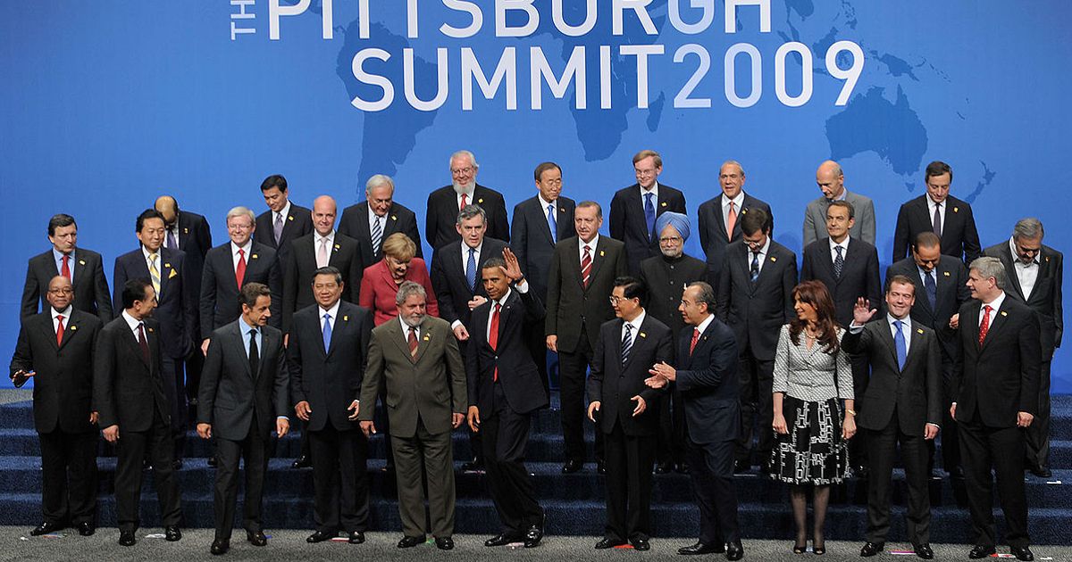
White House Press Secretary Robert Gibbs said in May that the next G-20 Summit would be held in Pittsburgh. As a result, there were more than a few laughs from the White House Press Corp.  And why not, what does anyone there know about finance and banking or surviving an economic downturn?  After all, it is an area where people pay a fair market value for a house.  How quaint! However, the world came to discuss all of the above.

The reason President Obama chose the “City of Champions” was due to visiting the area during the 2008 campaign.  He saw how it changed from a center of steel to one with a more varied economic base. One focused on medicine, finance, and high-tech industries.  Fortunately, the industrial fore-fathers of the city were not misers and gave back to their community in the form of libraries and universities. These were the crutches by which Pittsburgh could pull itself up by its bootstraps and start over.

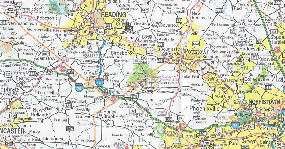
Leaders from around the world began arriving on Wednesday. This prompted rolling roadblocks on the Parkway West between Pittsburgh International Airport and Downtown.  The motorcades passed through the US 22/US 30-PA 60 interchange project. The American Recovery and Reinvestment Act of 2009 partially funded the work. Passage of the ARRA was to dig (no pun intended) the country out of the global recession. The topic of which would be the focus of the next two days.

While the leaders of the 20 largest economies and the European Union were arriving, so were the protesters. Members of Greenpeace repelled off the West End Bridge. They displayed a banner protesting the lack of attention paid to the environment by these leaders.  Arrests took place at the Fort Pitt Bridge, where five others tried to do the same.

Mayor Luke Ravenstahl deputized 1,000 men and women. They came from police departments as far away as Miami and as close as Johnstown. In addition to National Guardsmen and state police troopers, they made up a force of more than 3,000 officers.

The world’s leaders had an easier time getting around the city than the locals.  Only residents with a driver’s license with a Downtown address, delivery trucks (with deliveries made between 5 AM and 7 AM), taxis, hotel shuttles, armored cars, ACCESS vehicles, and medical suppliers could continue into the Golden Triangle.  Three police checkpoints were established. The locations were Smithfield Street Bridge at PA 837/West Carson Street, Fifth Avenue at Ross Street, and the Roberto Clemente Bridge at Isabella Street. However, motorists could exit anywhere.  Meanwhile, barricades closed ramps from Interstate 279, Interstate 376, and Interstate 579 and other bridges and streets.

The two-day summit went off without a hitch. Pittsburgh was able to do something no other city could: host a blood-less G-20.  Only 193 arrests took place, a few minor fires happened, and some minor damage to stores occurred.  The nearly 6,000 law enforcement personnel outnumbered the 5,000 protesters who had come to the city. Needless to say, crime dropped steeply. On the other hand, so did the need for EMTs. For instance, at times every ambulance in the city sat idle!  Thousands of police vehicles, driven by mostly out-of-towners, managed to navigate the maze of city streets without a single accident. That was perhaps the most surprising thing to come out of the two days.

Leaders of the 20 largest economies in the world came to discuss matters in Pittsburgh.

VisitPittsburgh hopes that the G-20 Summit helps tourism and attracting conventions.  It did raise interest on the global stage. As a result of the summit, the city was awarded another international event.  Pittsburgh will be the North American host city for the 2010 United Nations World Environment Day.  Meanwhile, perhaps the highest praise came from the Italian-born songwriter, singer, former model, and the current French First Lady. Carla Bruni-Sarkozy said, “I think I wish I could stay a little longer because we only stay one-and-a-half days.”

She added, “But I think it’s beautiful.” I don’t think VisitPittsburgh could have asked for a better spokeswoman in the world.

Share this:
Categories
Announcements News

2009 Official Road Map

This past weekend, I stopped at the welcome center on Interstate 70 at the Maryland state line in Warfordsburg. In doing so, I picked up a copy of the 2009 official road map. Here are the changes since the 2007 editions:

Berks County/Chester County
PA 82 removed between Elverson and Birdsboro

PA 82 shown truncated on the 2009 official road map.

Blair County/Centre County/State College Inset
Interstate 99 completed from Bald Eagle to State College in addition to being signed from there to Interstate 80

Interstate 99 is completed between Bald Eagle and State College and signed from there to Interstate 80 on the 2009 official road map.

Fayette County
PA Turnpike 43 completed between Exit 15 and Exit 22 and shown under construction between Exit 22 and PA 88

PA Turnpike 43 open between Uniontown and Brownsville, and under construction around the latter.

Lehigh County/Allentown-Bethlehem-Easton Inset
US 222/Trexlertown Bypass completed from PA 100 to Interstate 78

US 222/Trexlertown Bypass completed between PA 100 and Interstate 78.

Tioga County
US 15 finished from PA 287 to New York and PA 287 extended further along old US 15 to Lawrenceville

US 15 completed in Tioga County on the 2009 official road map.

New Castle Inset
US 224 extended further than US 422/PA 60 eastward on State Street and Falls Street

US 224 extended in Lawrence County on the 2009 official road map.

In conclusion, those are all the changes to the 2009 official road map. It has the same dimensions as the previous year’s; however, this year’s cover is of an Amish buggy driving on one of the newly designated Civil War Trails. You can view the map at PennDOT’s GIS page.

If the Departments of Transportation and Tourism would have waited, they could have given a shout-out to our three professional sports teams that won championships in the past year. The North Carolina Department of Transportation did that for the Carolina Hurricanes on the cover of their 2007 map.

Cover of the 2009 official road map.
Share this:
Categories
Announcements News

Social Network With Us

There is a lot of talk these days about the newest revolution on the Internet: Social Networking.  It started with this blog, which I use to write not just about the roads across the Commonwealth, but musings about Pennsylvania.  However, other means of social networking have come along since blogs were all the rage.  I began to think how these new tools could benefit Pennsylvania Highways.  So today, on the ninth anniversary of when I purchased the pahighways.com domain, I created a couple new avenues of communication, so you can social network with us by tweeting, liking, or watching Pennsylvania Highways.

Social network with us via Twitter, Facebook, or YouTube.

Twitter
The new cultural buzzword.  Everyone seems to be twittering, from Oprah to Senator John McCain.  I’ve seen other Twitter pages such as CNN’s and the Washington State Department of Transportation’s and thought how it could work for my site.  PennDOT and the PTC do have a system where people can receive text messages; however, it doesn’t have the immediacy of a Twitter post.  So using the WSDOT “template,” I created an account that will not only be used for updates to the site, but news items pertaining to the highway system.

https://twitter.com/pahighways

Facebook
Another phenomenon that seems to have come out of nowhere and taken the Internet by storm is Facebook.  It seems that everyone from 9 to 90 has a Facebook page, even people’s pets!  So I figured why not create a Pennsylvania Highways presence on this platform as well.  Posts will include news articles, website updates, announcements of upcoming road enthusiast meets, and other events.

https://www.facebook.com/pahighways

YouTube
No doubt you have spent time on this site. Probably watching a clip of a skateboarding bulldog while trying not to get caught by the boss.  YouTube is nothing new to the road enthusiast community, as others have been recording their journeys and uploading them to this popular website.  So now Pennsylvania Highways has entered the fray. However, trying to find its niche will take a little longer than it took to set the page up. 

One issue is that PennDOT has saved me the work by going ahead and videotaping all state routes.  Another issue is that I need a newer video camera than my family’s circa 1991 Panasonic camcorder that is as big as a half loaf of bread, or just buy the A/V dongle from Hauppauge, so I can record the video from it onto my computer’s hard drive.  Basically, this idea is still on the burner.

https://www.youtube.com/pahighways

So if you feel like it, social network with us at the links above.

Share this:
Categories
Events News

2009 State College Meet

Today was the second meet in Happy Valley but unlike the first edition, Mother Nature gave us a rain-free day.  I’d like to thank all who attended and for making the trip for the 2009 State College Meet.

The meet began at 12 PM at Hoss’s Steak & Sea on Business US 322 (North Atherton Street).  Food was good as well as the conversations.  Many of the attendees brought road-related materials to peruse as well as to keep:  Steve Alpert – Florida Turnpike maps; H.B. Elkins – new Kentucky and West Virginia maps; and Doug Kerr – Interstate 87 Northway maps. I brought some recent official state maps from Kentucky, Maryland, Tennessee, and of course, Pennsylvania.

Group picture of those who attended the 2009 State College Meet.
Left to right: Oscar Voss, Doug Lowmaster, Mike Barron, John Krakoff, Jeff Kitsko, Doug Kerr, Brian Rawson-Ketchum, Denny Pine, Brian Powell, Scott Onson, and Adam Froehlig

After lunch, we hopped in our cars and drove down via former US 220/US 322 to PA 550. On this road is the location of the first stop on the 2005 Meet tour. It provides a good view of the completed Interstate 99.  Where the two roads cross is where some of the acid rock problems had occurred. The large retaining pond, constructed on the south side of the Interstate to catch acidic run-off, contained a good amount of water.

Continuing down former US 220/US 322, now known as SR 3042, we stopped at the top of Skytop Mountain. This provides a good vantage point which overlooks the Interstate everyone loves to hate.  Construction crews discovered pyritic rock in this area, which eventually stalled work on Interstate 99 until a solution was devised. The plan included removing the disturbed rock and keeping the remainder at the location.  It is easy to see where the undisturbed acid rock is located.  Mesh and rocks cover it to prevent erosion.

We continued on SR 3042 to SR 3040 to Port Matilda, passing through the trumpet interchange where “END” and “BEGIN” signage still exist for Alternate US 220.  I would expect it to be decommissioned before the next official state map. The reason being there is no mention of the route on new signage on Interstate 80 or before the trumpet.

In the now traffic-thinned Port Matilda, we took Interstate 99 north back to State College.  The view from the alignment as it climbs Skytop is fantastic and will be spectacular in Fall.  We got to see in greater clarity the acid rock remediation as we headed back to the restaurant.

A few of the attendees had to leave at this point. The remainder of the group continued into State College on Business US 322.  From there, we then headed north on PA 26 to the southern stub of the Bellefonte Bypass.  It is now a ramp onto Interstate 99/US 220; however, there were plans to continue it south to the end of the US 322 expressway north of Lewistown.

Following northbound Interstate 99/US 220/PA 26, we turned off onto the former route of 26 right before the current interchange with Interstate 80.  There is earth moving taking place for the relocation of Jacksonville Road, which is part of the plan for the future Interstate 80/Interstate 99 directional “Y.”

After which we head back to Hoss’s where we said our farewells, and headed to our respective destinations after the 2009 State College Meet.

Share this:
Categories
Announcements News

It’s a Bouncing Baby Business Route

Congratulations Brownsville, you’re the proud parents of the newest auxiliary route in Pennsylvania! It is a bouncing baby business route for US 40.

With the new section of US 40 east of the borough finished, PennDOT decided to sign the former route as business route. The new designation keeps the US 40 markers on the former route from Redstone Way to PA 166. In addition, they return to the former route into Brownsville for the first time since 1970!

The numerous changes in this area are all due to the Mon-Fayette Expressway. Completing US 40 from the end of the expressway at Grindstone Road, where traffic has had to zig-zag since the Nixon administration, has always been a part of the expressway plan.

The section of US 40 expressway that exists was built in anticipation of it becoming part of the proposed route. The Turnpike Commission was considering including that piece even as it was planning the route through Fayette County. However, the PTC decided to route Turnpike 43 around Brownsville on an entirely new path.

Path of the newest US Business Route in Pennsylvania.
Path of the newest US Business Route in Pennsylvania.  (PennDOT)

Make sure to send all gifts and cards to PennDOT District 12-0 to congratulate them on their new bouncing baby business route.

Business US 40 (Brownsville)

Share this:
Categories
Announcements News

Two Decades of Futility Come to An End

It seems the route change many were expecting around the New Year did not pan out.  I am speaking of course about the extension of Interstate 376. However, it did not mean that the official state road map lacked any changes after the opening of Interstate 99 in Centre County. Two decades of futility came to an end involving PA 82 in Berks County.

In December, PennDOT decided to truncate PA 82 at PA 23 in Elverson. The remainder of the route in Chester County became SR 4082.  In Berks County, the route became SR 2082 north to Birdsboro. An extension of the PA 345 designation replaced PA 82 from Birdsboro to its former northern terminus at US 422.

The northern end of the closed section of PA 82 in Birdsboro.
The northern end of the closed section of PA 82 in Birdsboro

A tropical depression inundated eastern Pennsylvania on the night of September 8, 1987. Consequently, the flooding it caused destroyed several bridges that carried PA 82 across Hay Creek south of Birdsboro.  The Department of Transportation wanted to rebuild them, but local opposition was strong from the residents who lived nearby. The local residents became accustom to the lack of traffic and wanted to keep it that way.  As a result, PA 345 became the de facto detour for north-south traffic between southern Berks County and Birdsboro.

The section that was devastated by flooding in 1987 which sits in a valley.
The section devastated by flooding and subsequently closed to traffic.  (United States Geologic Survey)

Now, with all the changes, it may be said that two decades of futility finally reached an end.

Two decades of futility focused around this gap in PA 82.
The gap in the PA 82 alignment south of Birdsboro.  (PennDOT)

Route 82’s Name Will Be Changed – Reading Eagle

Share this:
Advertisements