It was a cold and blustery afternoon on February 27, 1999, when the first recorded road enthusiast meet took place in Greensburg. Here we are, a quarter-century later, and meets have taken place across the country. Not only has it been awhile since a SWPA (Southwestern Pennsylvania) meet took place, but it was time to commemorate that first one with the SWPA25 Meet.
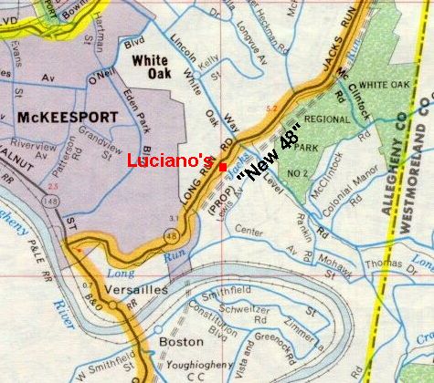
The meet began at 11 AM at Luciano’s Italian Brick Oven in White Oak, just outside McKeesport. I picked this restaurant because it had a private room. I also knew how good the food is from frequenting it many times over the years. Also, the restaurant’s rear parking lot would have sat under the alignment of the cancelled North-South Parkway a.k.a. the “New 48.” It would have run along the hillside above.
My gift to attendees were copies of the new 2024 Pennsylvania road maps, which I drove out to the welcome center on Interstate 70 just east of West Virginia to obtain. The last time I did that was for the 2003 SWPA Meet, but it went much better this time around. Instead of them looking at me like I was speaking gibberish, the staff was very helpful when I asked for a block of them. They gave me two blocks, so I’ll have 2024 maps to give away until SWPA50!
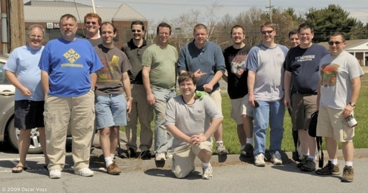
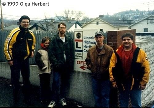
I also had issues dating back to 2005 in case anyone wanted to fill gaps in their collection. Along with the maps, I brought a copy of the first SWPA meet group picture taken back in February 1999. It was taken at the first office of the Lincoln Highway Heritage Corridor. Since 2009, the organization has called the Johnson House along the eastbound lanes of US 30 (the original path of the Lincoln Highway) at the southern terminus of PA 217 southeast of Latrobe home.
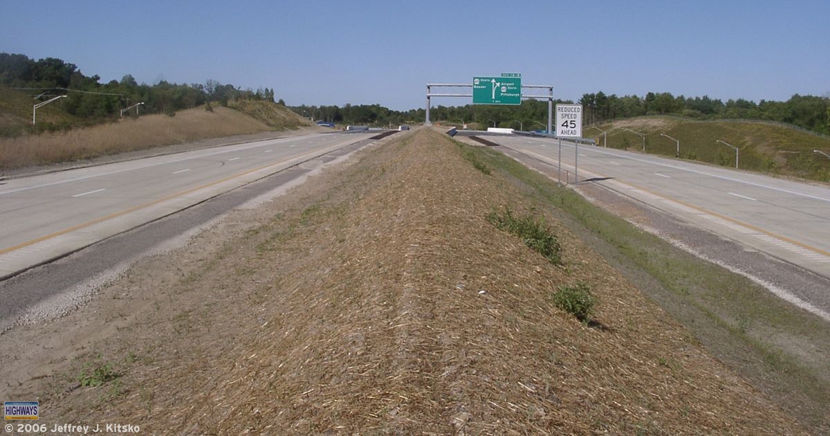
Lunch began by me welcoming everyone who decided to come out on that iffy weather day. As the servers were passing out our drinks and salads or soups, Craig White from JMT, a consultant on the project, gave a presentation. He talked about the portion of the Mon-Fayette Expressway currently under construction from PA 51 to near Dravosburg. He brought posters detailing the project, which may be found at the website for this section.
View this post on Instagram
After a lunch of pizza and pieces of cake that celebrated the 25th anniversary made by White Oak’s own Patti’s Pasticceria, another business I have patronized over the years, we hopped in our cars to begin the tour portion of the SWPA25 Meet. Since the distance between the restaurant and the work zone was great, I created a tour itinerary in PDF format. I indicated the stops on a part of PennDOT’s Type 10 map of Allegheny County.
The first stop was the former Kingdom Hall of Jehovah’s Witnesses along Camp Hollow Road (SR 2043) at the intersection with Lebanon School Road in West Mifflin. We had a perfect vantage point from the parking lot, looking across the road to where the expressway will eventually come. Next door was a former collection of apartments which were demolished to make way for the future route.
Due to the road being barricaded, the second stop on New England Road had to be skipped. I didn’t want the police to crash the tour. They did so on the then-unopened original section of Southern Beltway during the first National Meet in 2006. So we went to the third stop at the Community College of Allegheny County South Campus. Earth moving for the expressway is viewable from their parking lot.
Afterward, we continued to the fourth stop on Coal Valley Road. The road is closed due to construction of piers for the bridges that will carry PA Turnpike 43 over the valley. The fifth stop was to have been where the expressway will pass under PA 885. However, due to the rain that began to fall during the lunch portion, the area had turned to mud. Fortunately, the few that pulled in did not become stuck.
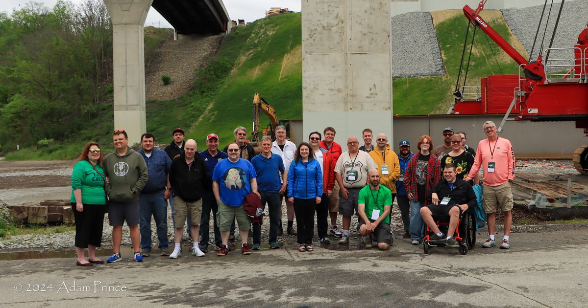
We all made it to the final stop at the park and ride in Large, where the Mon-Fayette Expressway’s northern terminus is currently located. This is where we took our group picture underneath the bridges currently under construction. The spans will eventually carry PA Turnpike 43’s main lanes. Needless to say, there were a lot more people in this picture than in the one from the first SWPA. Since this is the terminus of the expressway, it was also the terminus for the SWPA25 Meet tour. Some decided to leave from there, but some decided to join the “after tour.” That consisted of checking out the Elizabeth and Boston bridges. Adam Prince had suggested while I was planning the SWPA25 Meet.
While checking out the Elizabeth Bridge, or Regis R. Malady Bridge, which carries PA 51 over the Monongahela River, a couple of ladies asked us what we were doing. One turned out to be a member of the Elizabeth Township Historical Society. When she learned about my website, she asked for my contact information for a possible future speaking engagement.
View this post on Instagram
After checking out the Boston Bridge, we headed back to Luciano’s for those who were on the “after tour” to get their vehicles and say our goodbyes. I had brought up checking out the new Fern Hollow Bridge in Pittsburgh. This was the first area meet since the collapse of its predecessor. So a couple of us trekked up to Frick Park to snag some pictures of the completed span. Then it was back to Luciano’s again. Thanks to everyone who came out to celebrate the silver anniversary of the SWPA Road Enthusiast Meet series, which included two of the original attendees: Bruce Cridlebaugh of Bridges & Tunnels of Allegheny County and Pittsburgh, PA, who organized that first meet in 1999, and Adam Prince of Gribblenation. I also want to thank Elizabeth Township native, Adam, for assisting me with the meet.