One of the things I like about working on this website is showing and explaining how the highway system of Pennsylvania has evolved over the years. Now I am taking the show on the road…literally.
So on March 11, I am taking this website and crunching it down to an hour-long presentation entitled Pennsylvania’s Roadways: From the Lincoln to Eisenhower. It will be Sunday, March 11 beginning at 2 PM at the Lincoln Highway Experience, the headquarters for the Lincoln Highway Heritage Corridor, at 3435 Route 30 East (a.k.a. the Lincoln Highway) in Latrobe. Refreshments will be provided.
Due to limited seating in the auditorium, advanced reservations are required, which can be made through the LHHC’s website or by calling 724-879-4241. Admission is $10/person for non-LHHC members and $7/person for Friends of the Lincoln Highway.
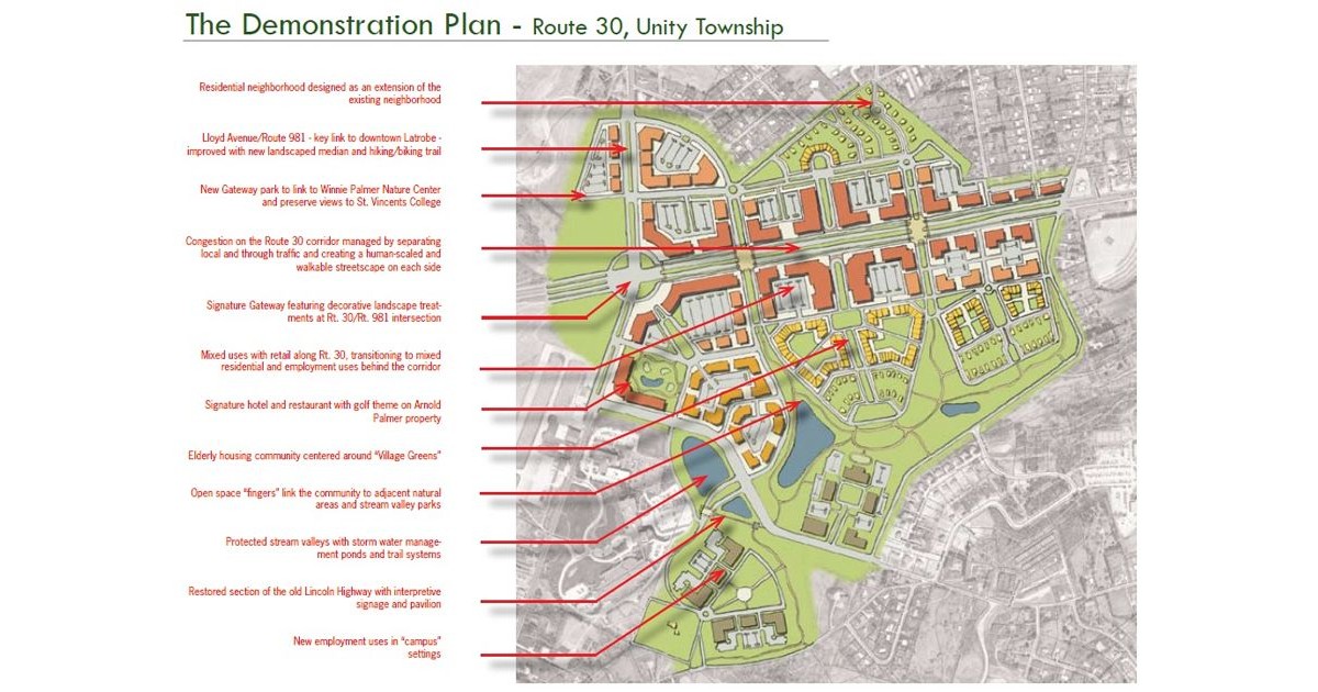
One of the things that we’re not that good about in Pennsylvania is planning for the future. Tonight, myself and others in my area decided to do something about that. Smart Growth Partnership of Westmoreland County has been holding a public Charrette this week at the University of Pittsburgh at Greensburg.
The imagined US 30 corridor south of Latrobe
We were placed in groups and asked to evaluate different plans for the area of US 30 in Unity Township outside Latrobe. The first plan would create almost another town along 30 from PA 981 to PA 982. No one liked this one because the minimum building height would be six stories. Obviously this would destroy the views of the Laurel Ridge and trying to keep the area rural. The second plan would be to keep more of the area in a rural setting, but enhance the existing developments along the corridor. The third plan would be a “Greenway” solution, where most of the businesses would be removed and more of the area returned to a natural state.
While most seemed to prefer the latter, I was in favor of the second plan. The first plan and last plan would eliminate the shopping areas of Latrobe 30 Plaza, Mountain Laurel Plaza, Wildcat Commons, and Unity Plaza. Stores such as Giant Eagle and Wal*Mart would go away. I highly doubt Wal*Mart will have gone the way of Montgomery Ward by the year 2020. Although people probably said the same about Wards in 1980 so who knows.
Planning for the future traffic growth, I proposed the idea of completely bypassing current US 30 with an expressway. This would remove the through traffic from the highway and create a Business US 30 on the current alignment. Actually, not my idea, but the “Route 30 Relocation” proposal from the Pittsburgh Area Transportation Plan devised in the 1960s. The same thing happened between Sadsburyville and Exton. The current alignment of 30 is an expressway and the original alignment is a business route. Then a redesign could take place of any area along the corridor without having to contend with as much traffic. However, my idea did not garner any approval. Oh well, so much for trying to undo past mistakes.
Pennsylvania has been the site of many firsts, such as the first computer (Philadelphia) and first commercial radio station (Pittsburgh). It was also the site of the first road enthusiast meet (Greensburg). So what a better place to hold the first National Road Enthusiast Meet than where it all began.
The first day was a journey back in time with some aspects of the present. I and four attendees traveled the Lincoln Highway from Robinson to Somerset County. Brian Butko, author of several books on the Lincoln Highway and other road-related products, joined us for part of the trip.
We began our trip by taking PA 60 from the US 22/US 30 cloverleaf in Robinson Township into Pittsburgh, then heading south on PA 837 to the Fort Pitt Bridge. Once across the bridge, we exited at the Boulevard of the Allies and followed that back to the Parkway East. Taking the US 30 exit, we followed it to Greensburg where we then traveled on Toll Gate Road to enter the city, as those who traveled then PA 1 did many times. On the eastern side of the city, we followed old segments near Westmoreland Mall, Hyundai of Greensburg, and a long section known locally as Frye Farm Road.
South of Latrobe, we turned onto PA 981 south to access the old alignment. We spotted a rare Lincoln Highway marker located on the front lawn of a home in Youngstown. Shortly after, the caravan passed Latrobe Country Club, whose proprietor is professional golfer Arnold Palmer. Our cruise continue on the old alignment through the borough and to where it joins the current eastbound lanes.
We stopped at the Lincoln Highway Heritage Corridor office in Ligonier where a few picked up some Lincoln Highway merchandise. Continuing eastward on US 30 we stopped at the Flight 93 Memorial and the site of the Quecreek Mine Accident.
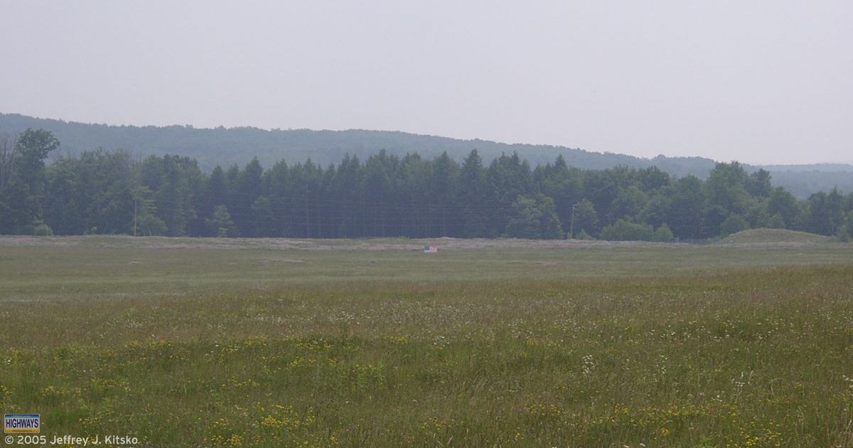
The flag is located at the point where United Airlines 93 impacted the ground
I offered to show everyone the Sipesville Fire Hall, where the families waited for word of their trapped relatives. While we were waiting, a member of the Sipesville VFD stopped and asked us if we wanted to see inside. It was quite a change from when I was an extra back in 2002 in The Pennsylvania Miners’ Story. Afterward we were privileged to be offered a tour of the new hall which was built as a replacement. Plans were to move the original building to the Quecreek site as part of a display. However, the building can not make the journey in one piece, but rather would have to be cut into four sections. Unfortunately, the choice will probably be to demolish the structure instead.
That marked day one of the first National Road Enthusiast Meet.