Categories
Events News

National Road Enthusiast Meet (Day 2)

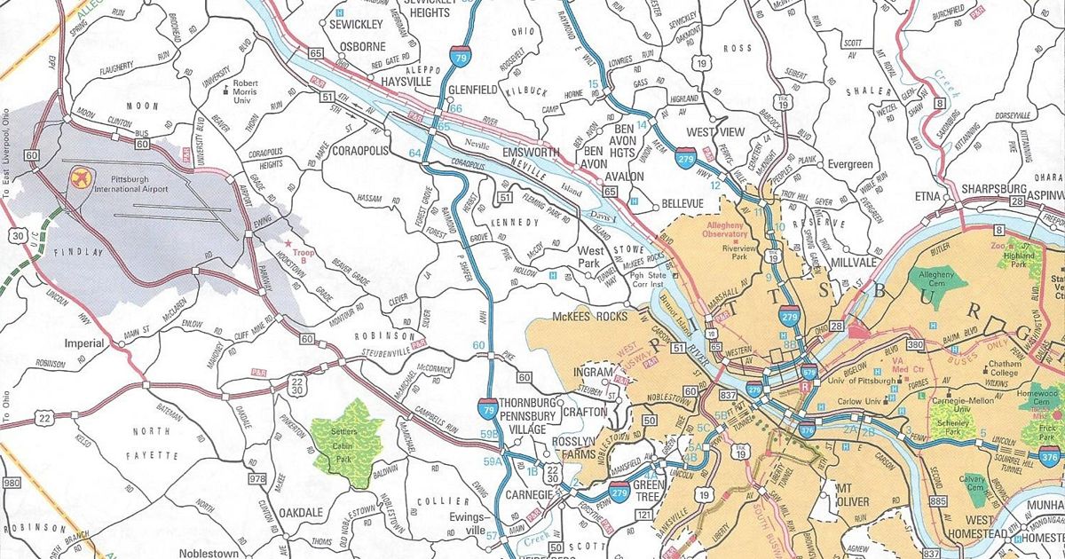
Today was the second day of the first National Road Enthusiast Meet.  We began the day at Primanti Brothers on PA 60/Steubenville Pike in Robinson Township.  Everyone seemed to enjoy this slice of Pittsburgh. I highly recommend stopping to have a Primanti’s sandwich…or a Roethlis-burger at Peppi’s. That is, unless of course you’re a Cleveland Browns fan.

After that, we jumped in our vehicles and traveled down PA 60 to Crafton to see the Industrial Highway.  It is the remnant of one of the many cancelled highways in the Pittsburgh area.  It now serves as an access road for businesses along Chartiers Creek.

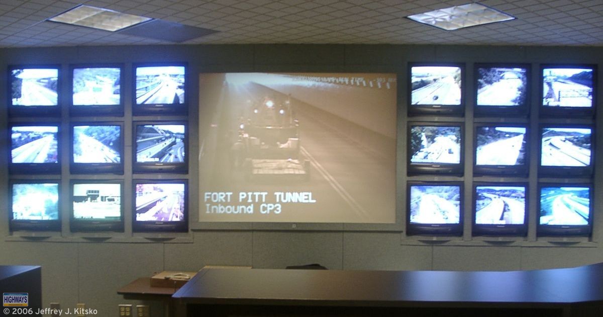
Following that stop, we headed back north on PA 60 to Interstate 79 south. The first official stop was to visit the Pittsburgh Regional Traffic Management Center. It is located at the PennDOT District 11-0 office in Bridgeville.  On the way, we saw some of the Interstate 79 reconstruction taking place south of the Parkway West interchange.

Dominic Munizza of PennDOT gave us a tour of the center, and showed us features of the Intelligent Transportation System, or ITS, network.  He gave demonstrations of the Variable Message Sign (VMS) boards, as well as the Highway Advisory Radio (HAR) system. We also got a demonstration of the cameras that line the expressways.  In fact, we happened to arrive at the TMC just after legendary Pittsburgh Steelers broadcaster Myron Cope was involved in an accident at the Banksville Road interchange.

A tour of the Pittsburgh Regional Traffic Management Center was the focus of Day Two of the National Road Enthusiast Meet.

The group met for dinner at a restaurant with a road theme:  Quaker Steak & Lube. We ate at the Point at North Fayette location. Afterwards, we took to our vehicles and headed into the city to check out the view from Mount Washington. It is the hill that overlooks the “Golden Triangle.”

That marked day two of the first National Road Enthusiast Meet.

Share this:
Categories
News

Extending Interstate 376 For All the Wrong Reasons

I am trying to understand the reasons of extending Interstate 376.  Besides it creating needless work for me by having to change pages and delete some, I am against this change.

Don’t get me wrong, I am for the upgrades of the Parkway West that are included in the extension plan, such as the 60 cloverleaf in Robinson. What I do not understand is the “logic” behind this renumbering.

Pittsburgh International Airport is not on an Interstate

US Representative Melissa Hart said in a WTAE-TV report in October:

We have the only international airport not served by an Interstate.

US Representative Melissa Hart

Obviously, she forgot Dulles International, right outside the nation’s capital. George Bush/Houston Intercontinental and LaGuardia International in New York City also do not connect to Interstates.

USAirways did not “de-hub” Pittsburgh International because it wasn’t connected directly to an Interstate.  Who knows?  The PTC might just get I-576 for the Southern Beltway, which will end right at the PIA interchange on 60.

People from outside the regional will know this is no dirt road.

US Senator Rick Santorum

An exaggeration, but no matter what map you look at, it shows expressway-grade highways around the airport.

If you sign it, they will come

Some also think that placing a red-white-blue marker on an expressway automatically brings economic growth faster than a plain, boring old black and white marker.  As if the “Interstate Fairy” comes by and brings jobs overnight, ignoring the business climate of the region. Pittsburgh Airport Area Chamber of Commerce President Sally Haas said in the March 21, 2006, edition of the Pittsburgh Tribune-Review:

Having that designation is critical for getting us on the map outside the Pittsburgh region. That’s the thing that attracts developers here.

We are already on the map, any of which can be purchased in the Pennsylvania Highways Map Store.  I guess the development at the 60 cloverleaf just happened by coincidence with an Interstate designation.

Easier to get to Downtown
Map of the routes between Pittsburgh International Airport and downtown prior to extending Interstate 376.
The routes between Pittsburgh International Airport and downtown

Another reason I have heard is that it will be easier for travelers leaving the airport to get to downtown.  To leave the airport, you have two options: Beaver/Moon and Pittsburgh.  Following the signs for “Pittsburgh,” and not taking any exits, you wind up in downtown no matter the route number(s).

Instead of money replacing all the signage for extending Interstate 376, I’d rather it goes other places. Fixing some of the 47% of structurally deficient bridges across the state is a start.  Or else we’ll see more failures such as the Lake View Drive overpass on Interstate 70, and next time, the outcome might be worse.

Renaming of Interstate 376 Corridor a Step Closer – Pittsburgh Post-Gazette

Share this:
Advertisements