Categories
Announcements News

2012 Official Road Map

Today, I stopped by my local DMV to get my driver’s license renewed. It was an uneventful process. That probably had to do with the fact that there had been an icing event that morning and no one was out traveling as they were usually after Christmas. As I waited for the new one to finish laminating, I happen to notice down at the other end of the counter, stacks of state maps.  So, I picked up a copy of the 2012 official road map. I guess better late than never that I was able to secure a copy right under the wire.  No idea why the Department of Transportation and VisitPA decided to print another in succession, since there is only one change.

Montgomery County
US 202 Parkway shown as completed from US 202 to PA 463

US 202 parkway in Montgomery County completed from PA 63 to PA 463 on the 2012 official road map

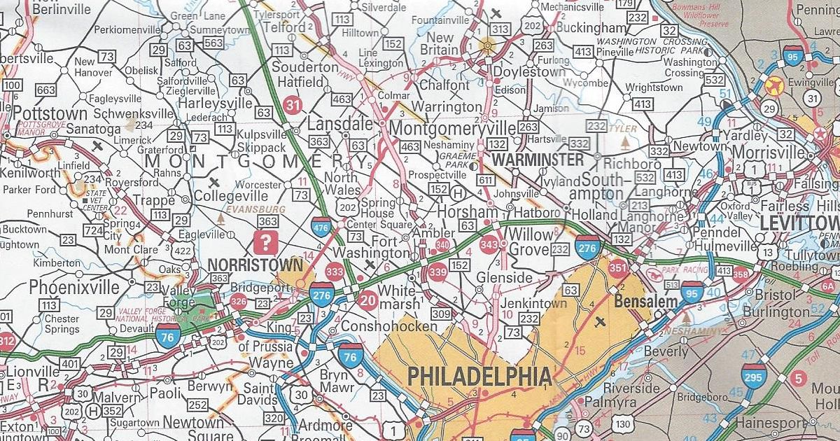
The parkway is a “consolation prize” for the lack of a full expressway. Planning for, which took place in the 1960s and 1970s as the Piedmont Expressway. Rather than build an expressway, the new roadway is and will be an at-grade facility with separated trails for biking and walking along the route. This was the more favorable plan for the communities along the new US 202 alignment.

That is the only change to the 2012 official road map. It has the same dimensions as the previous year’s map. However, this year’s cover features a picture of a man kayaking on the north branch of the Susquehanna Water Trail.

Cover of the 2012 Department of Transportation map
Share this:
Categories
Announcements News

OUCH! Watch Where You Stick That Pin!

You might have heard of the website Pinterest, or at the very least, seen “Pin It” icons on sites you have visited.  It is another social media websites like Facebook and Twitter, but not about sharing statuses or links to Icanhascheezburger, but sharing pictures.  People use Pinterest to plan weddings, pick out a place to visit for their next vacation, and design a new living room by posting pictures they find to “boards” on their page.

Businesses are also joining in on the fun of sharing.  The Department of Tourism, VisitPA, has a page that shares pictures from around the state of points of interest and scenes of natures.  Today, Pennsylvania Highways has joined to share pictures relating to the highway system of the Commonwealth as well things relating to highway travel.  The best part is, there is nothing sharp involved.

https://www.pinterest.com/pahighways

Share this:
Categories
Announcements News

Taking Pennsylvania Highways on the Road…Literally

One of the things I like about working on this website is showing and explaining how the highway system of Pennsylvania has evolved over the years.  Now I am taking the show on the road…literally.

So on March 11, I am taking this website and crunching it down to an hour-long presentation entitled Pennsylvania’s Roadways:  From the Lincoln to Eisenhower.  It will be Sunday, March 11 beginning at 2 PM at the Lincoln Highway Experience, the headquarters for the Lincoln Highway Heritage Corridor, at 3435 Route 30 East (a.k.a. the Lincoln Highway) in Latrobe.  Refreshments will be provided.

Due to limited seating in the auditorium, advanced reservations are required, which can be made through the LHHC’s website or by calling 724-879-4241.  Admission is $10/person for non-LHHC members and $7/person for Friends of the Lincoln Highway.

Share this:
Advertisements