Categories
Announcements News

2023 Official Road Map

I always keep up on when the Department of Transportation releases a new road map by periodically checking the Maps page at their site.    Whenever I see a change in the copyright year in the northeast quadrant PDF, I know I need to scour the state for a copy.  Sure enough, for the first time since 2019 and 2020, there is a new 2023 official road map in back-to-back years.

Unlike in the past, I can not visit my local DMV office for a copy because it has since closed.  There are two welcome centers within a few hours of my house.  I do not have the time to drive out to them in the hopes that they have new maps.  I learned that they don’t always when I stopped at the welcome center on westbound Interstate 90 this past July.  Unfortunately, the only maps they were still giving out were 2022’s version.  So I just ordered my copy from the PennDOT Sales Office.  At least, acquiring this edition was not as daunting as trying to get copies of 2020’s map.  That took until 2021!  That year was understandable since the state was in the red due to the Coronavirus pandemic.  They wanted to use up the 2019 stock before offering 2020 copies.

Much like the 2020 edition, no changes of note took place to the highway system.  Due to the election of Josh Shapiro as Governor, his name is now in the legend along with the new Secretary of Transportation, Michael B. Carroll.
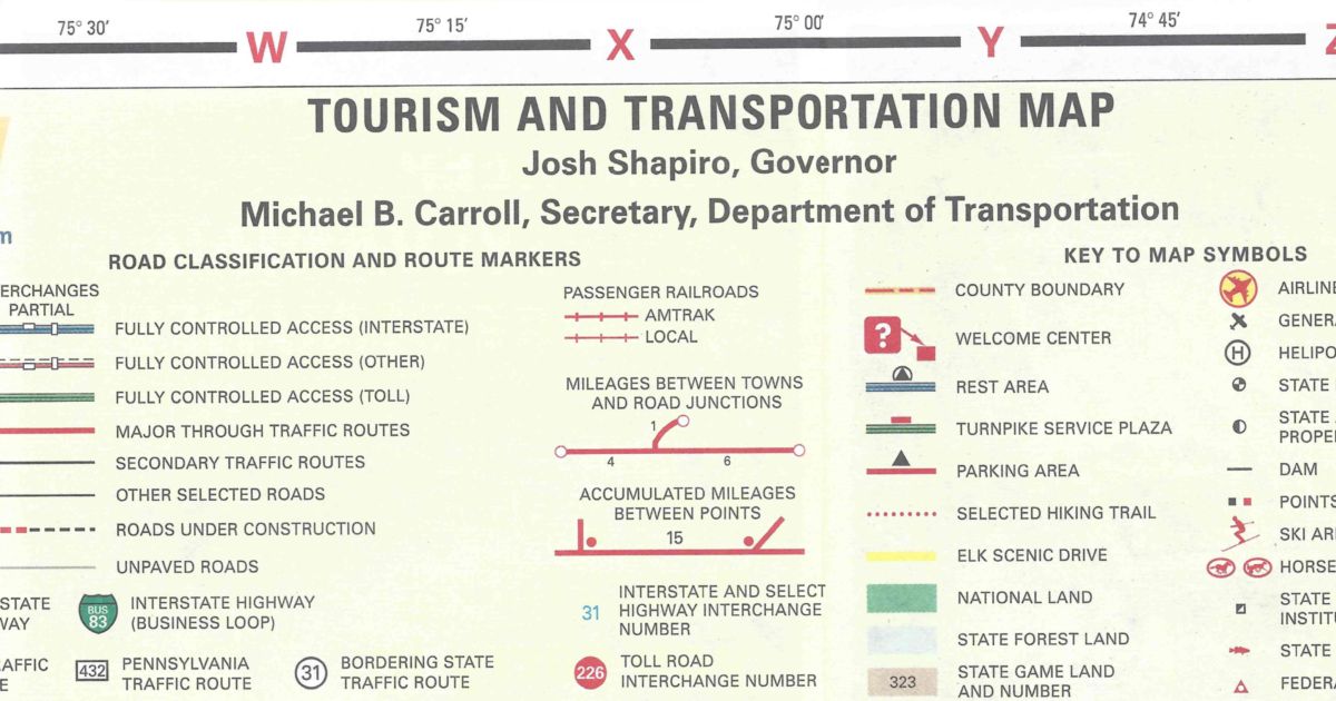
Legend for the 2023 official state road map

The map has the same dimensions as the previous year’s.  However, the cover of the 2023 official road map features a picture of three women at a camp site.  One is doing yoga, another is walking, and a third is sitting in a chair drinking coffee. You can view the 2023 official road map on PennDOT’s site PDF icon.

Cover of the 2023 official state road map
Share this:
Categories
Announcements News

Don’t Pull Those Threads!

It is the newest social media craze to hit the Internet:  Threads.  Just don’t pull those threads, instead follow them.

If you don’t know by now, Threads is Meta’s (Facebook’s and Instagram’s parent company) competitor to Twitter.  It is more on the Instagram side of the company, as it is an off-shoot of that product.  However, it is more like a text-based version of that product.  Even so, it gained 10 million followers in less time than Twitter, or even Facebook.

As I mentioned, it is a product similar to Twitter in that a user can share anything with their followers or the entire Internet according to their privacy settings.  It is how Twitter used to be before changes took place when Elon Musk purchased control and took the company private.  Speaking of Elon, he is suing Meta.

Look for our content at Threads, along with Twitter.

https://www.threads.net/@pahighways

Share this:
Categories
Announcements News

2022 Official Road Map

After a hiatus in 2021, the Department of Transportation has produced a new official state road map.  The reason 2021 was skipped, the first time since 2008, is because of the state’s strained financial resources due to the COVID-19 pandemic.  I knew there was a new map because I saw it on PennDOT’s website.

A few months back, I called the PennDOT Sales Office to specifically request a 2022 edition.  The customer service representative informed me those maps would not go out because they still had a lot of 2020s in stock.  Fine.  Before I left for York to attend the 2022 South Central Pennsylvania Road Meet, I had placed a mail order for new official road maps.  Upon returning home, I discovered they arrived when I was away.  A few days after I returned and was at AAA, I asked for a Pennsylvania map.  I figured I would get their Pennsylvania/New Jersey map.  Nope, another official state map!  When it rains, it pours.

Since I had not heard anything from PennDOT before leaving, I decided to make a side trip to the Welcome Center on Interstate 70 in Warfordsburg on my way to York.  The following is the only change in the 2022 official Pennsylvania map since the 2020 edition:

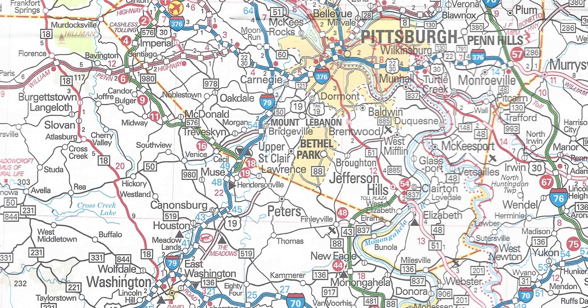
Allegheny County/Washington County
PA Turnpike 576 shown as completed from US 22 to Interstate 79

PA Turnpike 576 completed between US 22 and Interstate 79 on the 2022 official road mapWhat is strange is that this section is not printed in the Pittsburgh inset on the back.
The only other change in this edition is how interchanges appear on the Turnpike System.  For years, a purple circle with white numbers indicated E-ZPass-only interchanges.  A standard red circle with white numbers, like the rest of the interchanges, now mark these particular junctions.  The change is probably due to the Turnpike roadways doing away with cash transactions and all interchanges being E-ZPass-only.

The map has the same dimensions as the previous year’s, and features the same amenities, such as the tourism slogan.  One change is that instead of the year in a keystone as it has been since the 2017, it now separates “20” and “22” at the bottom of the cover.  However, this year’s cover picture features a family in their station wagon parked on a beach.  You can view the 2022 official road map on PennDOT’s site PDF icon.

Cover of the 2022 official state road map
Share this:
Categories
Announcements News

2020 Official Road Map

HALLELUJAH!  It has been like pulling teeth trying to get a copy of the 2020 official road map for over a year now.  My DMV office usually has them in their brochure display.  However, they only had 2018 and 2019 copies until getting rid of the display completely.  I nearly got one back in June on a trip to Washington County, but encountered a traffic jam approaching the western I-70/I-79 split.  I had an appointment to get to in Monroeville later in the day and didn’t want to lose any time; therefore, my visit to the welcome center at the West Virginia state line ended before it began.  Out of two that are within driving distance, that is the closest one to where I live.

Twice I ordered via mail from the PennDOT Sales Office, and twice received copies of the 2019 version.  The last time around I even wrote “2020 editions preferred” on the order, but alas, my plea was for not.  I felt hesitation calling due to the sales office having not been staffed during the COVID-19 pandemic.  This past Monday I thought I would take a shot, and fortunately spoke to a very helpful lady.  So today, nine months and change into 2021, I have finally received a copy of the 2020 map.

Correct web address for PennDOT

Unlike last year, there are no changes of note between this map and 2019’s in terms of the road system.  There is one update on the cover.  From 2017 to 2019, the URL for the Department of Transportation was printed as “PENNDOT.GOV” in the upper-right corner of the cover.  For some reason, on the cover of the 2019 edition, it erroneously changed to a “.com.”  It only recently moved from www.dot.state.pa.us to that address.  The correct URL has returned to this year’s edition.

Cover of the 2020 official state road map

The map has the same dimensions as the previous year’s, and features the same amenities, such as the tourism slogan and “2020” in a keystone.  However, this year’s cover picture is of the Blue Rocks boulder field in Berks County.  You can view the 2020 official road map on PennDOT’s site.

Share this:
Categories
Announcements News

2019 Official Road Map

With the Department of Transportation having printed an official road map for every year of the past decade, I figured there would be one for 2019. I stopped by the DMV and picked up the last one of the 2010s decade, and marks the 2010s the first one in 50 years to have a map published in every year. The following are the changes in the 2019 official Pennsylvania map since the 2018 edition:

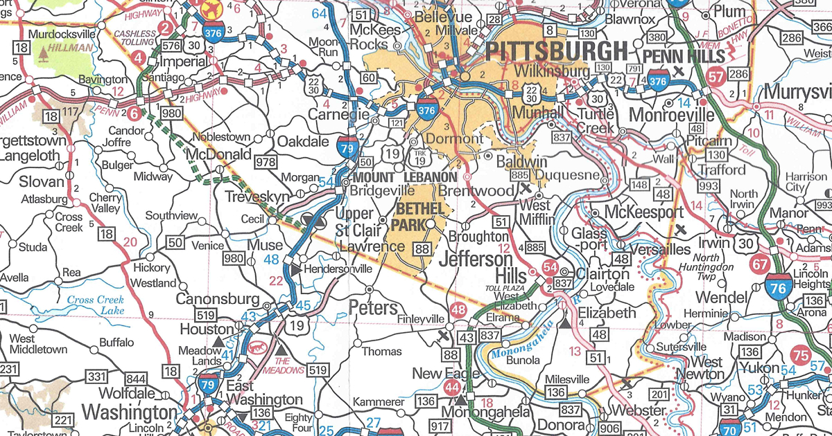
Allegheny County/Washington County
PA Turnpike 576 shown as under construction from US 22 to Interstate 79

PA Turnpike 576 between US 22 and Interstate 79 is shown under construction on the 2019 official road map

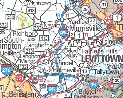
Bucks County
Interstate 95 and Pennsylvania Turnpike interchange now complete and Interstate 95 routed over the Delaware River Bridge
Interstate 295 replaces Interstate 95 north of the Turnpike

The I-95/I-295 interchange with the Pennsylvania Turnpike and I-295 are shown on the 2019 official road map

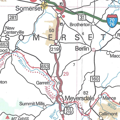
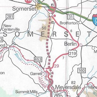
Somerset County
US 219 expressway completed

US 219 is indicated as completed on the 2019 official road map
Cover of the 2019 official state road map

The map has the same dimensions as the previous year’s, and features the same amenities, such as the tourism slogan and “2019” in a keystone.  This year’s cover picture is of a family taking a selfie on a ski slope.  However, there is one noticeable error on the cover.  The Department of Transportation’s website is erroneously printed as “PENNDOT.COM” in the upper-right corner, when it has been a “.gov” for the past few years.  You can view the 2019 official road map on PennDOT’s site PDF icon.

Share this:
Categories
Announcements News

2018 Official Road Map

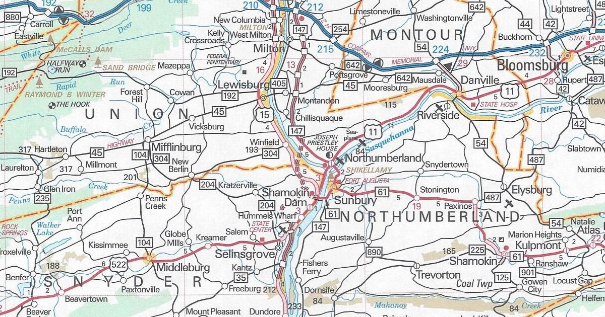
Knowing the track record of the Pennsylvania Department of Transportation, I figured there would be a new 2018 official road map.  Sure enough, there is, so I swung by the DMV office to pick up a few.  The following are the changes since the 2017 issue:

Snyder County/Union County
Central Susquehanna Valley Thruway (US 15 and PA 147) shown as under construction

The Central Susquehanna Valley Thruway is shown as under construction on the 2018 official road map

That is the only change to the 2018 official road map, but it is a big change. The Central Susquehanna Valley Thruway is another project that PennDOT shelved in the 1970s due to lack of funds, which is finally seeing the light of day.  The Governor Edward Rendell administration promised $51 million for the highway.  However, money for the project did not get allocated by the time he left office. Funding would not be secured until 2013 when Act 89 was signed into law by then Governor Tom Corbett. The bill provides for road projects, bridge repairs, as well as funding for public transit.

The map has the same dimensions as the previous year’s, and features the same amenities, such as the tourism slogan and “2018” in a keystone.  However, this year’s cover picture is from Kinzua Bridge State Park in McKean County.

Cover of the 2018 Department of Transportation map
Share this:
Categories
Announcements News

It’s a Snap…chat!

One thing that we have tried to make Pennsylvania Highways be is at the forefront of innovations of Internet technology.  Recently, that technology is with the evolution of social media, or what was once referred to as “Web 2.0.”  While we will be the first to admit that the site itself still has work to be done, it’s presence in social media has been extensive.  Some of our social media channels have worked out well engaging with the public, such as Twitter and Facebook, and others not so much, such as Del.icio.us and Vimeo, have not.

One new social media outlet that has been talked about in recent time is Snapchat. It is similar to text messaging or instant messaging, except that the “snaps” you send someone automatically deletes itself after a period of time. Even with this limitation, businesses are jumping on the bandwagon and joining.

We figured we might as well jump on the bandwagon as well, but trying to navigate Snapchat is a little challenging. Businesses use it to advertise discount codes for their stores, share branded filters, or show “behind-the-scenes” activities. I doubt anyone wants to see me code pages or update content, so I guess it’ll be used to promote new construction projects. If you want to join us on the trip, just snap (see what I did there?) our snapcode below.

Pennsylvania Highways Snapcode
Share this:
Categories
Announcements News

2017 Official Road Map

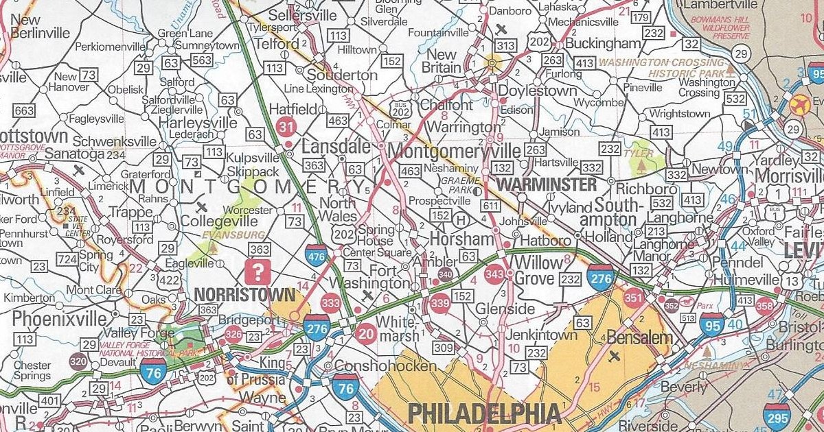
While looking on the PennDOT website, I discovered there was a new 2017 official road map.  So, I took a drive to the DMV office and picked up a few. One copy is for the Pennsylvania Highways Library and a couple to trade.  The following are the changes since the 2016 map, and long overdue ones at that:

Bucks County/Montgomery County
Business US 202 now shown on the former route of US 202

Business US 202 in Montgomery and Bucks counties is finally signed on the 2017 official road map

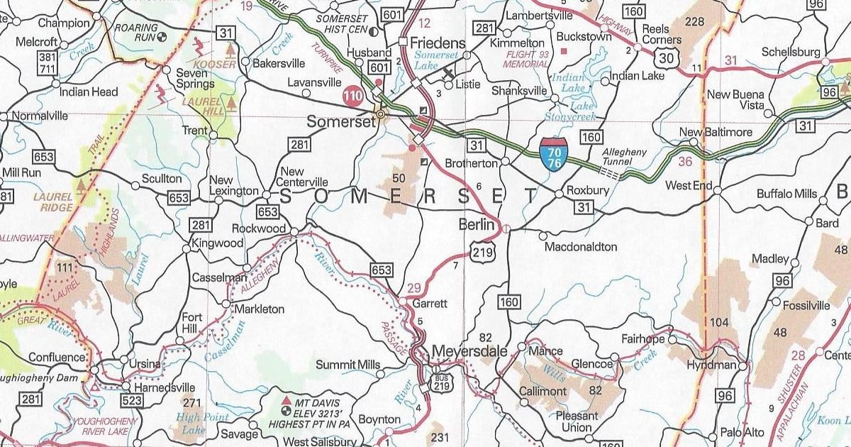
Somerset County
US 219 under construction from Meyersdale to Somerset


US 219 is finally indicated as under construction on the 2017 official road map

While under construction since 2013, this edition is the first to show the work taking place. I have expressed my bewilderment to this major project being ignored over the past three yearly map issues in their respective reviews. As for Business US 202, it was signed in 2012 when the new US 202 parkway was completed.

While it has the same dimensions as the previous year’s, the cover is much different than on past issues.  For the first time since the 2003 edition, “Pennsylvania” is not printed in a Clearview-like font on a blue background at the top of the cover.  It is now printed in the font that is in use by the Department of Tourism, and the new slogan, “Pursue Your Happiness” is printed below.  The year of issue is at the bottom of a keystone, appropriately enough.  This year’s also marks the inclusion of the Department of Transportation’s new web address, with “PENNDOT.GOV” printed in the upper-right corner of the cover.  The picture on the cover of the 2017 official road map is of Ohiopyle State Park in Fayette County.

Cover of the 2017 Department of Transportation map
Share this:
Categories
Announcements News

2016 Official Road Map

Since my driver’s license was up for renewal, I was at the DMV and figured I would see if there were any new state road maps out on display.  As usual, they did not disappoint, and I snagged a copy of the 2016 official road map.

Unlike last year, there are no changes of note between this version and the 2015 version.  Just as in 2014, one blatantly obvious omission still is in Somerset County. The major project that has already begun there is construction of the “missing link” of US 219 expressway between Meyersdale and Somerset. Construction began on this link on February 15, 2013; however, it is missing on this year’s map again. It was missing on the 2014 and 2015 editions as well. It is odd because this is a project which has been championed for years by local officials. One politician in particular who pushed for the road was the late US Representative John Murtha. I would venture a guess that it will be shown as under construction at some point on a future edition.

Construction of US 219 between Meyersdale and Somerset is still missing on the 2016 official road map

It has the same dimensions as the previous year’s. However, the cover of the 2016 official road map features a picture of Liberty Street in Franklin.

Cover of the 2016 Department of Transportation map
Share this:
Categories
Announcements News

Up Periscope!

We all know the function of periscopes on submarines.  They are the instrument that sailors use to check out what is going on on the surface.  Just as that periscope helps see a wider view, there is now an app that can do the same thing.

Periscope was developed by Kayvon Beykpour and Joe Bernstein in 2014 and acquired by Twitter a year later.  The purpose of the app is to stream in real-time anything using a smartphone.  Hopefully I will be able to use it to live stream events such as ribbon-cutting ceremonies, project open houses, and other events related to the highway system.  As they say in the television business, “stay tuned.”

https://www.periscope.tv/pahighways

Share this:
Advertisements