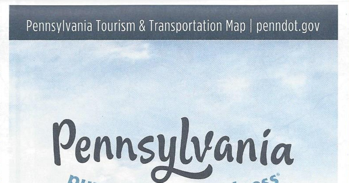
It has been 12, almost 13, years since a map was published by the Turnpike Commission. So it came as a surprise to see a PDF version of one from 2024 on their website. I stopped in at the Western Regional Office looking for this elusive map. Being in the neighborhood to check out the newest Rutter’s, and first west of the US 219 corridor, I took a short (and free) detour up PA Turnpike 66. Well, I found a map, and it is new-ish. OK, it is the 2020 official Turnpike map.
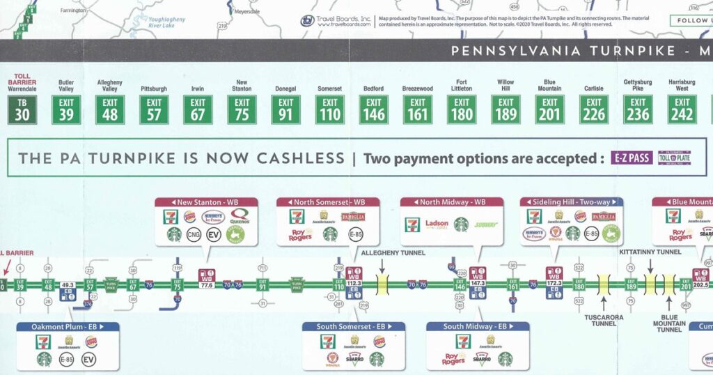
Similarly to previous editions, the 2020 official Turnpike map has the strip maps of the mainline Turnpike and the extensions. The food choices at the service plazas are illustrated. Not only are there two changes since the 2013 map, one of them is a pretty big one.
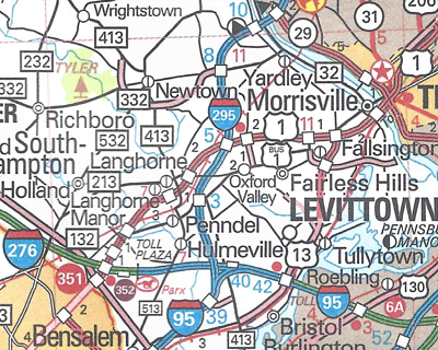
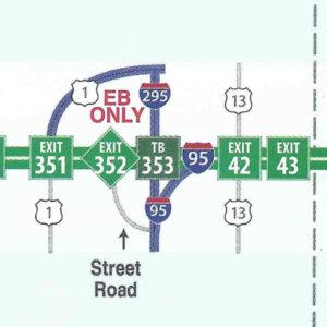
Bucks County Interstate 95 connector is open to traffic
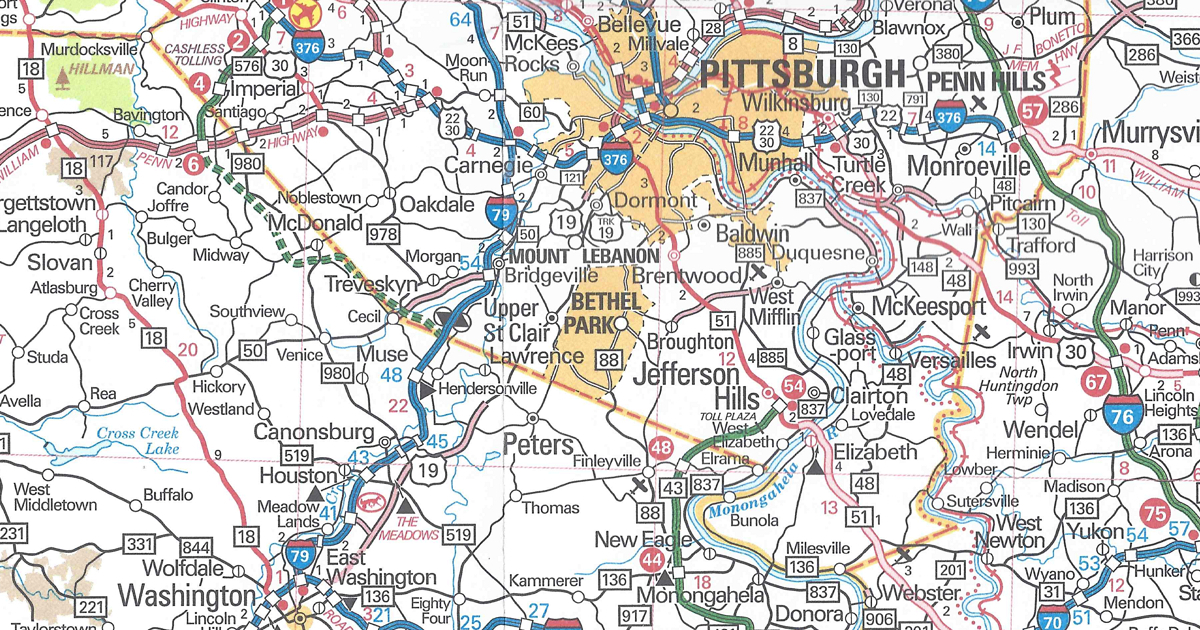
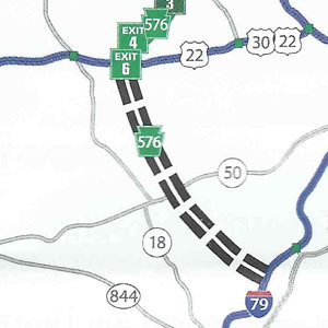
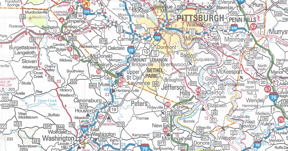
Allegheny County/Washington County PA Turnpike 576 is under construction between US 22 and Interstate 79.
This map lists lodging selections at interchanges along the mainline Turnpike and Northeast Extension. Included are phone numbers for making reservations with those establishments. Each one has a number that corresponds to their location in the inset maps of those interchanges.
The Turnpike Commission began studying transitioning to all-electronic toll collection in 2010. However, the COVID-19 pandemic forced their hand, and they changed the mainline, Northeast Extension, and Mon-Fayette Expressway to cash-less in 2020. Therefore, a notice on the map right above the mainline Turnpike strip map mentions acceptance of only E-ZPass and TOLL BY PLATE now. Furthermore, a text box next to that one references the then ongoing pandemic and that limited services are available at the service plazas, with the web address of their page at the Pennsylvania Turnpike’s website.
The cover features a picture of the Susquehanna River Bridge. It carries traffic over said river and is located between Exit 242/Harrisburg West and Exit 247/Harrisburg East.
Since three state maps have been published in a row, I figured there was a good chance they printed a 2025 official road map. I better play the Powerball and/or MegaMillions because I called it correctly. Sure enough, the PennDOT maps page had a link to the state map with a “2025” copyright. I printed off the order form and tossed it in the map. A few days later, viola! Four free maps: one to keep and three others to give away. A lot less than the blocks of 2024s I still have, and will have for years to come!
Not much has changed, as there is just one on the 2025 official Pennsylvania map since the 2024 edition. Or perhaps it should be best clarified as one correction.
Pittsburgh enlargement PA Turnpike 576 is no longer indicated as an Interstate on the newest section between US 22 and Interstate 79 and is back to being a state route. And we helped! After discovering that error, we contacted the Department of Transportation and Mark Leitzell, manager of Cartographic Services, replied:
Thank you for bringing this inconsistency to our attention. The shielding on the Pittsburgh enlargement has been corrected and will display correctly on subsequent printings of the Tourism and Transportation Map product.
Sure, it was a curious error, considering that the Turnpike Commission wanted parts or all of it marked as an Interstate. Even AAA jumped the gun back in the mid-2000s by designating it as an Interstate. However, printing state maps costs tax dollars. We feel that the state government should spend tax dollars printing maps without errors.
Another change is PennDOT’s URL on the cover, only two years removed from the last change, and this time going from “penndot.pa.gov” to “pa.gov/penndot.”
The map has the same dimensions as the previous year’s. However, the cover of the map features a picture of a child enjoying a single-seat roller coaster-type ride. You may view the 2025 official road map on PennDOT’s site.
It was a cold and blustery afternoon on February 27, 1999, when the first recorded road enthusiast meet took place in Greensburg. Here we are, a quarter-century later, and meets have taken place across the country. Not only has it been awhile since a SWPA (Southwestern Pennsylvania) meet took place, but it was time to commemorate that first one with the SWPA25 Meet.
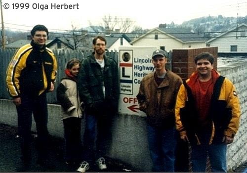
The first meet’s group picture. Left to right: Chris Cuomo, Bruce Cridlebaugh’s daughter, Bruce Cridlebaugh, Adam Prince, and Jeff Kitsko
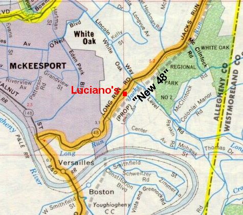
The meet began at 11 AM at Luciano’s Italian Brick Oven in White Oak, just outside McKeesport. I picked this restaurant because it had a private room. I also knew how good the food is from frequenting it many times over the years. Also, the restaurant’s rear parking lot would have sat under the alignment of the cancelled North-South Parkway a.k.a. the “New 48.” It would have run along the hillside above.
The path of the proposed North-South Parkway (“New 48”) in relation to Luciano’s Italian Brick Oven. (Rand McNally)
My gift to attendees were copies of the new 2024 Pennsylvania road maps, which I drove out to the welcome center on Interstate 70 just east of West Virginia to obtain. The last time I did that was for the 2003 SWPA Meet, but it went much better this time around. Instead of them looking at me like I was speaking gibberish, the staff was very helpful when I asked for a block of them. They gave me two blocks, so I’ll have 2024 maps to give away until SWPA50!
I also had issues dating back to 2005 in case anyone wanted to fill gaps in their collection. Along with the maps, I brought a copy of the first SWPA meet group picture taken back in February 1999. It was taken at the first office of the Lincoln Highway Heritage Corridor. Since 2009, the organization has called the Johnson House along the eastbound lanes of US 30 (the original path of the Lincoln Highway) at the southern terminus of PA 217 southeast of Latrobe home.
Lunch began by me welcoming everyone who decided to come out on that iffy weather day. As the servers were passing out our drinks and salads or soups, Craig White from JMT, a consultant on the project, gave a presentation. He talked about the portion of the Mon-Fayette Expressway currently under construction from PA 51 to near Dravosburg. He brought posters detailing the project, which may be found at the website for this section.
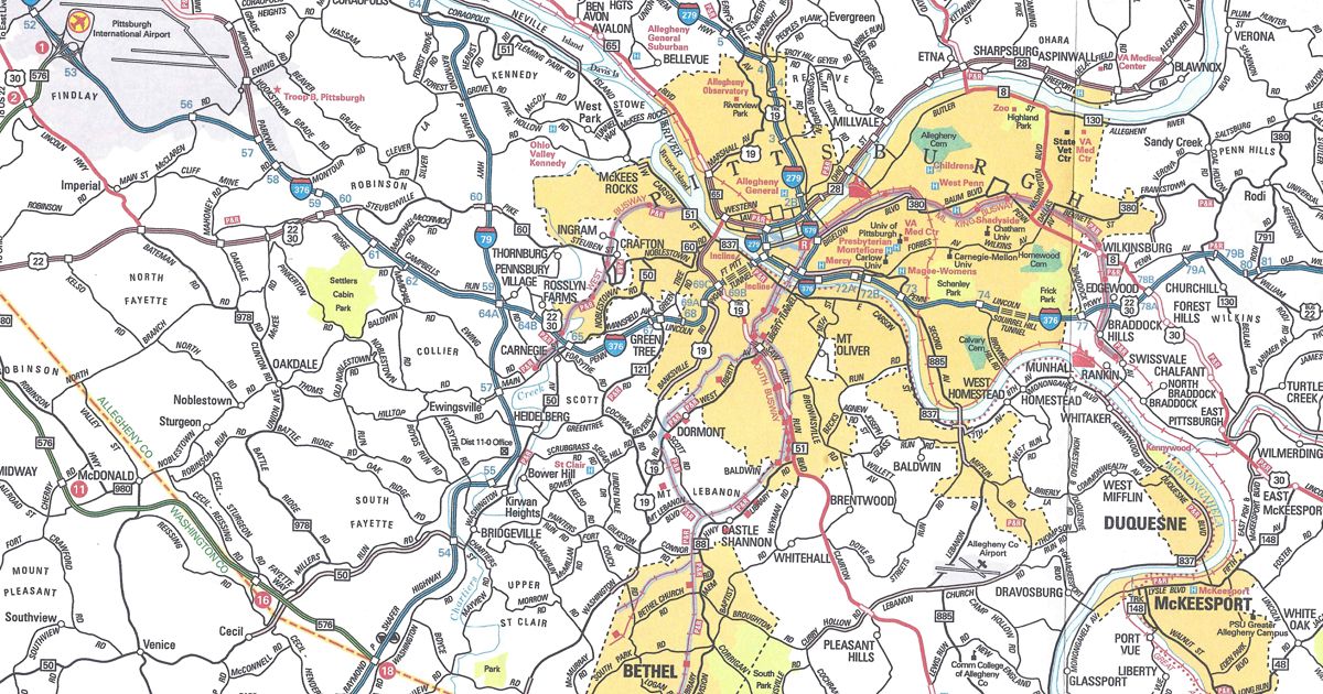
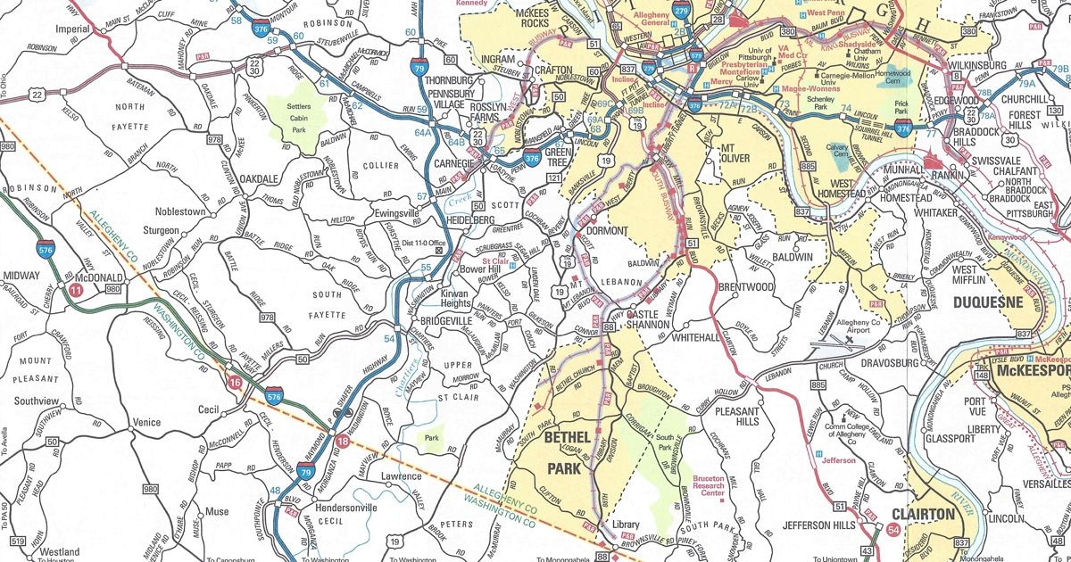
After a lunch of pizza and pieces of cake that celebrated the 25th anniversary made by White Oak’s own Patti’s Pasticceria, another business I have patronized over the years, we hopped in our cars to begin the tour portion of the SWPA25 Meet. Since the distance between the restaurant and the work zone was great, I created a tour itinerary in PDF format. I indicated the stops on a part of PennDOT’s Type 10 map of Allegheny County.
The first stop was the former Kingdom Hall of Jehovah’s Witnesses along Camp Hollow Road (SR 2043) at the intersection with Lebanon School Road in West Mifflin. We had a perfect vantage point from the parking lot, looking across the road to where the expressway will eventually come. Next door was a former collection of apartments which were demolished to make way for the future route.
Due to the road being barricaded, the second stop on New England Road had to be skipped. I didn’t want the police to crash the tour. They did so on the then-unopened original section of Southern Beltway during the first National Meet in 2006. So we went to the third stop at the Community College of Allegheny County South Campus. Earth moving for the expressway is viewable from their parking lot.
Afterward, we continued to the fourth stop on Coal Valley Road. The road is closed due to construction of piers for the bridges that will carry PA Turnpike 43 over the valley. The fifth stop was to have been where the expressway will pass under PA 885. However, due to the rain that began to fall during the lunch portion, the area had turned to mud. Fortunately, the few that pulled in did not become stuck.
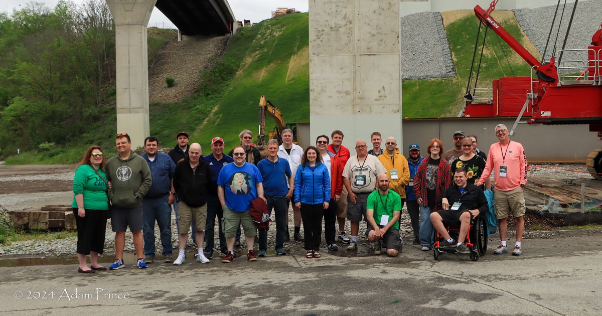
We all made it to the final stop at the park and ride in Large, where the Mon-Fayette Expressway’s northern terminus is currently located. This is where we took our group picture underneath the bridges currently under construction. The spans will eventually carry PA Turnpike 43’s main lanes. Needless to say, there were a lot more people in this picture than in the one from the first SWPA. Since this is the terminus of the expressway, it was also the terminus for the SWPA25 Meet tour. Some decided to leave from there, but some decided to join the “after tour.” That consisted of checking out the Elizabeth and Boston bridges. Adam Prince had suggested while I was planning the SWPA25 Meet.
Compared to the first meet, almost five times more attendees for the silver anniversary.
While checking out the Elizabeth Bridge, or Regis R. Malady Bridge, which carries PA 51 over the Monongahela River, a couple of ladies asked us what we were doing. One turned out to be a member of the Elizabeth Township Historical Society. When she learned about my website, she asked for my contact information for a possible future speaking engagement.
After checking out the Boston Bridge, we headed back to Luciano’s for those who were on the “after tour” to get their vehicles and say our goodbyes. I had brought up checking out the new Fern Hollow Bridge in Pittsburgh. This was the first area meet since the collapse of its predecessor. So a couple of us trekked up to Frick Park to snag some pictures of the completed span. Then it was back to Luciano’s again. Thanks to everyone who came out to celebrate the silver anniversary of the SWPA Road Enthusiast Meet series, which included two of the original attendees: Bruce Cridlebaugh of Bridges & Tunnels of Allegheny County and Pittsburgh, PA, who organized that first meet in 1999, and Adam Prince of Gribblenation. I also want to thank Elizabeth Township native, Adam, for assisting me with the meet.
In preparation for the SWPA25 Road Enthusiast Meet this Saturday, I drove out to the welcome center on Interstate 70 at the West Virginia state line. The reason was to obtain road maps for the attendees. Giving the latest official state map to attendees of my meets is something I have done for over 20 years. The last time I drove to this welcome center, I shocked the kid working the counter when I asked for 25 road maps. However, this time, I explained to the employees what I needed. They gladly gave me two “blocks” of the 2024 official road map!
I knew a new edition came out since the northeast quadrant of the state map on PennDOT’s website had a copyright of 2024. In the past few years, it has been nearly impossible to obtain a new map. The PennDOT Sales Office wants to clear out the previous year’s stock before sending out the new stock. Fortunately, the welcome center had 2024s, so my guests will receive a current one. There is just one change on it since the 2023 edition.
Pittsburgh Inset PA Turnpike 576 now indicated as complete between US 22 and Interstate 79. The full state map has shown it as such since the 2022 edition. One problem: the new section erroneously “upgrades” it to an Interstate. The route designation is correct on the Findlay Connector and full state map.
The Southern Beltway is indicated as complete; however, the portion of the Mon-Fayette Expressway currently under construction from the end at PA 51 to near Dravosburg is not shown as such.
The map has the same dimensions as the previous year’s. However, the cover of the 2024 official road map features a picture of a hang glider flying over a valley. You may view the 2024 official road map on PennDOT’s site.
I always keep up on when the Department of Transportation releases a new road map by periodically checking the Maps page at their site. Whenever I see a change in the copyright year in the northeast quadrant PDF, I know I need to scour the state for a copy. Sure enough, for the first time since 2019 and 2020, there is a new official road map in back-to-back years.
Unlike in the past, I can not visit my local DMV office for a copy because it has since closed. There are two welcome centers within a few hours of my house. I do not have the time to drive out to them in the hopes that they have new maps. I learned that they don’t always when I stopped at the welcome center on westbound Interstate 90 this past July. Unfortunately, the only maps they were still giving out were 2022’s version. So I just ordered my copy from the PennDOT Sales Office. At least, acquiring this edition was not as daunting as trying to get copies of 2020’s map. That took until 2021! That year was understandable since the state was in the red due to the Coronavirus pandemic. They wanted to use up the 2019 stock before offering 2020 copies.
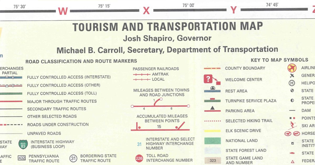
Due to the election of Josh Shapiro as Governor in 2022, his name is now in the legend along with the new Secretary of Transportation, Michael B. Carroll.
The following are the changes in the 2023 official Pennsylvania map since the 2022 edition:
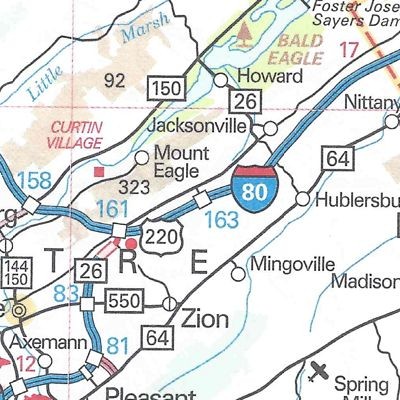
Centre County Exit 163 on Interstate 80 completed as part of the first phase of the future interchange with Interstate 99.
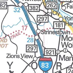
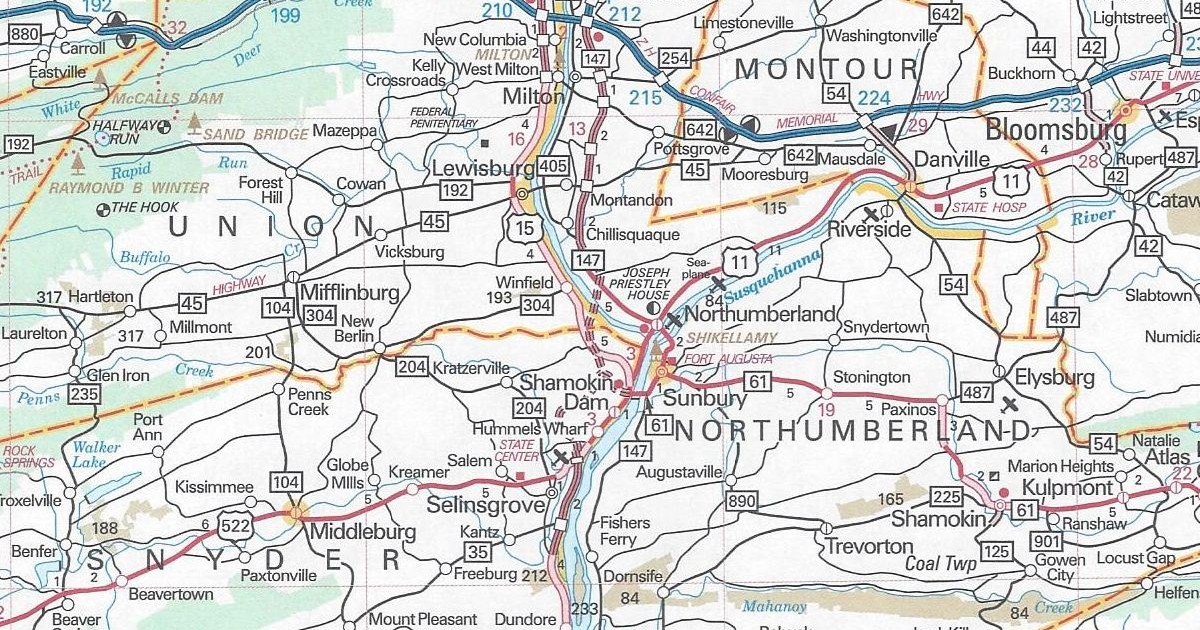
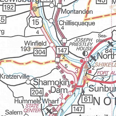
Union County/Northumberland County The Northern Section of the Central Susquehanna Valley Thruway completed, and PA 147 rerouted onto it to end at its new southern terminus at US 15.
Another change is PennDOT’s URL on the cover from “penndot.gov” to “penndot.pa.gov.”
The map has the same dimensions as the previous year’s. However, the cover of the 2023 official road map features a picture of three women at a camp site. One is doing yoga, another is walking, and a third is sitting in a chair drinking coffee. You can view the 2023 official road map on PennDOT’s site.
It is the newest social media craze to hit the Internet: Threads. Just don’t pull those threads, instead follow them.
If you don’t know by now, Threads is Meta’s (Facebook’s and Instagram’s parent company) competitor to Twitter. It is more on the Instagram side of the company, as it is an off-shoot of that product. However, it is more like a text-based version of that product. Even so, it gained 10 million followers in less time than Twitter, or even Facebook.
As I mentioned, it is a product similar to Twitter in that a user can share anything with their followers or the entire Internet according to their privacy settings. It is how Twitter used to be before changes took place when Elon Musk purchased control and took the company private. Speaking of Elon, he is suing Meta.
Look for our content at Threads, along with Twitter.
After a hiatus in 2021, the Department of Transportation has produced a new official state road map. The reason 2021 was skipped, the first time since 2008, is because of the state’s strained financial resources due to the COVID-19 pandemic. I knew there was a new map because I saw it on PennDOT’s website.
A few months back, I called the PennDOT Sales Office to specifically request a 2022 edition. The customer service representative informed me those maps would not go out because they still had a lot of 2020s in stock. Fine. Before I left for York to attend the 2022 South Central Pennsylvania Road Meet, I had placed a mail order for new official road maps. Upon returning home, I discovered they arrived when I was away. A few days after I returned and was at AAA, I asked for a Pennsylvania map. I figured I would get their Pennsylvania/New Jersey map. Nope, another official state map! When it rains, it pours.
Since I had not heard anything from PennDOT before leaving, I decided to make a side trip to the Welcome Center on Interstate 70 in Warfordsburg on my way to York. The following is the only change in the 2022 official Pennsylvania map since the 2020 edition:
Allegheny County/Washington County PA Turnpike 576 shown as completed from US 22 to Interstate 79
What is strange is that this section is not printed in the Pittsburgh inset on the back.
The only other change in this edition is how interchanges appear on the Turnpike System. For years, a purple circle with white numbers indicated E-ZPass-only interchanges. A standard red circle with white numbers, like the rest of the interchanges, now mark these particular junctions. The change is probably due to the Turnpike roadways doing away with cash transactions and all interchanges being E-ZPass-only.
The map has the same dimensions as the previous year’s, and features the same amenities, such as the tourism slogan. One change is that instead of the year in a keystone as it has been since the 2017, it now separates “20” and “22” at the bottom of the cover. However, this year’s cover picture features a family in their station wagon parked on a beach. You can view the 2022 official road map on PennDOT’s site.
HALLELUJAH! It has been like pulling teeth trying to get a copy of the 2020 official road map for over a year now. My DMV office usually has them in their brochure display. However, they only had 2018 and 2019 copies until getting rid of the display completely. I nearly got one back in June on a trip to Washington County, but encountered a traffic jam approaching the western I-70/I-79 split. I had an appointment to get to in Monroeville later in the day and didn’t want to lose any time; therefore, my visit to the welcome center at the West Virginia state line ended before it began. Out of two that are within driving distance, that is the closest one to where I live.
TWICE I ordered via mail from the PennDOT Sales Office, and TWICE received copies of the 2019 version. The last time around I even wrote “2020 editions preferred” on the order, but alas, my plea was for not. I felt hesitation calling due to the sales office having not been staffed during the COVID-19 pandemic. This past Monday I thought I would take a shot, and fortunately spoke to a very helpful lady. So today, nine months and change into 2021, I have finally received a copy of the 2020 map.
Unlike last year, there are no changes of note between this map and 2019’s in terms of the road system. There is one update on the cover. From 2017 to 2019, the URL for the Department of Transportation was printed as “PENNDOT.GOV” in the upper-right corner of the cover. For some reason, on the cover of the 2019 edition, it erroneously changed to a “.com.” It only recently moved from www.dot.state.pa.us to that address. The correct URL has returned to this year’s edition.
The map has the same dimensions as the previous year’s, and features the same amenities, such as the tourism slogan and “2020” in a keystone. However, this year’s cover picture is of the Blue Rocks boulder field in Berks County. You can view the 2020 official road map on PennDOT’s site.
With the Department of Transportation having printed an official road map for every year of the past decade, I figured there would be one for 2019. My suspicions were correct. I stopped by the DMV and picked up the last one of the 2010s decade. In addition, it makes the 2010s the first one in 50 years to have a map published every year. The following are the changes in the 2019 official Pennsylvania map since the 2018 edition:
Allegheny County/Washington County PA Turnpike 576 shown as under construction from US 22 to Interstate 79
Bucks County Interstate 95 and Pennsylvania Turnpike interchange now complete and Interstate 95 routed over the Delaware River Bridge Interstate 295 replaces Interstate 95 north of the Turnpike to New Jersey
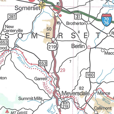
Somerset County US 219 expressway completed between Meyersdale and Somerset
York County PA 297 replaces the entire length of PA 295 to eliminate the numeric duplication with the newly signed Interstate 295.
The map has the same dimensions as the previous year’s. It also features the same amenities, such as the tourism slogan and “2019” in a keystone. This year’s cover picture is of a family taking a selfie on a ski slope. However, there is one noticeable error on the cover. The Department of Transportation’s website is erroneously printed as “PENNDOT.COM” in the upper-right corner, whereas it has been a “.gov” for the past few years. You may view the 2019 official road map on PennDOT’s site.
Knowing the track record of the Pennsylvania Department of Transportation, I figured there would be a new 2018 official road map. Sure enough, there is, so I swung by the DMV office to pick up a few. The following are the changes since the 2017 issue:
Snyder County/Union County Central Susquehanna Valley Thruway (US 15 and PA 147) shown as under construction
That is the only change to the 2018 official road map, but it is a big change. The Central Susquehanna Valley Thruway is another project that PennDOT shelved in the 1970s due to lack of funds, which is finally seeing the light of day. The Governor Edward Rendell administration promised $51 million for the highway. However, money for the project did not get allocated by the time he left office. Funding would not be secured until 2013 when Act 89 was signed into law by then Governor Tom Corbett. The bill provides for road projects, bridge repairs, as well as funding for public transit.
The map has the same dimensions as the previous year’s, and features the same amenities, such as the tourism slogan and “2018” in a keystone. However, this year’s cover picture is from Kinzua Bridge State Park in McKean County.


 .
.

 What is strange is that this section is not printed in the Pittsburgh inset on the back.