It has been three years since there was a holiday edition of the longest running road enthusiast meets in southwestern Pennsylvania. That and the streak of Saturday-only meets came to an end today with the Winter 2010 SWPA Meet. I’d like to thank all who traveled both near and far to attend. They did so even with the snow falling in the area and the winter storm churning up the Eastern Seaboard.
The meet began at 12 PM at the Route 40 Classic Diner on what is now Business US 40 in Brownsville. Food was good as well as the conversations. My Maryland counterpart, Mike Pruett, brought a copy of an old trails guide book. It is a precursor to the modern road atlas, from the late 1920s, for everyone to peruse. I brought some recent Pennsylvania official maps from 2006 to 2010. Just in case anyone needed to fill gaps in their collections.
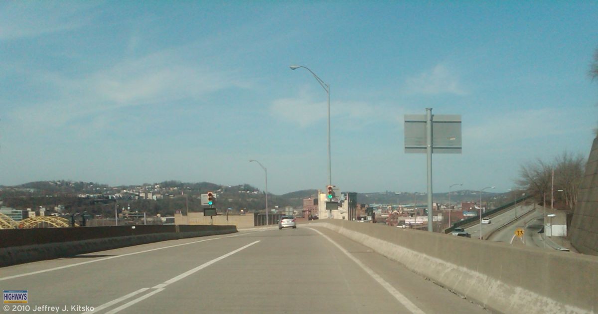
Since these holiday meets are on a smaller scale than the ones during warmer months, the tour was not too extensive. After lunch, we headed down Business US 40 into Brownsville for a taste of the old National Road and to check out the work on connecting PA Turnpike 43 to the PA 88 expressway in West Brownsville. The new alignment, which leaves PA 88, is quite evident as it swings east to cross the Monongahela River. The former intersection of old and new PA 88 has been reconfigured to be a continual route through the future interchange. This leaves up for debate whether PA 88 will be moved back to its former route into West Brownsville, or join with PA Turnpike 43 to US 40.
The cloverleaf at PA Turnpike 43 and US 40 is temporarily a partial one. This is due to ongoing construction to upgrade the segment of PA 88 that will be incorporated into the expressway. The northbound lanes are being rebuilt. What is interesting is that the overhead gantry that was before the cloverleaf has been replaced with a blue, mono-tube gantry that is seemingly becoming standard on the roadway.
Back across the Lane Bane Bridge, we picked up the old road and stopped at the Searights Toll House. Unlike the last Winter SWPA Meet, there were no broken windows nor damaged screen doors to report. It was good to see that a security system was installed, as indicated by a sign by the entrance. Here we said goodbye to half of the attendees and the rest of us continued east on US 40 to drive through the new PA Turnpike 43/US 119 stack interchange. Afterward, we took the new route back to bring the Winter 2010 SWPA Meet to an end saying our farewells, and headed to our respective destinations.
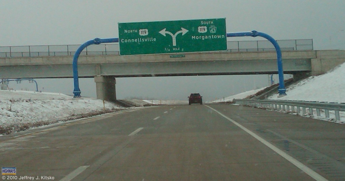
The brisk morning of December 13 marked the beginning of the end for the long-awaited Uniontown-to-Brownsville section of the long-awaited Mon-Fayette Expressway. It was then that the flyover interchange opens between PA Turnpike 43, US 119, and PA 51/Pittsburgh Street in Uniontown.
With the SWPA XMAS Meet a week away, I decided to make a trip to scout locations for the tour. Unfortunately, I didn’t get there until dusk, so none of the pictures came out clearly enough to post. The few that I did take, I was able to update the US 119 and PA Turnpike 43 Exit Guides. The interchange itself is quite an impressive Semi-Directional “T,” with the diamond interchange with PA 51 underneath. What is strange is that the ramp from US 119 northbound is only one lane. It should be two since it is carrying the PA Turnpike 43 designation.
While both directions of US 119 have a diagrammatical sign for this complex junction, the guide sign for Turnpike 43 heading southbound on US 119 has the control cities of Brownsville and Pittsburgh, while northbound it is just Pittsburgh.
Guide sign on PA Turnpike 43 southbound approaching US 119.
As of now, there are no exit numbers for any of the interchanges between the Chadville Demonstration Project in South Uniontown and the new interchange at Pittsburgh Street. Not surprising considering that there is only one PA Turnpike 43 marker on US 40 westbound/US 119 northbound. It is located just before the Main Street interchange. While the US 40 and US 119 markers are posted together, the poor PA Turnpike 43 is by itself about 30 feet before the other two. Poor PA Turnpike 43, ostracized by the black and white markers! Heading southbound, there is only one mention of PA Turnpike 43 on a pull-through sign at the Main Street interchange. Then there is nothing until the 40/119 split. Only then is it denoted as PA 43 which it has since that section was completed almost two decades ago.
While the flyover interchange opens, the segment from it to Exit 15 at Northgate Highway also opened to traffic Monday. Northbound traffic exiting and southbound traffic entering at that interchange will have to pay a toll.
Today, I stopped at the welcome center on Interstate 70 at the Maryland state line in Warfordsburg and picked up a copy of the 2010 official road map. I am surprised PennDOT even bothered to print one this late in the year that isn’t a “B” version, especially since there will be a new governor come Tuesday. These are the changes since the 2009 edition, all of which involve the extension of Interstate 376:
Allegheny County/Pittsburgh enlargement Interstate 376 extended west beyond I-279 to multiplex with US 22/US 30 and replace PA 60 Interstate Business Loop 376 replaced Business PA 60
Beaver County/Lawrence County/New Castle enlargement Interstate 376 replaced PA 60 and PA Turnpike 60
Mercer County Interstate 376 replaced PA 60 PA 760 replaced PA 60 from I-80 to Sharon
Those are all the changes to the 2010 official road map. In addition, there are two mentions of the new 511 system: one on the back cover under the list of welcome centers and another at the top next to the legend.
Rarely do I find an error on the official maps, but this year there is a blatant one near the junction of the Penn-Lincoln Parkway and PA 60 west of Pittsburgh. A US 22/US 322 shield is located where there should be, and last year was, a US 22/US 30 shield.
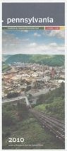
It has the same dimensions as the previous year’s. However, this year’s cover features a view of Johnstown from the Inclined Plane station above the city in Westmont.
After a six-year hiatus, the second SEPA Road Enthusiast Meet was held today. I’d like to thank all who attended and for making the trip for the 2010 SEPA Meet, which took the record for attendance at a Pennsylvania meet from the 2003 SWPA Meet.
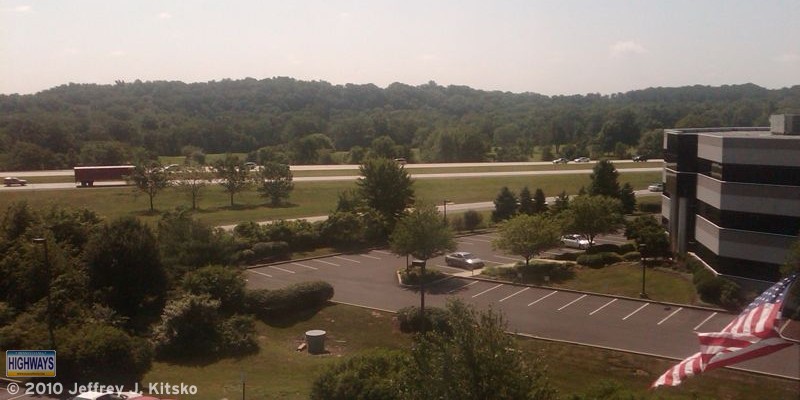
View of US 422, also known as the Pottstown Expressway, from my hotel room window that morning.
The 2010 SEPA Meet began as usual at 12 PM at the Sly Fox Brewhouse & Eatery, home of the Route 113 Indian Pale Ale, on what else, PA 113 in Phoenixville. Some of the attendees did partake of the Route 113 IPA, or as PennDOT would call it, the SR 0113 Indian Pale Ale. It just might end up being the official beverage for road enthusiasts over the age of 21. The food was good as well as the conversations.
Many of the attendees brought road-related materials to peruse as well as to keep: Adam Froehlig – various state official maps from Virginia, West Virginia, and Pennsylvania; Doug Kerr – I-87 Northway maps; and H. B. Elkins – goodie bags full of Kentucky maps and other Kentucky Transportation Cabinet paraphernalia. I brought a planning map for the Keystone State’s Interstate System from the early 1960s for guests to view. In 2006, I had acquired that from eBay.
After lunch, we hopped in our cars and followed PA 23 to the first stop, which was at the Philadelphia Traffic Management Center in the PennDOT District 6-0 headquarters in King of Prussia. Thanks go to Len Pundt, who worked for PennDOT and who helped arrange the tour. The TMC, which was called the Traffic Control Center when I toured it in 2004, has been upgraded since then. Two video walls show feeds from traffic cameras around Philadelphia, as well as content from the Internet and TV. There was a bit of excitement as we were witness to an accident on the Platt Bridge, tying up traffic. Accidents seems to have become a constant with Pennsylvania meets involving a traffic management center tour.
Continuing east on PA 23, we stopped at the Schuylkill Parkway overpass just north of Bridgeport. Len described what was to have happened with that project. It would have been the eastern end of the “Goat Path” Expressway, which was to begin in Lancaster. Len provided some background on this abandoned project. One of its current uses is as a driver training course for the State Police. He explained PennDOT’s funding issues, which led to it cancelling this and numerous other expressway projects in the 1970s. One of the points he made was that cancelling these projects did initially save money. However, there is no way to build these to solve the traffic issues of the 21st Century. Right-of-way acquisition alone would be astronomically high to carve these highways through dense urbanized areas.
We bid Len adieu and took I-276/PA Turnpike eastbound to PA 309 northbound to observe some of the rehabilitation project. Work has been taking place since 2003 along the Fort Washington Expressway. As soon as joining the expressway, we experienced a vastly improved roadway from the one that had been serving commuters since it was built as a new alignment for US 309. We encountered the last remaining section to be undergoing rehabilitation heading north and exited in the construction zone at Norristown Road to go west to Bethlehem Pike. That roadway was the pre-expressway route of US 309. Traveling north to Cedar Hill Road allowed us to view the progress on the northernmost segment from an overpass.
After stopping at the overpass to see the work, we continued northeast to PA 63 then turned northwest to go to the intersection with US 202 to see the progress on the US 202 Parkway project. A new alignment is underway at PA 63 and work is taking place south along the current alignment.
We passed some of the work along US 202 as we headed back to the Sly Fox Brewhouse & Eatery to conclude the 2010 SEPA Meet. Back at the restaurant, we said our farewells and headed to our respective destinations.
The Federal Highway Administration vetoed the Commonwealth’s plan to put tolls on Interstate 80 to help fill the potholes in PennDOT’s budget. Since then, ideas on how to accomplish that feat in a different manner have been flying fast and furious. Any plan will mean drivers will pay more. The task of finding $472 million was taken up by three state representatives: Bill Kortz of Allegheny County, Michael O’Brien of Philadelphia, and Scott Conklin of Centre County. Their idea? Tolls! What a welcome to Pennsylvania for drivers.
Their idea is officially called Special Session House Bill 2 or “Gateway Tolling for Transportation Independence Today.” It would have toll plazas constructed at the state lines on Interstates 78, 79, 80, 81, 84, 90, and 95. Traffic entering and exiting would be charged anywhere between $1 for passenger vehicles to $5 for trucks. Residents near the borders could buy a book of tickets at a reduced price to give them a cheaper toll. However, trucking companies based within Pennsylvania would be entirely exempt from paying. The toll booths would be manned by PennDOT, not PTC, employees. They would offer coin-drop baskets as well as E-ZPass gantries equipped with video cameras to capture violator’s license plates who would receive a bill in the mail.
These tolls would basically be a “user fee” paid by those who drive said Interstates, for maintenance of said Interstate. Tolling currently free Interstates whose construction was funded 90% by the federal government is allowed to provide for maintenance, and only maintenance. The plan to toll Interstate 80 would have siphoned money off for other transportation-related projects, which is not allowed. Representative Coklin estimates that between $235 million and $300 million a year could be raised for the Department of Transportation.
The proposal faces two roadblocks: passage by the special session of the Legislature and a stamp of approval from the Federal Highway Administration. Since the proposal would need their approval, the process for implementation could take several years. Therefore, the idea might not provide immediate results.
Interstate 80 turns the big 4-0 this year! For most of those 40 years, politicians have been trying to undo what was done. President Dwight D. Eisenhower signed the Federal Highway Act of 1956. It kicked off the building of the Interstates as a system of free, limited-access highways crisscrossing the United States. This happened at a time when building toll roads were all the rage. Pennsylvania was the first to build a long-distance toll road and other states followed our lead.
Once the mainline Turnpike was finished and the Northeast Extension nearing completion, the Turnpike Commission looked to building other extensions. However, Ike stole the PTC’s thunder by putting pen to paper. All of those proposed extensions became the blueprint for the Department of Highways to lay out the Commonwealth’s Interstate System. Without Eisenhower witnessing the German Autobahns first-hand as Supreme Commander of the Allied Forces in World War II, what we now now know as Interstate 80 would have been constructed as the Turnpike Commission’s “Keystone Shortway.” So the idea of a toll road slicing right through the middle of Penn’s Woods is not a new idea. It’s just made to seem that way.
The exact day of Interstate 80’s completion is marked as September 21, 1970. Once completed, it was obvious that the road offered a shorter route between New York City and Chicago versus going north via the New York State Thruway or south via the Turnpike. Of course it wouldn’t be fair for Pennsylvanians to pay the entire cost of maintenance on the Interstate when most of the users were from out of state and just passing through. The first idea to change the Keystone Shortway into the “Keystone Tollway” came during the Milton Shapp administration in the early 1970s. Nothing happened.
The plan was resurrected in the 1980s when the Turnpike Expansion bill known as Act 61 was signed. Again nothing happened. In the late 1990s, Representative Bud Shuster (yes, Mr. Interstate 99) resurrected the idea because he felt road repairs were due. The proposal was originally rejected by Governor Tom Ridge but in April 1999 he went back; however, again nothing happened as Ridge was tapped to be the first Secretary of Homeland Security.
The idea resurfaced in 2004. Department of Transportation Secretary Allen Biehler told the state House Appropriations Committee then that a series of toll plazas could be built approximately every 30 miles across the state. He added that the feasibility study had been going on for several months and would take another two to complete. PennDOT would just need permission from the Federal Highway Administration to charge tolls. The reason is because federal money was used to build the Interstate.
There is also the question of whether the PTC or PennDOT would be in charge of operations and maintenance. Tolls are one option for raising needed funds to pay for maintenance and possibly widening it to six lanes in sections. One section in particular is from Interstate 81 to the Delaware River. A year later on March 8, 2005, Secretary Biehler told the Senate Appropriations Committee that costs of building toll booths, maintenance facilities, and police stations would exceed $650 million and take years to complete.
A PennDOT study stated it would be feasible to charge tolls over the long run. However, it would take decades to break even and pay off the debt. Biehler said that “it wasn’t a wise move to institute tolls at this time.” State Senator J. Barry Stout of Washington County said he was “a little shocked to see the final conclusion.” As the minority chairman of the Senate Transportation Committee, he endorsed the idea of putting ten toll booths, with a $2.50 fare at each, on the Interstate from Ohio to New Jersey. Again, nothing would happen.
The idea seemed to really start gaining traction in 2007 when Act 44 was passed. Under the terms, the Pennsylvania Turnpike Commission would take over operation of the road and construct ten toll plazas at 30 mile intervals from Ohio to New Jersey. The estimated $946 million/year collected from them, as well as increased fare rates on the mainline Turnpike, would go to fund highway and bridge repairs across the state. Officials continued to push ahead by announcing that the PTC would spend more than $1 billion on improvements to the Interstate over the next few years. They would include repairing bridges, adding truck climbing lanes, upgrading pavement, and extending on-ramps.
On October 16, 2007, the Department of Transportation and Turnpike Commission entered into a 50-year lease agreement for Interstate 80. As part of Act 44, the two agencies filed a formal application with the Federal Highway Administration on October 13 seeking approval to implement tolls.
However, in a letter dated October 17 to Transportation Secretary Allen Biehler and PTC CEO Joseph Brimmeier, chief counsel and acting deputy administrator of the Federal Highway Administration, James D. Ray stated,
As should be clear, FHWA has not granted Pennsylvania the authority to toll I-80. In fact, now that we have received a formal application, we will conduct a thorough analysis of the application’s merits based on the statutory criteria and determine if the selection of Interstate 80 in Pennsylvania for one of three nationwide tolling pilot authorities is appropriate. The approval of any application under this program is a discretionary decision. We will take into account a variety of factors, including, but not limited to, actual or expected competition from other interstate facilities.
On the night of Thursday, November 9, Congress eliminated the amendment to a transportation appropriations bill that would have forbidden putting tolls on free Interstates. That was done at the request of Governor Rendell, Democrats, and Senator Arlen Specter. The two Representatives from along the corridor who added the rider cried foul.
On July 14, 2008, the Turnpike Commission announced its planned $2.5 billion upgrades to the Interstate in the first decade of ownership. The upgrades include building two new interchanges to connect the Interstate with Interstate 99, replacing or resurfacing about 80 percent of the 311 miles, and replacing 60 original bridges.
On August 6, the PTC announced their toll collecting would be much different than that on their other expressways. Instead of traditional toll plazas, Interstate 80 would be the first all electronic toll road in Pennsylvania. It would have E-ZPass readers at nine gantries across the state each costing $60 million to build. Those without a transponder would be sent a picture of their license plate and a bill for their toll plus a $1 processing fee. In both cases much like the 407 ETR outside of Toronto, Ontario.
Those with transponders would also get a free pass at the first gantry, roughly equating to a 60-mile free ride on the road. After that, they would be charged $2.70 at the second and each gantry after wards. This offer would not be extended to most commercial vehicles, including 18-wheelers that account for up to 30% of traffic. However, regular users would be eligible for volume discounts.
Feeling confident and having all their cars in a row, the state resubmitted the plan on July 22, 2008. They expected the decision would take two or three months to decided on phase one approval for tolling Interstate 80. Two months later, the decision handed down was against tolling 80, so yet again nothing would happen.
The story might have ended there. It didn’t as the Commonwealth submitted the exact plan a second time in late October 2009. It came as no surprise to this blogger that on April 6, 2010, yet again the application was rejected. However, this time it seems the Federal Highway Administration finally drove a stake through the plan’s heart. Governor Rendell announced that day that it will not be resubmitted. Therefore, it can finally be said that after 40 years, nothing will happen.
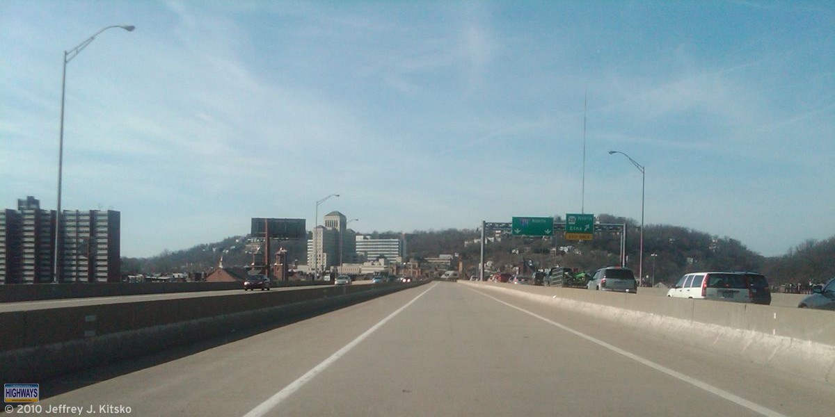
OK, so it has taken a little over 20 years to drive the only HOV lanes in Pennsylvania, but who’s counting? There are many reasons why I’ve never driven them to this point. The biggest reason being is I’ve only lived east or south of Pittsburgh. So it didn’t make sense to utilize them when taking the Parkway North. That was until today. After a quick stop in Shadyside, I continued on my journey north to Ross Park Mall.
The lanes comprise the third Port Authority of Allegheny County busway, built as part of Interstate 279 and Interstate 579. However, personal vehicles are permitted to use this busway unlike the other three. They are HOV+2 and inbound one-way for the morning rush and outbound one-way for the evening rush and weekends.
The Trip
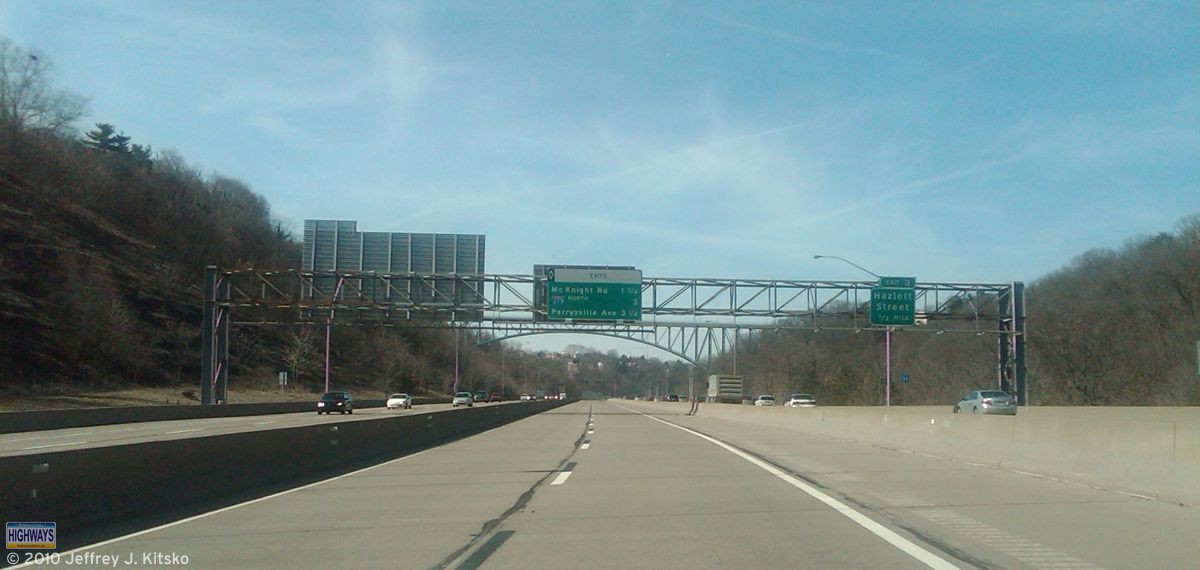
The entrance at Bedford Street near the Mellon Arena leads down a long ramp that is initially two lanes as it crosses PA 380/Bigelow Boulevard; however, it narrows to one to cross the Veterans Bridge. Of course, when reversed, it’s one lane that widens into two.Crossing the Allegheny River on Veterans Bridge on State Route 6579 which is the PennDOT inventory designation for the HOV lane on Interstate 579.In the East Street Valley, where the other lone HOV lane from the North Shore joins the one from Interstate 579 to create a two-lane roadway designated by PennDOT as State Route 6279. It’s like the First Class section of the Parkway North!Approaching the McKnight Road interchange in the North Hills of Pittsburgh. Just as at the I-279/PA 28 interchange south on the North Side, the lanes split here as well. One exits to McKnight Road, while the other continues north to Perrysville Avenue and eventually to merge into the mainline.
It is that time of the year, commonly referred to as the holiday let down. That period in the calendar when we go from ushering in a new year to hiding eggs. People start looking forward to the Summer and vacation time it will bring. It is also that time of the year when the trucking industry magazine, Overdrive, releases the results of their latest “Worst Roads” survey. Sadly to say, we’re number one again.
For most of the 1990s, Pennsylvania held the dubious distinction of “Worst Roads” in the United States. The state’s fortunes began to change in the late 1990s, when Pennsylvania slid down to second place.
For the past decade, the number one slot has bounced between newcomers such as Arkansas and Louisiana. Pennsylvania has taken top, or bottom, billing 13 out of 19 years Overdrive has been conducting the survey. It takes the title back in 2009. I find this distinction particularly amusing this year. The reason being the replacement or rehabilitation of all the structurally deficient bridges thanks to the American Recovery and Reinvestment Act. In fact, a Congressional committee named Pennsylvania as the top-ranked large state, third overall, for starting and completing projects funded by the ARRA.
States are not just judged by the conditions of their highway systems, but other things related to trucking. Interstate 80 still retains the title of “Most Improved Road” from last year. However, in 2008 it was second under “Best Highway Segment” and forth under “Worst Highway Segment.”
Interstate 80 through Stroudsburg
Pennsylvania still retains third place for “Toughest on Truck Inspections and Law Enforcement.” A distinction it shares with Maryland this year. The strangest change is our truck stops. They went from third best to a tie with California and New York for third worst. Now that’s some swing!
You’re probably wondering how something like that, or the aforementioned Interstate 80 ranking, can happen. I learned from an editor with Overdrive the process of tallying the votes. Instead of averaging the good and bad scores, the good and bad are separated, then averaged. That explains how Pennsylvania was second under “Worst Roads” and five under “Best Roads” one year.
Unfortunately, no shout out this year for me or the website. It is just as well since Pennsylvania highways (the ones made of concrete and asphalt) are back on top, or bottom.
Let me tell you kids about the good ol’ days, as some folks like to call them. Human knowledge would be put into “books,” which are like websites. These “books” were similar to a Kindle, iPad, or Slate, but consisted of “paper” rather than microchips. They also did not need recharging every other day, nor a Wi-Fi or cellular connection. Even back in these “analog” days, there was a Pennsylvania Highways presence.
In this simpler time, a “superhighway” consisted of asphalt and concrete rather than fiber optics and servers. These roads would connect the farthest reaches of the country with the other farthest reaches. In the early days of the highway system, there were no signs nor maps. Forget about GPS devices! They wouldn’t be available at the local Sears, Roebuck and Company for about another eight decades.
Associations formed around the United States to solve the problems that early travelers faced on unmarked and unnumbered trails. In this early period of road travel, names marked highways rather than numbers. Two of the more notable ones were the Lincoln Highway and the Yellowstone Trail.
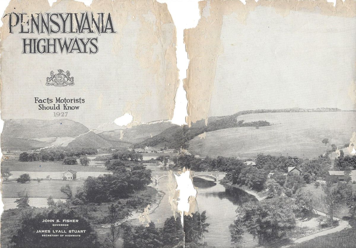
States saw what these groups were doing and decided to take matters into their own hands. They began marking those routes by numbers rather than names. Pennsylvania was one of the first to number main highways in 1925. It was also the first to assign a single designation to cross-state routes. To spread the world to the traveling public about these routes and help tourism across the Commonwealth, PennDOT’s predecessor the Department of Highways published the booklet Pennsylvania Highways: Facts Motorists Should Know in 1927.
Pennsylvania Highways circa 1927
I did not know about this booklet when I named the website, which was originally entitled Pennsylvania Highways and Byways. My uncle discovered this rare gem on eBay. He gave it to me as a birthday gift, roughly 80 years after it was printed. The North-South Parkway, or the “New 48” as it was referred to, would have cut through where he lives had it been built.
The booklet begins with a message about being the keystone of the highway system from Governor John S. Fisher and one about the highway program from Secretary of Highways, James Lyall Stuart. Further articles talked about the Pennsylvania Highway Patrol (State Police) and how motorists benefit from maintenance from the Department of Highways Chief Engineer. There is even one on the highways of Pennsylvania from the perspective of a woman. One article that stood out was from the President of the Pennsylvania Motor [AAA] Federation Richard C. Haldeman, who proclaimed in the title, “Pennsylvania Has the Best Highway System in America.”
Much like the modern version, the booklet contains descriptions of routes under the State’s jurisdiction, as well as pictures from various points along them. The following is a list of the state routes which existed at the time of publication:
1 – Lincoln Highway
2 – Lackawanna Trail
3 – William Penn Highway
4 – Susquehanna Trail
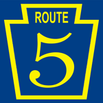
5 – Lakes to Sea Highway
6 – Old Monument Trail
7 – Roosevelt Highway
8 – William Flinn Highway
9 – Yellowstone Trail
10 – Buffalo-Pittsburgh Highway
11 – National Pike
12 – Baltimore Pike
13 – Harrisburg to Maryland State Line via Carlisle
17 – Benjamin Franklin Highway
19 – Lewistown to Narrowsburg, via Wilkes-Barre and Scranton
24 – Harrisburg to the Maryland Line, through Gettysburg and Emmittsburg
41 – Harrisburg to Lancaster
44 – Buchanan Trail
64 – From State Line, North of Cumberland, Maryland to Susquehanna Trail, South of Lawrenceville
88 – Perry Highway
A map section in the middle of the booklet shows these primary routes, as well as others signed at the time. At this time, route markers were gold on blue rather than the black on white we know today. During this era, telephone or telegraph poles would have route markers painted on them. The map section for the central part of the state made mention of this practice.
Included is an explanation of “DETOUR” and “TEMPORARY” routes. This was important since the highway system was still very much a work in progress. Depictions of various signs that one would find along the roadways of the Commonwealth peppered the booklet. This was to let motorists what they’d find to help them navigate the still burgeoning highway system. What I find interesting are the signs for things such as speed limits and passing zones. They were the same shape as the keystone markers which greeted travelers at the entrances to towns.
Of course, there were no Interstates nor toll roads, or even US routes for that matter. The map section contains the following explanation for those missing routes:
The numbers assigned transcontinental highways by the Joint Board named by the Secretary of Agriculture will not be used on Pennsylvania Highways in 1927. Until a final decision has been made on all routes and the decision is accepted by the Pennsylvania Department of Highways, the markings will not be found on Pennsylvania highways or officially recognized by the Pennsylvania Department of Highways.
I guess that decision came quickly because US routes would appear on the 1928 Department of Highways map.
The tourism section provided pieces on historic sights listed by county. Specific ones such as Lake Erie and President James Buchanan’s birthplace are written about in greater depth. Listings of state parks and tourist camp sites were provided for those who wanted to enjoy the great outdoors. Directions between cities were provided by either traveling one direct route or several alternate routes. The mention of road improvements that had taken place are under the respective route descriptions. Directions are also provided to out-of-state places such as New England and Florida!
Tenjamin G. Eynon, Registrar of Motor Vehicles, wrote the final section of the booklet. He explained the function of his department as well as providing information on titles, plates, required equipment for cars, and rules of the road. The last page has a list with pictures of flowers found along Pennsylvania’s highways, as well as rules on picking them.
It is always interesting to find gems like this which detail transportation in a long-ago era. The more things change, the more they stay the same, it seems. Next up, kids: I will tell you a fantastic story of when MTV played music videos. If there is time, I’ll tell one about when The Weather Channel broadcast weather reports!
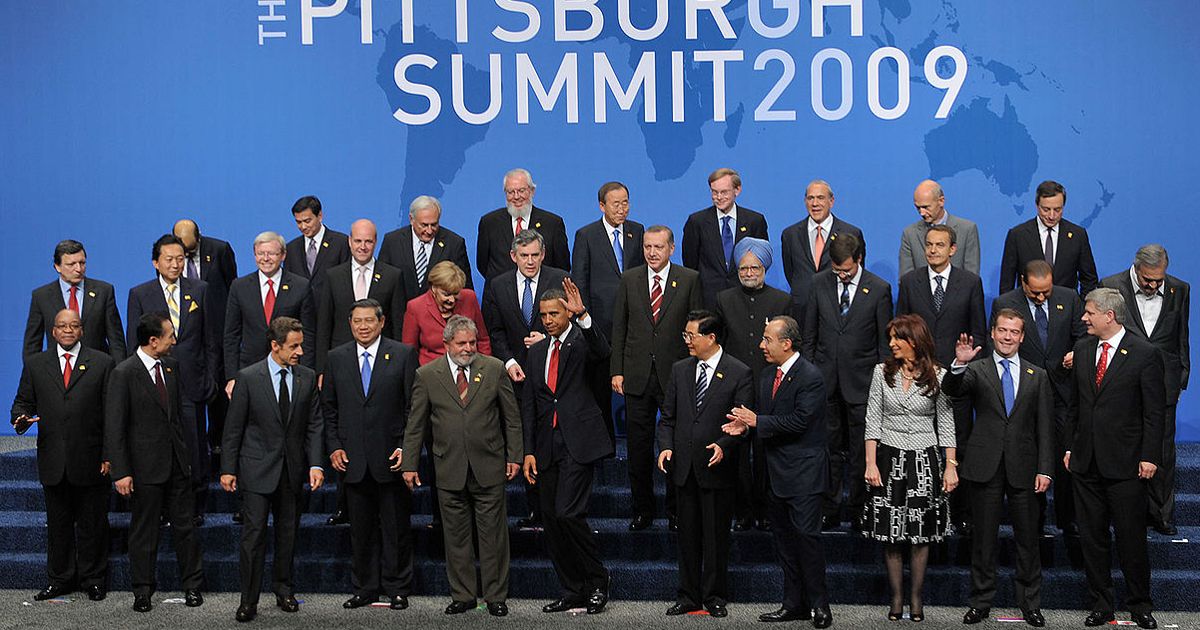
White House Press Secretary Robert Gibbs said in May that the next G-20 Summit would be held in Pittsburgh. As a result, there were more than a few laughs from the White House Press Corp. And why not, what does anyone there know about finance and banking or surviving an economic downturn? After all, it is an area where people pay a fair market value for a house. How quaint! However, the world came to discuss all of the above.
The reason President Obama chose the “City of Champions” was due to visiting the area during the 2008 campaign. He saw how it changed from a center of steel to one with a more varied economic base. One focused on medicine, finance, and high-tech industries. Fortunately, the industrial fore-fathers of the city were not misers and gave back to their community in the form of libraries and universities. These were the crutches by which Pittsburgh could pull itself up by its bootstraps and start over.
Leaders from around the world began arriving on Wednesday. This prompted rolling roadblocks on the Parkway West between Pittsburgh International Airport and Downtown. The motorcades passed through the US 22/US 30-PA 60 interchange project. The American Recovery and Reinvestment Act of 2009 partially funded the work. Passage of the ARRA was to dig (no pun intended) the country out of the global recession. The topic of which would be the focus of the next two days.
While the leaders of the 20 largest economies and the European Union were arriving, so were the protesters. Members of Greenpeace repelled off the West End Bridge. They displayed a banner protesting the lack of attention paid to the environment by these leaders. Arrests took place at the Fort Pitt Bridge, where five others tried to do the same.
Mayor Luke Ravenstahl deputized 1,000 men and women. They came from police departments as far away as Miami and as close as Johnstown. In addition to National Guardsmen and state police troopers, they made up a force of more than 3,000 officers.
The world’s leaders had an easier time getting around the city than the locals. Only residents with a driver’s license with a Downtown address, delivery trucks (with deliveries made between 5 AM and 7 AM), taxis, hotel shuttles, armored cars, ACCESS vehicles, and medical suppliers could continue into the Golden Triangle. Three police checkpoints were established. The locations were Smithfield Street Bridge at PA 837/West Carson Street, Fifth Avenue at Ross Street, and the Roberto Clemente Bridge at Isabella Street. However, motorists could exit anywhere. Meanwhile, barricades closed ramps from Interstate 279, Interstate 376, and Interstate 579 and other bridges and streets.
The two-day summit went off without a hitch. Pittsburgh was able to do something no other city could: host a blood-less G-20. Only 193 arrests took place, a few minor fires happened, and some minor damage to stores occurred. The nearly 6,000 law enforcement personnel outnumbered the 5,000 protesters who had come to the city. Needless to say, crime dropped steeply. On the other hand, so did the need for EMTs. For instance, at times every ambulance in the city sat idle! Thousands of police vehicles, driven by mostly out-of-towners, managed to navigate the maze of city streets without a single accident. That was perhaps the most surprising thing to come out of the two days.
VisitPittsburgh hopes that the G-20 Summit helps tourism and attracting conventions. It did raise interest on the global stage. As a result of the summit, the city was awarded another international event. Pittsburgh will be the North American host city for the 2010 United Nations World Environment Day. Meanwhile, perhaps the highest praise came from the Italian-born songwriter, singer, former model, and the current French First Lady. Carla Bruni-Sarkozy said, “I think I wish I could stay a little longer because we only stay one-and-a-half days.”
She added, “But I think it’s beautiful.” I don’t think VisitPittsburgh could have asked for a better spokeswoman in the world.